On-demand emergency notification system using GPS-equipped devices

a technology of emergency notification and gps, applied in the direction of automatic exchange, special service for subscribers, electrical equipment, etc., can solve the problems of overloaded emergency phone lines, people are unaware of the evacuation, and tools are not always easy to use and may be unavailabl

Active Publication Date: 2012-03-27
UNIV OF SOUTH FLORIDA
View PDF17 Cites 68 Cited by
  • Summary
  • Abstract
  • Description
  • Claims
  • Application Information

AI Technical Summary

Problems solved by technology

Often, people are unaware of the evacuation zone classification for their current location.
While online mapping tools are available to determine the evacuation zone based on location, these tools are not always easy to use and may be unavailable in the event of an oncoming hurricane.
Emergency phone numbers are made available for those individuals who do not have Internet access to use these online tools, but often the emergency phone lines are overloaded by the sheer number of people requesting evacuation zone information.
Additionally, tourists who are unfamiliar with the area may not be aware of any of these resources, or may not know their current address even if they are able to access online mapping tools or emergency phone numbers.

Method used


Image

  • On-demand emergency notification system using GPS-equipped devices
  • On-demand emergency notification system using GPS-equipped devices
  • On-demand emergency notification system using GPS-equipped devices

Examples


Embodiment Construction

[0021]In the following detailed description of the preferred embodiments, reference is made to the accompanying drawings, which form a part hereof, and within which are shown by way of illustration specific embodiments by which the invention may be practiced. It is to be understood that other embodiments may be utilized and structural changes may be made without departing from the scope of the invention.

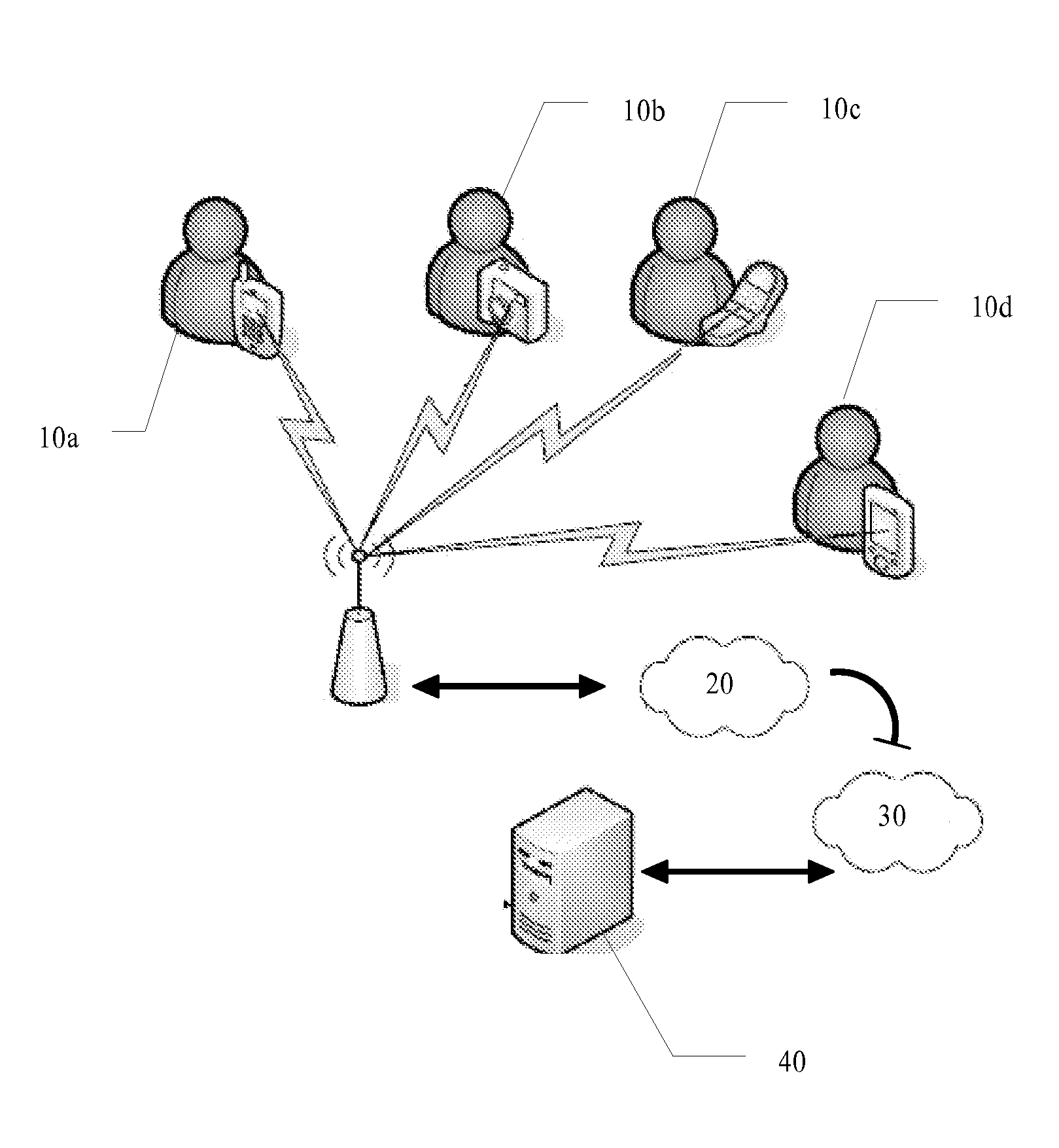
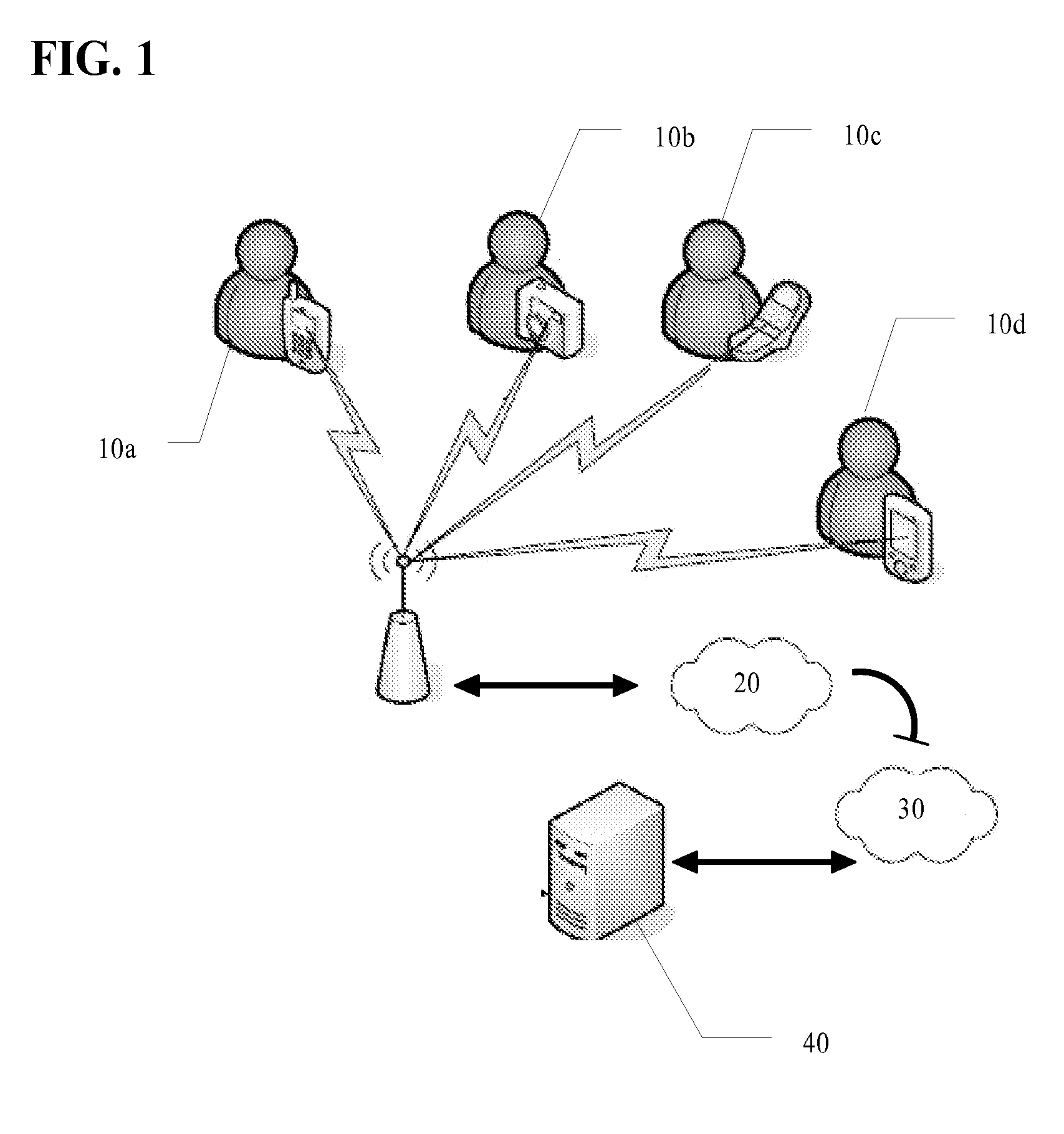
[0022]The present invention improves transportation and security by leveraging the use of personal electronic devices with global positioning system (GPS) in security applications. Applying low cost, scalable technologies that are widely-used by the public to augment and boost intelligence gathering, analysis and sharing is a cost-effective way to fill gaps in emergency communications.

[0023]The inventive system utilizes wireless phones in emergency communications that employ location-aware technologies, in portable form, in security applications.

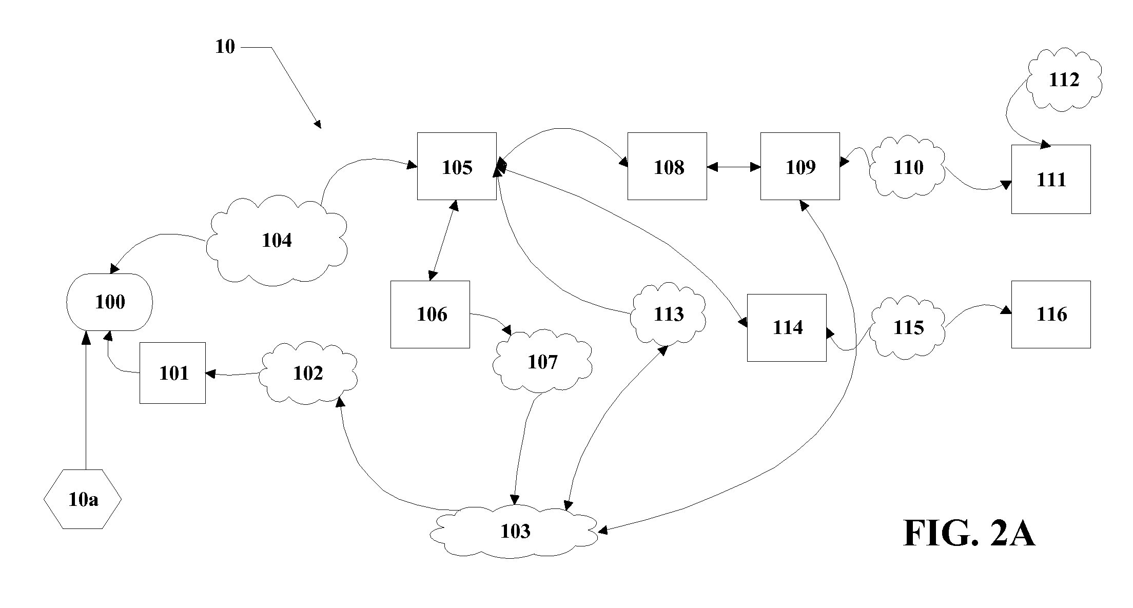
[0024]An illustrative embodiment of th...


PUM


Abstract

Provided is an emergency locator system adapted for GPS-enabled wireless devices. Global Positioning System (GPS) technology is and Location Based Services (LBS) are used to determine the exact location of a user and communicate information relating to the emergency status of that location. The user initiates the locator application via a wireless device and their physical location information is automatically transferred to a server. The server then compares the user's location with Geographic Information System (GIS) maps to identify the emergency status associated with their location. Once the server has calculated the current emergency status, the information is automatically returned to the user, along with emergency instructions.

Description

CROSS REFERENCE TO RELATED APPLICATIONS[0001]This application is a divisional of U.S. patent application 11 / 465,931, filed Aug. 21, 2006. This application also claims priority to U.S. Provisional Patent Application 60 / 595,960, filed Aug. 19, 2005 and U.S. Provisional Patent Application 60 / 720,297, filed Sep. 23, 2005.BACKGROUND OF THE INVENTION[0002]This invention relates to a method of providing emergency-related information to and from a centralized location over a wireless network.[0003]Recently, catastrophic hurricanes have become a normal summer event. Hurricanes often force mandatory or voluntary evacuations over large areas of land. These evacuation areas are typically divided into evacuation zones. For example, evacuation zones may be identified as zones A through E; with zone A identified as being an area at the highest risk for flooding or high winds, and zone E being an area least likely to be affected by an impending hurricane. As the weather becomes more severe, officia...

Claims


Application Information

Patent Timeline
Patent Type & Authority Patents(United States)
IPC IPC(8): H04M11/04H04L29/06H04M3/493H04M3/42H04W24/00
CPCH04M3/42348H04M3/487H04M11/04H04M2242/04
Inventor BARBEAU, SEAN J.WINTERS, PHILIP L.PEREZ, RAFAELLABRADOR, MIGUELGEORGGI, NEVINEDOS SANTOS, SASHA
Owner UNIV OF SOUTH FLORIDA
Why Eureka
Try Eureka