Apparatus and method for automatic airborne LiDAR data processing and mapping using data obtained thereby
a lidar data and automatic processing technology, applied in the field of lidar and aerial mapping, can solve the problems of low accuracy, low final product cost, and lack of software tools that automatically and efficiently process lidar data
- Summary
- Abstract
- Description
- Claims
- Application Information
AI Technical Summary
Benefits of technology
Problems solved by technology
Method used
Image
Examples
Embodiment Construction
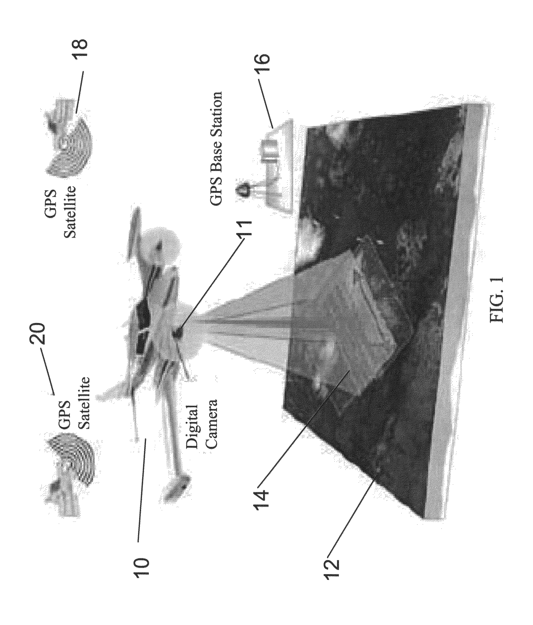
[0047]The present invention, in some embodiments thereof, relates to LiDAR and aerial mapping of ground topography, and more particularly but not exclusively to a mapping process using data obtained from the LiDAR sensor.
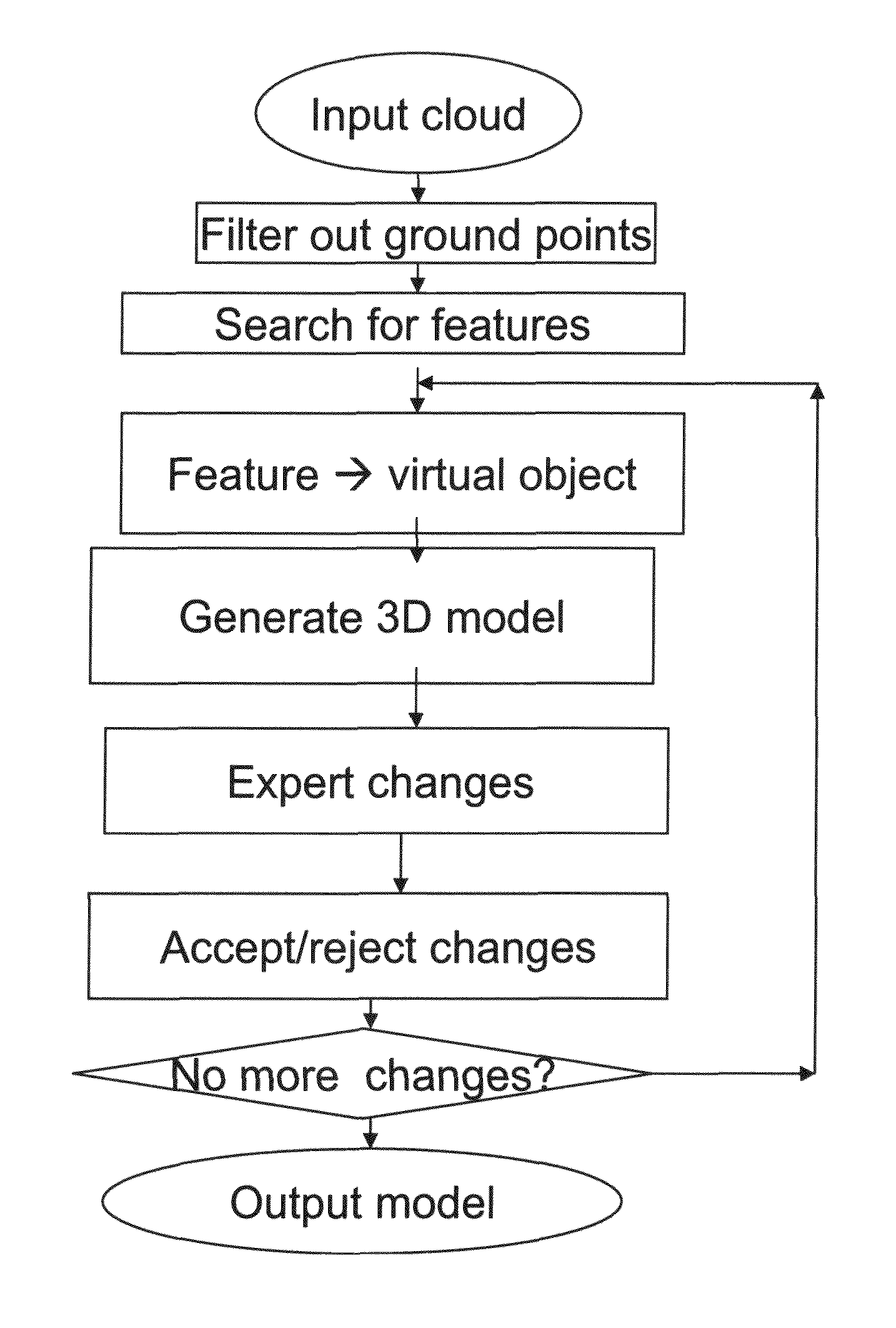
[0048]The raw LiDAR data may be inserted into a bare earth filter unit which calculates ground height over the data, bearing in mind that topography can vary over the data gathering area. Once ground height is calculated then all points relating to the ground are removed to leave only those points relating to features superimposed on the ground such as trees and buildings. These features may then be resolved into specific objects. Then the data points identified as these specific objects can be automatically replaced by virtual versions of the objects.
[0049]The result may then be included in a 3D model.
[0050]The result of the above processing may then be presented to the specialist to confirm, add or correct the result using a graphical interface, which also allows ...
PUM
 Abstract
Description
Claims
Application Information
 - R&D
- Intellectual Property
- Life Sciences
- Materials
- Tech Scout
- Unparalleled Data Quality
- Higher Quality Content
- 60% Fewer Hallucinations
Browse by: Latest US Patents, China's latest patents, Technical Efficacy Thesaurus, Application Domain, Technology Topic, Popular Technical Reports.
© 2025 PatSnap. All rights reserved.Legal|Privacy policy|Modern Slavery Act Transparency Statement|Sitemap|About US| Contact US: help@patsnap.com


