System and method for cost-effective, high-fidelity 3D-modeling of large-scale urban environments

a large-scale, high-fidelity technology, applied in the direction of instruments, navigation instruments, static indicating devices, etc., can solve the problems of complex and challenging visualization of urban environments, sketchy, and inability to provide the user the experience of roving

Active Publication Date: 2014-08-26
SHENKAR VICTOR +1
View PDF38 Cites 30 Cited by
  • Summary
  • Abstract
  • Description
  • Claims
  • Application Information

AI Technical Summary

Problems solved by technology

However, visualization of urban environments is complex and challenging.
Such three-dimensional urban models are rather sketchy and therefore cannot provide the user the experience of roving through “true” urban places.
Currently practiced methodologies to produce precise and complete 3D-city models are extremely laborious and time-consuming.
They lead to excessive production cost and schedule, and do not represent a commercially acceptable solution for constructing full-size city models anywhere in the world.

Method used


Image

  • System and method for cost-effective, high-fidelity 3D-modeling of large-scale urban environments
  • System and method for cost-effective, high-fidelity 3D-modeling of large-scale urban environments
  • System and method for cost-effective, high-fidelity 3D-modeling of large-scale urban environments

Examples


Embodiment Construction

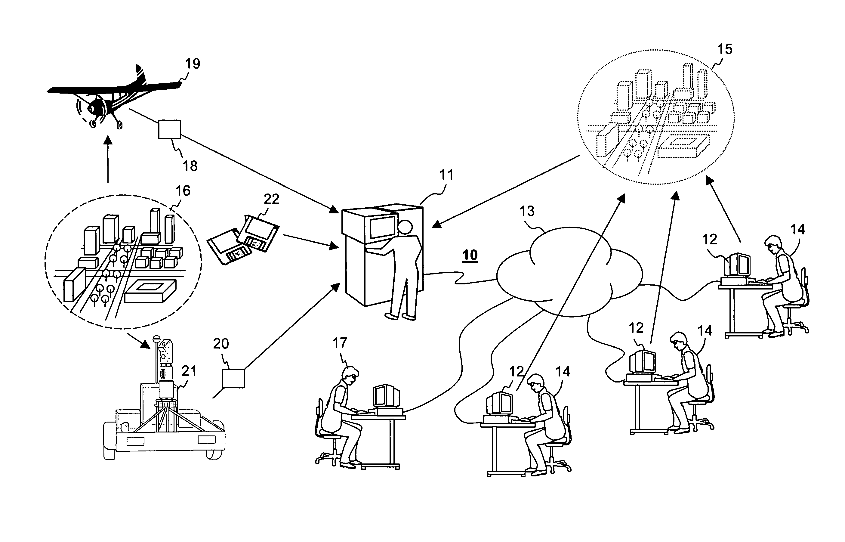
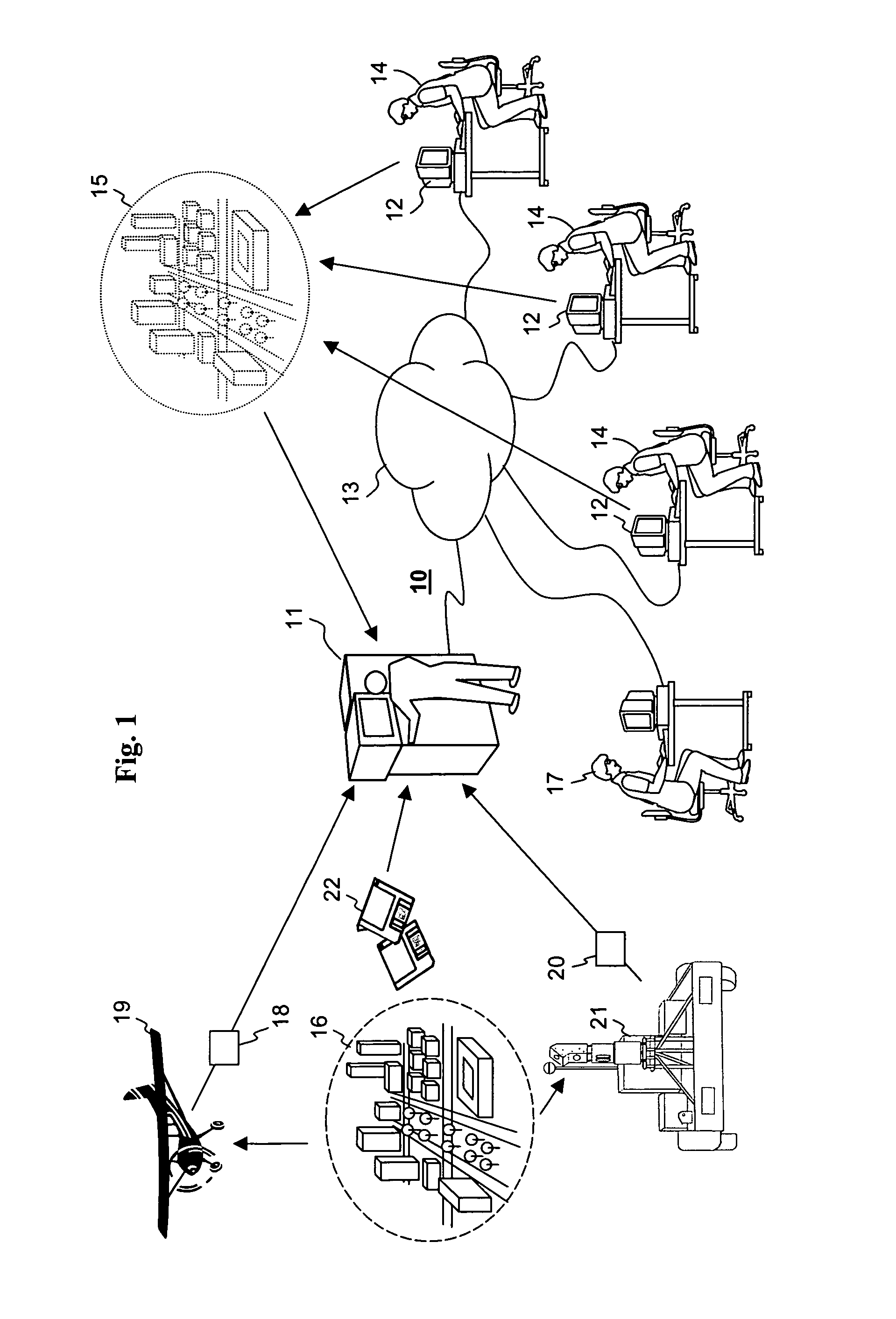
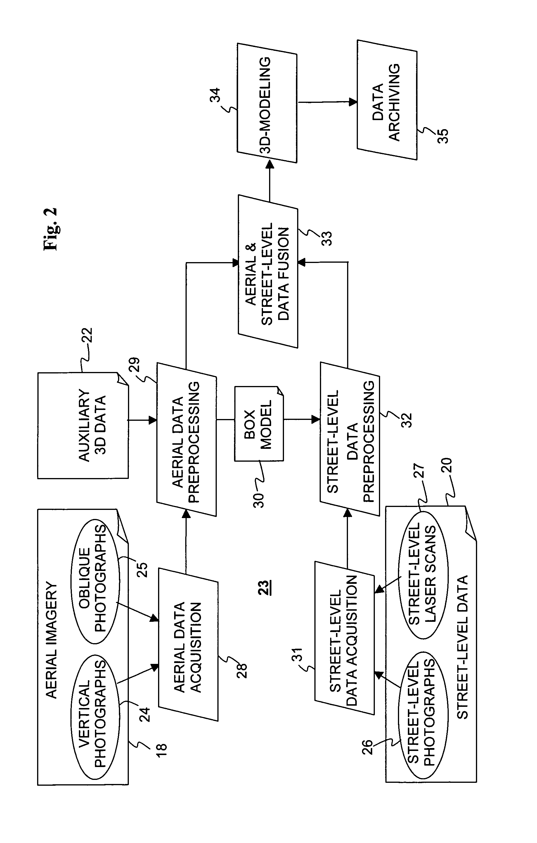
[0147]The present embodiments comprise systems and methods for creating high-fidelity, three-dimensional models of large-scale urban environments. The principles and operation of a 3D modeling system and method, according to the present invention, may be better understood with reference to the drawings and accompanying description.

[0148]Before explaining at least one embodiment of the invention in detail, it is to be understood that the invention is not limited in its application to the details of construction and the arrangement of the components set forth in the following description or illustrated in the drawings. The invention is capable of other embodiments or of being practiced or carried out in various ways. Also, it is to be understood that the phraseology and terminology employed herein is for the purpose of description and should not be regarded as limiting.

[0149]In this document, an element of a drawing that is not described within the scope of the drawing and is labeled ...


PUM


Abstract

A method, a system, and a program for high-fidelity three-dimensional modeling of a large-scale urban environment, performing the following steps:acquiring imagery of the urban environment, containing vertical aerial stereo-pairs, oblique aerial images; street-level imagery; and terrestrial laser scans,acquiring metadata pertaining to performance, spatial location and orientation of imaging sensors providing the imagery;identifying pixels representing ground control-points and tie-points in every instance of the imagery where the ground control-points and tie-points have been captured;co-registering the instances of the imagery using the ground control-points, the tie-points and the metadata, andreferencing the co-registered imagery to a common, standard coordinate system.The referenced co-registration obtained enables:extraction of ground coordinates for each pixel located in overlapping segments of the imagery, representing a 3D-point within the urban environment; andapplying data pre-processing and 3D modeling procedures;to create the high-fidelity 3D model of a large-scale urban environment.

Description

CROSS-REFERENCE TO RELATED APPLICATIONS[0001]The present application is filed under 35 U.S.C. 371 based on PCT International Application PCT / US2006 / 033966 having an international filing date of Aug. 31, 2006, which application claims priority from a provisional patent application 60 / 712,790 filed Sep. 1, 2005, the contents of which are hereby incorporated by reference.FIELD AND BACKGROUND OF THE INVENTION[0002]The present invention relates to a system and a method enabling a cost-effective, high-fidelity, three-dimensional modeling of a large-scale urban environment.[0003]With the proliferation of the Internet, online views of the real world became available to everybody. From static, graphic, two-dimensional maps to live video from web cams, a user can receive many kinds of information on practically any place in the world. Obviously, urban environments are of a great interest to a large number of users.[0004]However, visualization of urban environments is complex and challenging. ...

Claims


Application Information

Patent Timeline
Patent Type & Authority Patents(United States)
IPC IPC(8): G06K9/62
CPCG06T17/05
Inventor SHENKAR, VICTORHARARI, ALEXANDER
Owner SHENKAR VICTOR
Why Eureka
Try Eureka