
System for determining position of marker depth coordinates for construction of geological model of deposit

a technology of depth coordinates and geological model, which is applied in the field of system for determining the position of marker depth coordinates for the construction of geological model of deposit, can solve the problems that the conventional system cannot calculate the position of marker depth using the conventional system, and the system cannot ensure the location of mineral deposits. high accuracy

Active Publication Date: 2017-05-30
OOO ROCK FLOW DYNAMICS
View PDF5 Cites 1 Cited by
  • Summary
  • Abstract
  • Description
  • Claims
  • Application Information

AI Technical Summary

Benefits of technology

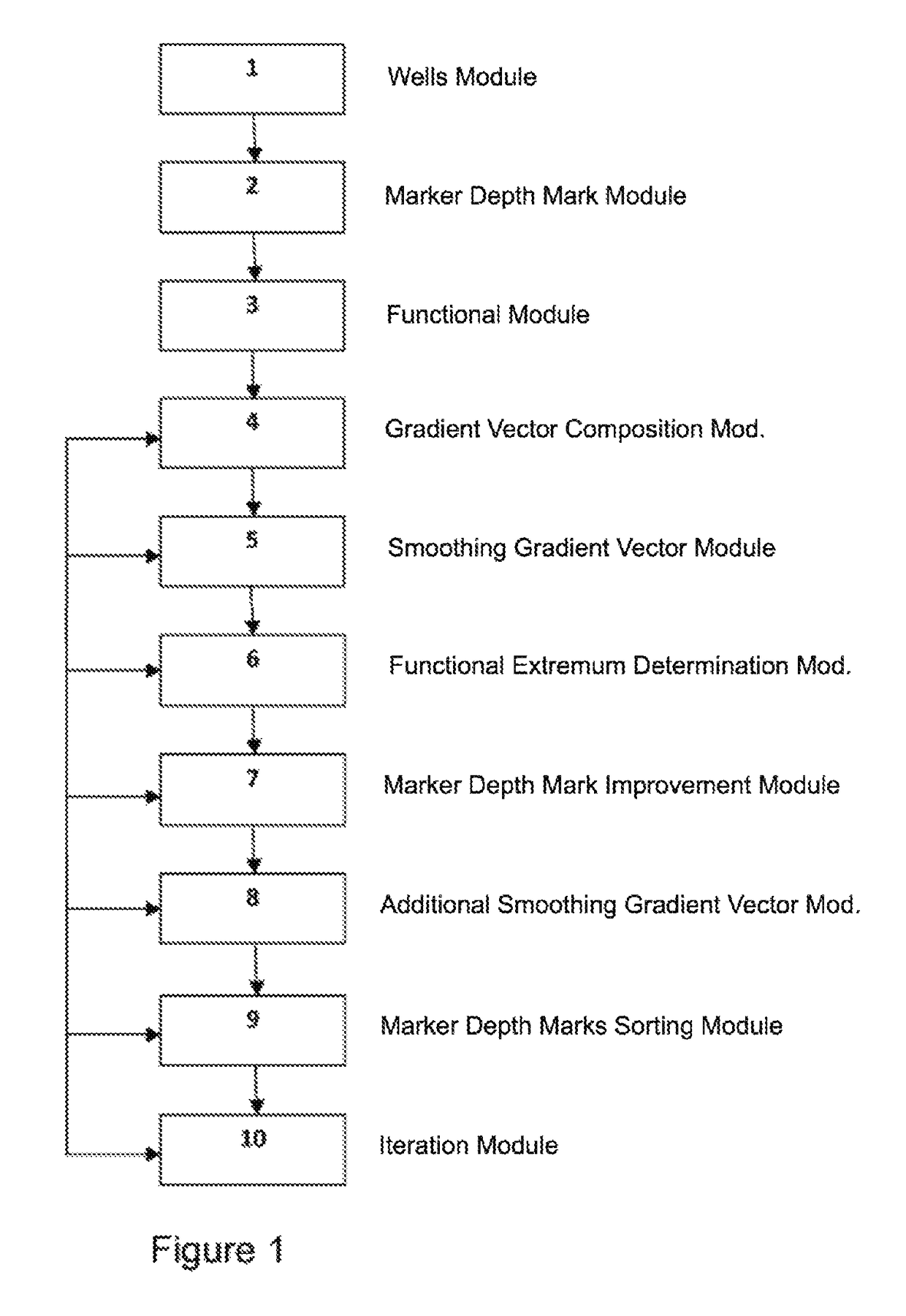
The embodiments described herein provide methods and systems for improved geological modeling. Specifically, they address issues with conventional systems by using marker depth data to determine the position of wells in a deposit. The system composes a gradient vector, smooths it by replacing each component with a mean value, and searches for a larger value of the functional. It also includes an iteration module that repeats these procedures until no larger value is found. The technical effects of this invention include improved accuracy and efficiency in geological modeling.

Problems solved by technology

However, the conventional systems fail to ensure highly accurate determinations of the location of mineral deposits, and in particular oil wells.
In addition, the positions of marker depths cannot be calculated using the conventional systems.

Method used


Image

  • System for determining position of marker depth coordinates for construction of geological model of deposit
  • System for determining position of marker depth coordinates for construction of geological model of deposit
  • System for determining position of marker depth coordinates for construction of geological model of deposit

Examples


Embodiment Construction

[0017]In the following detailed description, reference will be made to the accompanying drawing(s), in which identical functional elements are designated with like numerals. The aforementioned accompanying drawings show by way of illustration, and not by way of limitation, specific embodiments and implementations consistent with principles of the present invention. These implementations are described in sufficient detail to enable those skilled in the art to practice the invention and it is to be understood that other implementations may be utilized and that structural changes and / or substitutions of various elements may be made without departing from the scope and spirit of present invention. The following detailed description is, therefore, not to be construed in a limited sense. Additionally, the various embodiments of the invention as described may be implemented in the form of a software running on a general purpose computer, in the form of a specialized hardware, or combinatio...


PUM


Abstract

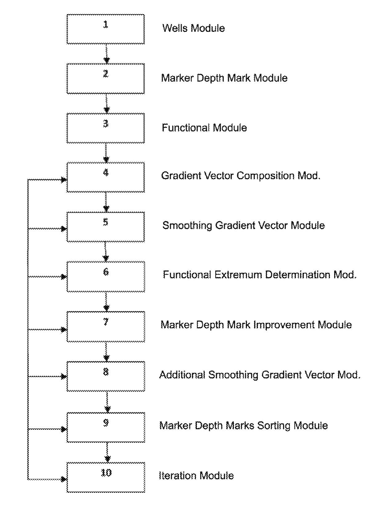
System for building a geological model of oil or other mineral deposit. The system determines functionals represented by the sum of coefficients of correlation for a set of well log curves. A technical result is the improvement of the accuracy of evaluating parameters that are used to build geological model of the location of oil or other deposits. The system makes it possible, given set of markers, chosen as initial solution and to calculate their depths at each well to ensure the best total correlation. For any marker in the set, functional is determined, represented by the sum of correlation coefficients for the set of well log methods for pairs of wells located within specified distance from one another. Partial derivatives are evaluated for this functional, and the vector thus obtained is smoothed and used to search for a larger value of the functional within certain segment along this vector.

Description

CROSS-REFERENCE TO RELATED PATENT APPLICATIONS[0001]This U.S. patent application is related to the following U.S. patent applications filed on the same day: U.S. patent application Ser. No. 14 / 094,773 entitled “SYSTEMS AND METHODS FOR DETERMINING POSITION OF MARKER DEPTH COORDINATES FOR CONSTRUCTION OF GEOLOGICAL MODEL OF DEPOSIT,” U.S. patent application Ser. No. 14 / 094,776 entitled “SYSTEMS AND METHODS FOR DETERMINING POSITION OF MARKER DEPTH COORDINATES FOR CONSTRUCTION OF GEOLOGICAL MODEL OF DEPOSIT,” and U.S. patent application Ser. No. 14 / 094,779 entitled “SYSTEM FOR DETERMINING POSITION OF MARKER DEPTH COORDINATES FOR CONSTRUCTION OF GEOLOGICAL MODEL OF DEPOSIT,” all of which are incorporated by reference herein in their entirety.BACKGROUND OF THE INVENTION[0002]Technical Field[0003]The invention relates to a system for building a geological model of oil or other mineral deposit. In particular, the system relates to a system for determining functionals representing the sum of...

Claims


Application Information

Patent Timeline
Patent Type & Authority Patents(United States)
IPC IPC(8): G06F17/50E21B47/04G01V99/00G01V1/40G01V11/00G01V1/50
CPCE21B47/04G01V1/40G01V1/50G01V11/00G01V99/005G01V2210/60G06F17/5009G06F30/20G01V20/00
Inventor CHESKIS, OLGA ANDREEVNATREGUB, SEMEN LEONIDOVICHKAZAROV, ANDREY SERGEEVICH
Owner OOO ROCK FLOW DYNAMICS
Learn More