Method for implementing real time monitoring using three-dimensional sight simulation
A real-time monitoring and landscape technology, applied in the field of simulation monitoring system, can solve problems such as urban traffic congestion, low traffic efficiency, and rising traffic accident rate
- Summary
- Abstract
- Description
- Claims
- Application Information
AI Technical Summary
Problems solved by technology
Method used
Image
Examples
Embodiment Construction
[0014] The present invention will be described in further detail below in conjunction with the accompanying drawings.
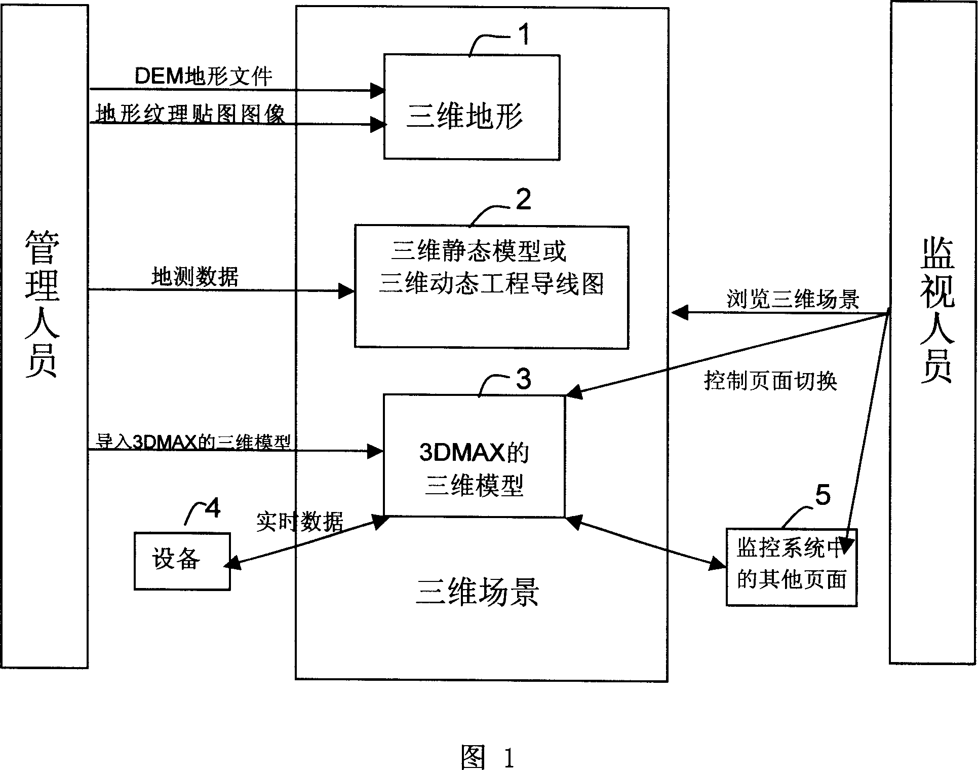
[0015] Managers in the real-time monitoring system are responsible for establishing a 3D scene and associating certain objects in the 3D scene with relevant monitoring equipment or other control pages in the monitoring system.
[0016] As shown in Figure 1, in step 1, the manager imports DEM (Digital Elevation Model, digital elevation model) terrain file (including DEM row, column number, grid spacing and upper left corner geodetic coordinates) and terrain texture map image (containing image resolution and top-left geodetic coordinates), generating realistic 3D terrain with terrain textures.
[0017] In step 2, the manager imports the geodetic data (the geodetic data can be a static 3D object, or it can be dynamically changing, such as engineering wires in a coal mine representing the progress of the project), and the static geodetic data generates a 3D stati...
PUM
 Abstract
Description
Claims
Application Information
 - R&D
- Intellectual Property
- Life Sciences
- Materials
- Tech Scout
- Unparalleled Data Quality
- Higher Quality Content
- 60% Fewer Hallucinations
Browse by: Latest US Patents, China's latest patents, Technical Efficacy Thesaurus, Application Domain, Technology Topic, Popular Technical Reports.
© 2025 PatSnap. All rights reserved.Legal|Privacy policy|Modern Slavery Act Transparency Statement|Sitemap|About US| Contact US: help@patsnap.com

