Method, apparatus and system for matching map and conferring route

A technology of path estimation and map matching, which is applied in the traffic control system of road vehicles, traffic control system, road network navigator, etc., can solve the problems of map data reorganization and low operation efficiency, so as to improve efficiency and improve operation efficiency , calculate the simple effect of

Active Publication Date: 2009-04-15
CENNAVI TECH
View PDF0 Cites 52 Cited by
  • Summary
  • Abstract
  • Description
  • Claims
  • Application Information

AI Technical Summary

Problems solved by technology

[0003] In the traditional method, the two aspects of map matching and path estimation are often carried out separately during system operation, and the original map data is not reorganized to generate the FCD path required for map matching and path estimation during system operation. The network expands the grid data to improve the operating efficiency of the subsequent map matching and path estimation, so that the operating efficiency of the entire system is relatively low

Method used


Image

  • Method, apparatus and system for matching map and conferring route
  • Method, apparatus and system for matching map and conferring route
  • Method, apparatus and system for matching map and conferring route

Examples


Embodiment Construction

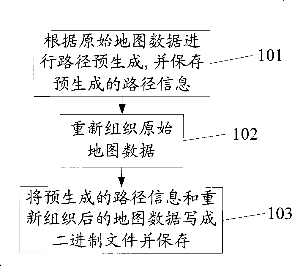
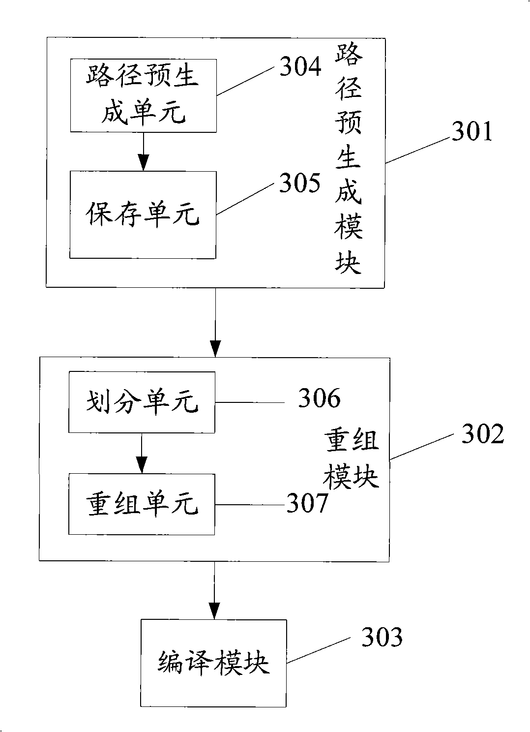
[0024] In order to improve the operating efficiency of map matching and path estimation, the invention provides a method for map matching and path estimation.

[0025] In the existing intelligent transportation system (ITS), the traffic information tool is obtained through a floating car (Float Car Data). The floating car is also called a probe car. Its basic principle is: according to the vehicle position, direction and speed information regularly recorded by the floating car equipped with the vehicle-mounted global positioning system during its driving, map matching, path estimation, etc. are applied. Relevant calculation models and algorithms are used to associate the position data of floating cars with urban roads in time and space, and finally obtain traffic congestion information such as the vehicle speed of the roads passed by the floating cars and the travel time of the roads. If a sufficient number of floating vehicles are deployed in the city, and the location data o...


PUM


Abstract

The invention discloses a method of map matching and route estimation, and a device and a system thereof, and pertain to the processing and application field of urban road traffic situation information, and aim at solving the problem of low operating efficiency of the map matching and route estimation in the prior art. The device and the system preprocess the original map data in the map matching and route estimation: first, pre-generating a route, then dividing a road net into smaller grids, re-organizing the data of each new grid, and finally compiling the data into a file according to a defined data structure for the following map matching and route estimation, thus enhancing the operating efficiency. The method, the device and the system can directly position the grid at which a GPS point is located, and as the grids are smaller, Link numbers in the grids are fewer, the GPS point matching rate is extremely fast; and no frequent route exploration is needed in the following route estimation, which greatly improves the route estimation efficiency, thus an algorithm of the method is simple.

Description

technical field [0001] The invention relates to the field of processing and application of urban road traffic condition information, in particular to a map matching and path estimation method, device and system. Background technique [0002] Map matching is to find out the road section of the point on the map through the longitude and latitude of the GPS point of the Float Car Data (FCD); path estimation is to infer a reasonable matching path on the map based on the walking track of the GPS point . Today, with the rapid development of urban traffic, urban roads are becoming more and more complex, so the car terminal navigation system has been paid more and more attention by people. However, it is a technical difficulty to organize and manage large-scale road network information on the vehicle-mounted terminal with limited processing capacity, and to realize fast map matching and route estimation on this basis. [0003] In the traditional method, the two aspects of map matc...

Claims


Application Information

Patent Timeline
Patent Type & Authority Applications(China)
IPC IPC(8): G08G1/00G08G1/123G08G1/137G01C21/30G01C21/34
Inventor 胡建魏俊华张孝娟陈燕妮
Owner CENNAVI TECH
Why Eureka
Try Eureka