Satellite navigation system

A technology of satellite navigation system and global positioning system, which is applied in the field of satellite navigation system, can solve the problems of inconvenient use and inability to display 2D bird's-eye view at the same time, and achieve the effect of expanding the use function

Inactive Publication Date: 2009-05-27
MITAC COMP (SHUN DE) LTD
View PDF0 Cites 21 Cited by
  • Summary
  • Abstract
  • Description
  • Claims
  • Application Information

AI Technical Summary

Problems solved by technology

However, since there is only a single touch-sensitive display in the satellite navigation system, and only one operation mode can appear in the window of the display at a time, such as: function menu, input interface, 2D or 3D navigation mode
Therefore, when the display shows the 3D navigation mode, the 2D bird's-eye view cannot be displayed at the same time, which will cause inconvenience in use

Method used


Image

  • Satellite navigation system
  • Satellite navigation system
  • Satellite navigation system

Examples


Embodiment Construction

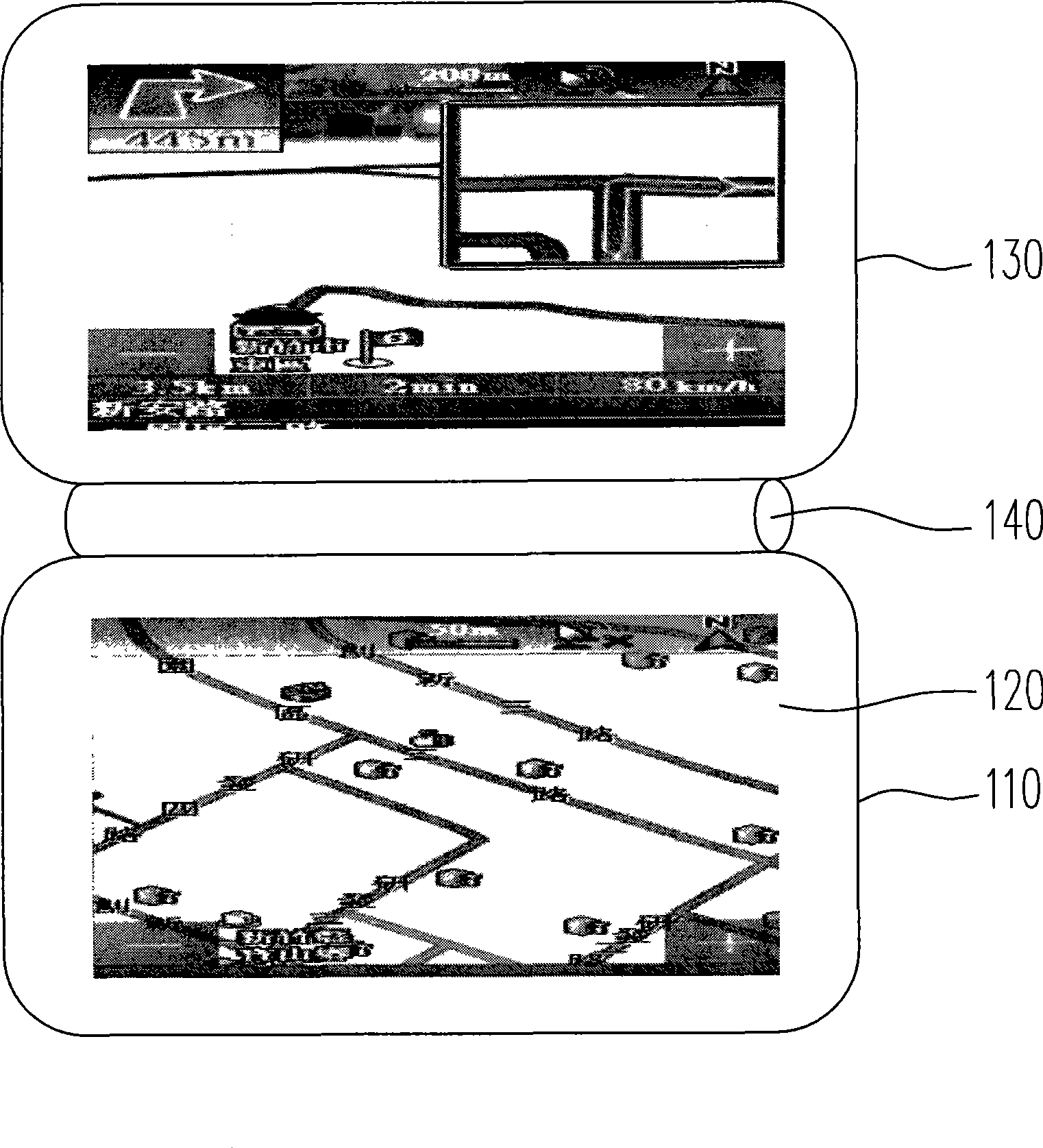
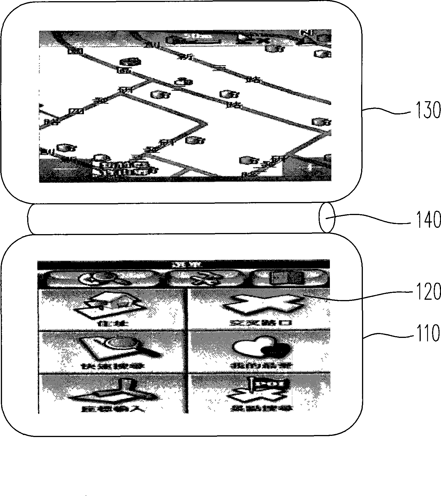
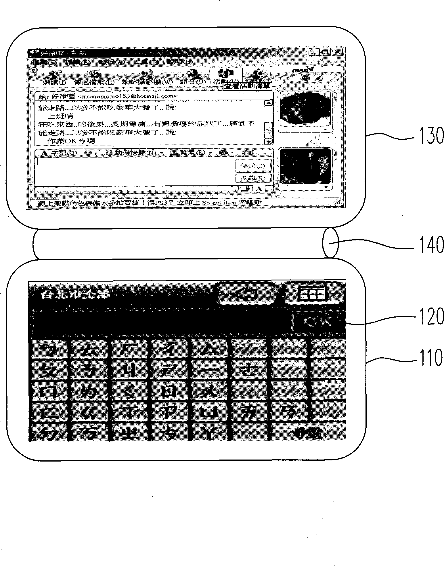
[0016] figure 1 It is a schematic structural diagram of a satellite navigation system according to an embodiment of the present invention. Please refer to figure 1 , the satellite navigation system 100 of the present invention is mainly arranged on a car, and its feature is mainly to utilize the design of double screens to display two different operation modes at the same time, for example: a geographical view in 2D bird's-eye view mode is displayed on one of the screens map, and a geographic map in 3D navigation mode is displayed on another screen to facilitate the driver to make a more correct driving judgment.

[0017] The satellite navigation system 100 mainly includes a host 110 , a global positioning system module (not shown in the figure), a first touch display 120 and a second touch display 130 . The host 110 is mainly used to process received data, output calculation results, store data, etc., and usually includes a processor and a temporary storage device. The glo...


PUM


Abstract

The invention relates to a satellite navigation system, which includes a host, a global positioning system module, a first touch control type display and a second touch control type display. The host is used for processing data, and the global positioning system module is arranged in the host to receive a satellite signal of global positioning system and calculate position the satellite navigation system. The first touch control type display is arranged on the host and is electrically connected with the host. The second touch control type display is pivoted on one side of the host and is electrically connected with the host, wherein the first touch control type display and the second touch control type display are used for displaying different operation mode. The satellite navigation system of the present invention employs design of double-screen, so that, different operation modes can be simultaneously displayed.

Description

【Technical field】 [0001] The present invention relates to a satellite navigation system, and more particularly to a satellite navigation system with dual screens. 【Background technique】 [0002] The Global Positioning System (GPS) is a navigation system combining satellite and wireless technology, which can provide users with precise positioning, speed and time. The application of GPS has widely existed in the current market. With the advancement of satellite technology, many GPS technologies and business opportunities are also developing rapidly. GPS was limited to military units in the early days, and its purpose is for military purposes, such as fighter planes, ships, vehicles, and personnel , The precise positioning of the attack target, etc. Today, GPS has been opened to the public for positioning. This technology, which combines space satellites and communication technology, has been vigorously deployed in the private market, and has produced some revolutionary change...

Claims


Application Information

Patent Timeline
Patent Type & Authority Applications(China)
IPC IPC(8): G01C21/26G01C21/36G01S1/02G01S5/02
Inventor 刘能
Owner MITAC COMP (SHUN DE) LTD
Why Eureka
Try Eureka