Geological calamity emergency monitoring, predicting and analyzing method

A technology of geological disasters and analysis methods, applied in geophysical surveying, seismology, measuring devices, etc., can solve the problems of inability to monitor and analyze parameters in a large area of ​​disaster-affected areas, damage to comprehensive disaster monitoring devices, and inability to effectively identify landslide locations and methods , movement mode, formation process and harm range and other issues

Inactive Publication Date: 2009-07-08
INST OF MOUNTAIN HAZARDS & ENVIRONMENT CHINESE ACADEMY OF SCI
View PDF0 Cites 22 Cited by
  • Summary
  • Abstract
  • Description
  • Claims
  • Application Information

AI Technical Summary

Problems solved by technology

[0003] The technical system and system for early warning and monitoring of secondary disasters has not yet been established. Manual site survey and reinforcement of key areas are the main technical means to reduce the threat of secondary disasters
These means cannot effectively monitor and analyze the parameters of large-scale disaster-affected areas, and cannot effectively identify the location, method, movement mode, formation process, and hazard

Method used


Image

  • Geological calamity emergency monitoring, predicting and analyzing method
  • Geological calamity emergency monitoring, predicting and analyzing method
  • Geological calamity emergency monitoring, predicting and analyzing method

Examples


Embodiment Construction

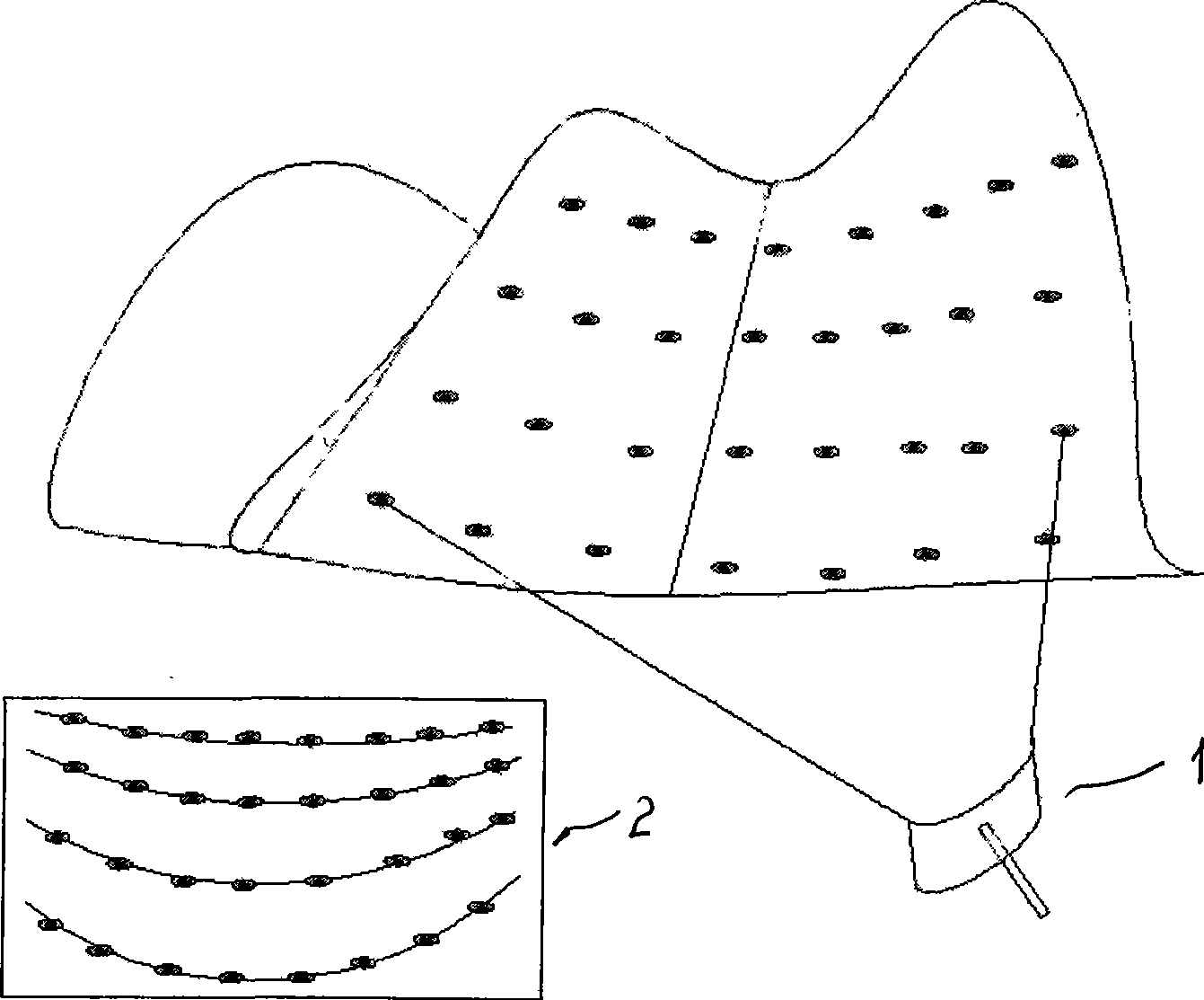
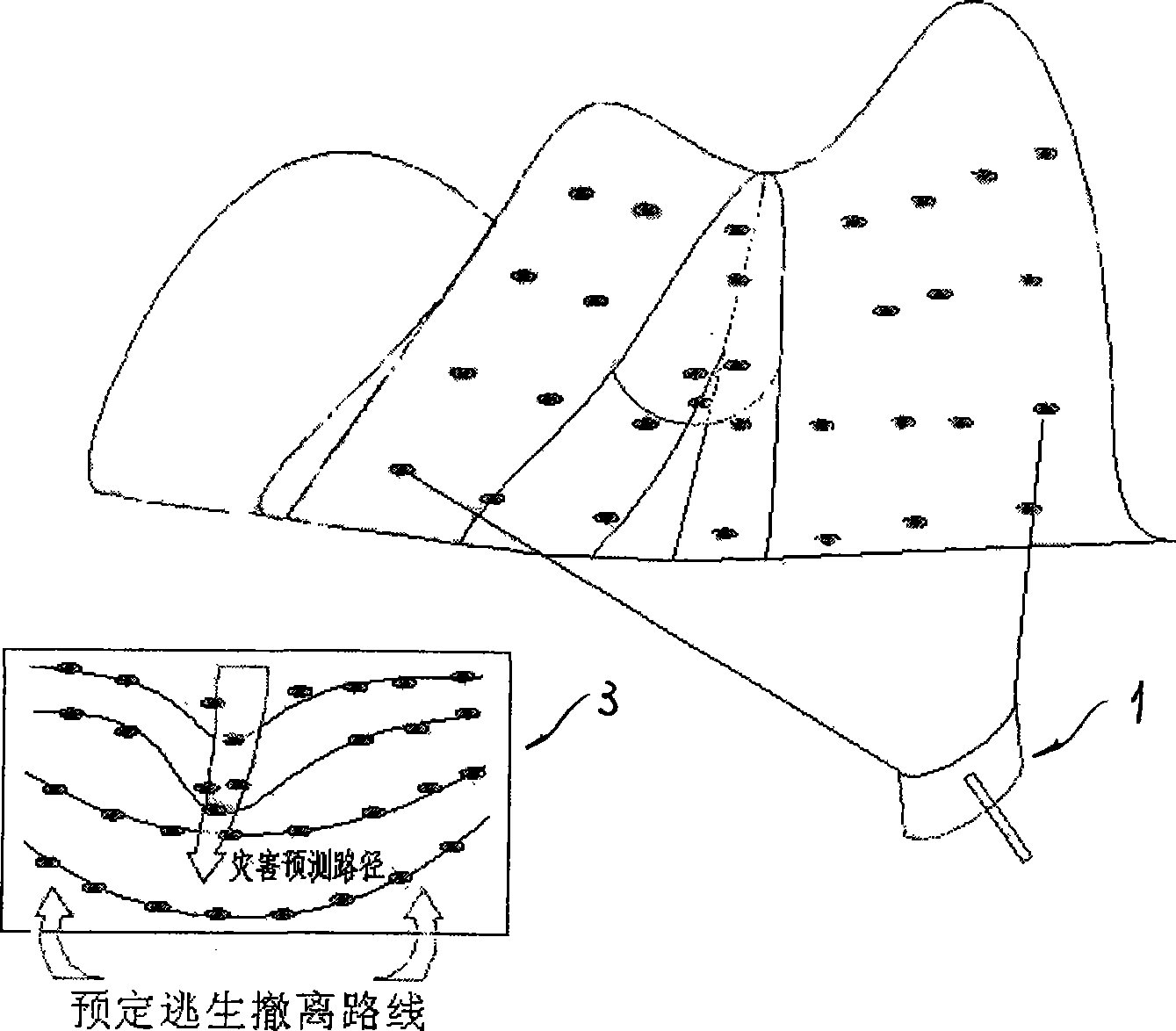
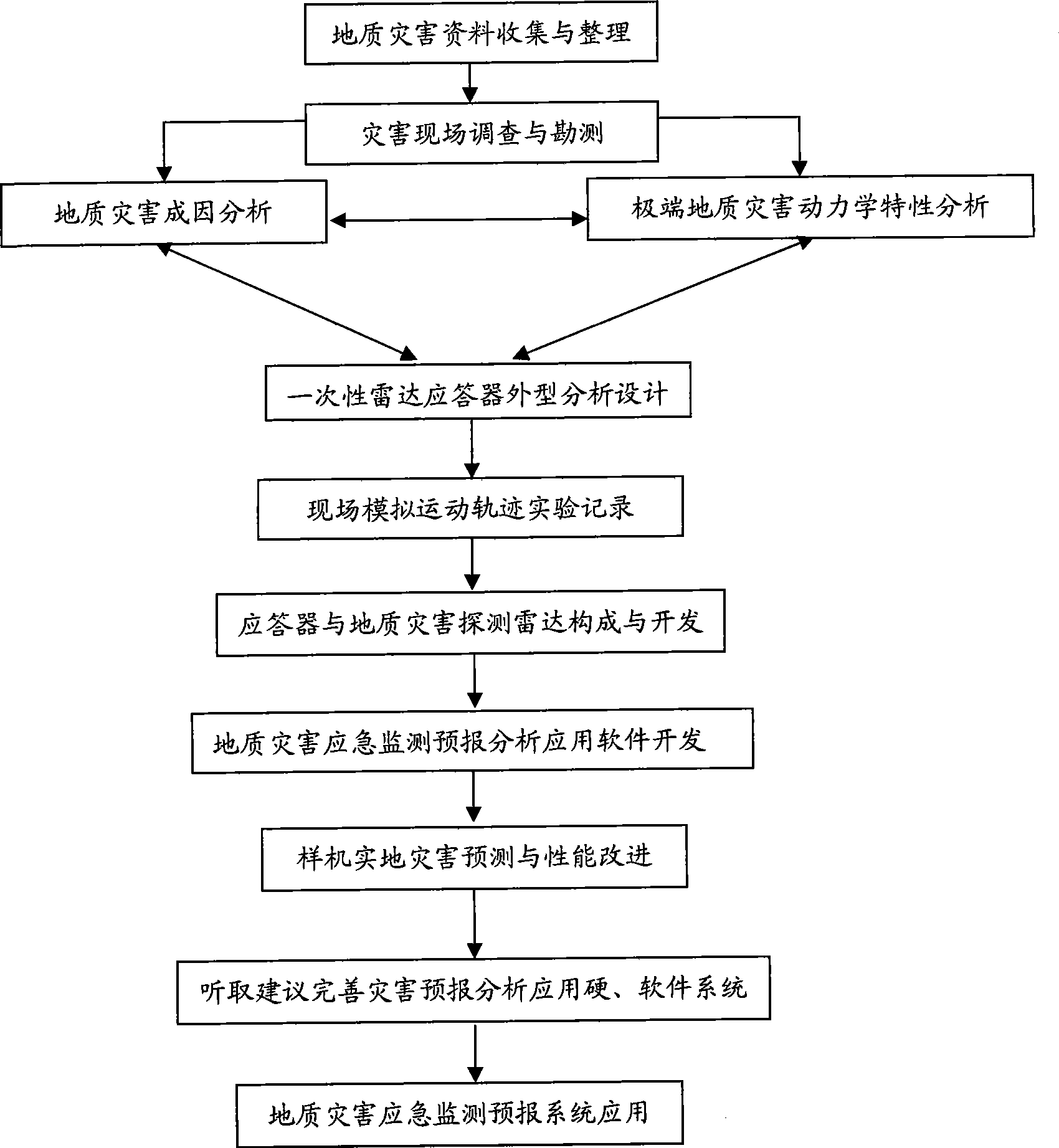
[0028] According to the schematic diagram of geological disaster detection mode of the present invention ( figure 1 and figure 2 , respectively showing the radar transponder layout image 2 in the disaster monitoring area, and the deformation image 3 of the radar strain gauge in the early stage of disaster formation and the all-weather radar detector 1. The upper part of the figure is a schematic representation of the disaster monitoring area topography shape), the monitoring method of the present invention is at first emphasizing on The "guardian sentinel" type mainly focuses on the direct mobile monitoring of the disaster body, supplemented by other parameters, avoids large and comprehensive complex calculation and reasoning as far as possible, and moves the disaster prediction and alarm function to the scene.

[0029] Geological disaster emergency monitoring and forecasting system, including,

[0030] All-weather continuous monitoring radar: use radar scanning and position...


PUM


Abstract

The invention discloses a geologic hazard emergency monitoring forecast system and a method for analyzing the forecast of the system. Disposable radar responders move together with landslide or debris flow, flood and the like on ground surface by irregularly launching the disposal radar responders in a geologic hazard region which is formed or is forecasted to be formed. Through technology of radar scanning, running tracks of the radar responders can be monitored and compared intuitively and quickly; the place and the time formed by the hazard can be further analyzed and determined combining with status of topography and landform; and basic causes and important information, such as a territorial scope which is about to be affected by the hazard, forecasted imminent time slice and safe escape route, and the like, can be acquired assorted with rainfall, earthquake and other information. The system and the method have a standard product structure and low cost, and have incomparable advantages on the forecast of geologic hazard which has clear cause, certain predictability, large scale and short-terming burst under quick response.

Description

technical field [0001] The invention belongs to the technical field of physical automatic control, in particular to a geological disaster emergency monitoring and forecasting system and a forecasting analysis method thereof. Background technique [0002] my country is one of the countries most severely affected by natural disasters in the world. Relevant studies have shown that the impact of global warming on the distribution and occurrence of disaster risks in my country will be all-round and multi-level: strong typhoons will become more active, heavy rain and flood disasters will increase, and the possibility of basin-wide floods will increase; Geological disasters derived from extreme events such as earthquakes, mountain torrents caused by local heavy rainfall, landslides, mudslides, and barrier lakes will also increase. [0003] The technical system and system for early warning and monitoring of secondary disasters has not yet been established. Manual site survey and rei...

Claims


Application Information

Patent Timeline
IPC IPC(8): G01V1/00G01S13/88
Inventor 赵宇崔鹏段晓康
Owner INST OF MOUNTAIN HAZARDS & ENVIRONMENT CHINESE ACADEMY OF SCI
Why Eureka
Try Eureka