Method for expressing processing of roads on map

A technology of roads and maps, applied in the field of surveying and mapping geographic information, can solve problems such as unreasonable and difficult to understand roads, achieve the effects of enhancing data analysis functions and graphics transmission speed, improving browsing speed, and reducing labor costs

Inactive Publication Date: 2010-02-17
XIAN MEIHANG INFORMATION IND
View PDF0 Cites 28 Cited by
  • Summary
  • Abstract
  • Description
  • Claims
  • Application Information

AI Technical Summary

Problems solved by technology

[0002] In the prior art, map road processing is extremely troublesome. With the wide application of GPS technology, the traditional road map representation can no longer fully satisfy the c

Method used


Image

  • Method for expressing processing of roads on map
  • Method for expressing processing of roads on map
  • Method for expressing processing of roads on map

Examples


Embodiment Construction

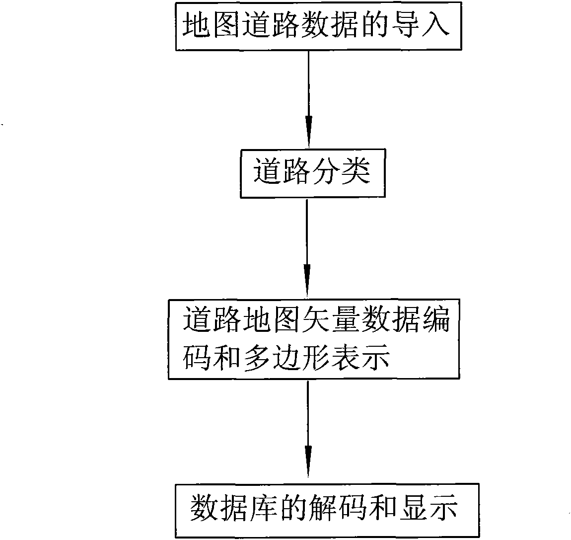
[0039] like figure 1 As shown, a processing representation method of a road on a map of the present invention comprises the following steps:

[0040] Step 1. Importing map road data: importing the map road data collected and surveyed into the database, determining the scale of the map as 1:500-1:5000, and performing format conversion processing on the map road data to generate road map vector data;

[0041] Step 2, road classification: the generated road map vector data is divided into six categories: expressways, tunnels, road bridges, main roads, secondary roads and side roads; wherein, the road bridges are viaducts or overpasses, and the main roads are It is an urban arterial road, the secondary road is an urban branch road, and the small road is a road for pedestrians and bicycles; when there is a tunnel part or a bridge part on the expressway, it is extracted and classified as a tunnel class or road and bridge class;

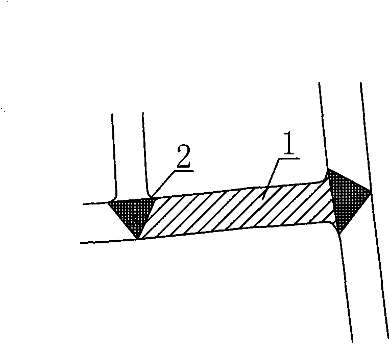
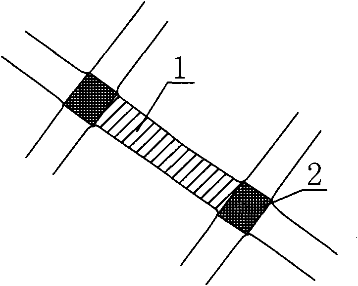
[0042]Step 3. Road map vector data encoding and pol...


PUM


Abstract

The invention discloses a method for expressing the processing of roads on a map. The method comprises the following steps: 1, importing road data of a map; 2, classifying roads; 3, coding the map vector data of the roads and giving the polygonal expression, particularly, creating three surface polygon models of road polygons, crossing polygons and road isolation zone polygons, two point models ofcrossing nodes and road blind end nodes and a line model of road center line, and coding the features of each road polygon model, creating an attribute table for the three major road models of points, lines and surfaces, and generating the map vector date in a compressed format at the same time; and 4, decoding and displaying the database. The invention has the advantages of simple method, low data redundancy, strong data analysis function and high graphic transmission speed, and meanwhile, the invention further has the advantages of high road classification accuracy and low cost. The invention can fully present the complicated urban road system through the different classification of surface road elements and the creation of road models.

Description

technical field [0001] The invention belongs to the technical field of surveying and mapping geographic information, and relates to a road processing representation method, in particular to a processing representation method for roads in a vector map on a map. Background technique [0002] In the prior art, map road processing is extremely troublesome. With the wide application of GPS technology, the traditional road map representation can no longer fully satisfy the current road system on the two-dimensional map, especially for viaducts, overpasses and ring roads. Dealing with the problem that the road representation is unreasonable and difficult to understand. Contents of the invention [0003] The object of the present invention is to address the deficiencies in the prior art, and provide a method for processing and representing roads on a map with simple representation method, less data redundancy, high division accuracy and low cost. [0004] In order to solve the ab...

Claims


Application Information

Patent Timeline
IPC IPC(8): G09B29/00
Inventor 刘阳王美娟宋宏吴军荣
Owner XIAN MEIHANG INFORMATION IND
Why Eureka
Try Eureka