Eureka AIR delivers breakthrough ideas for toughest innovation challenges, trusted by R&D personnel around the world.

Active three-dimensional omnidirectional vision-based river width measuring device

A panorama vision and width measurement technology, which is used in measurement devices, surveying and navigation, open-air water source surveys, etc., and can solve problems such as low accuracy, high labor intensity, and slow measurement speed.

Inactive Publication Date: 2010-07-14
ZHEJIANG UNIV OF TECH
View PDF1 Cites 12 Cited by
  • Summary
  • Abstract
  • Description
  • Claims
  • Application Information

AI Technical Summary

Problems solved by technology

[0013] In order to overcome the shortcomings of the existing river survey work, such as high labor intensity, low efficiency, slow measurement speed, and low precision, the present invention provides an active stereoscopic Panoramic Vision River Width Measuring Device

Method used

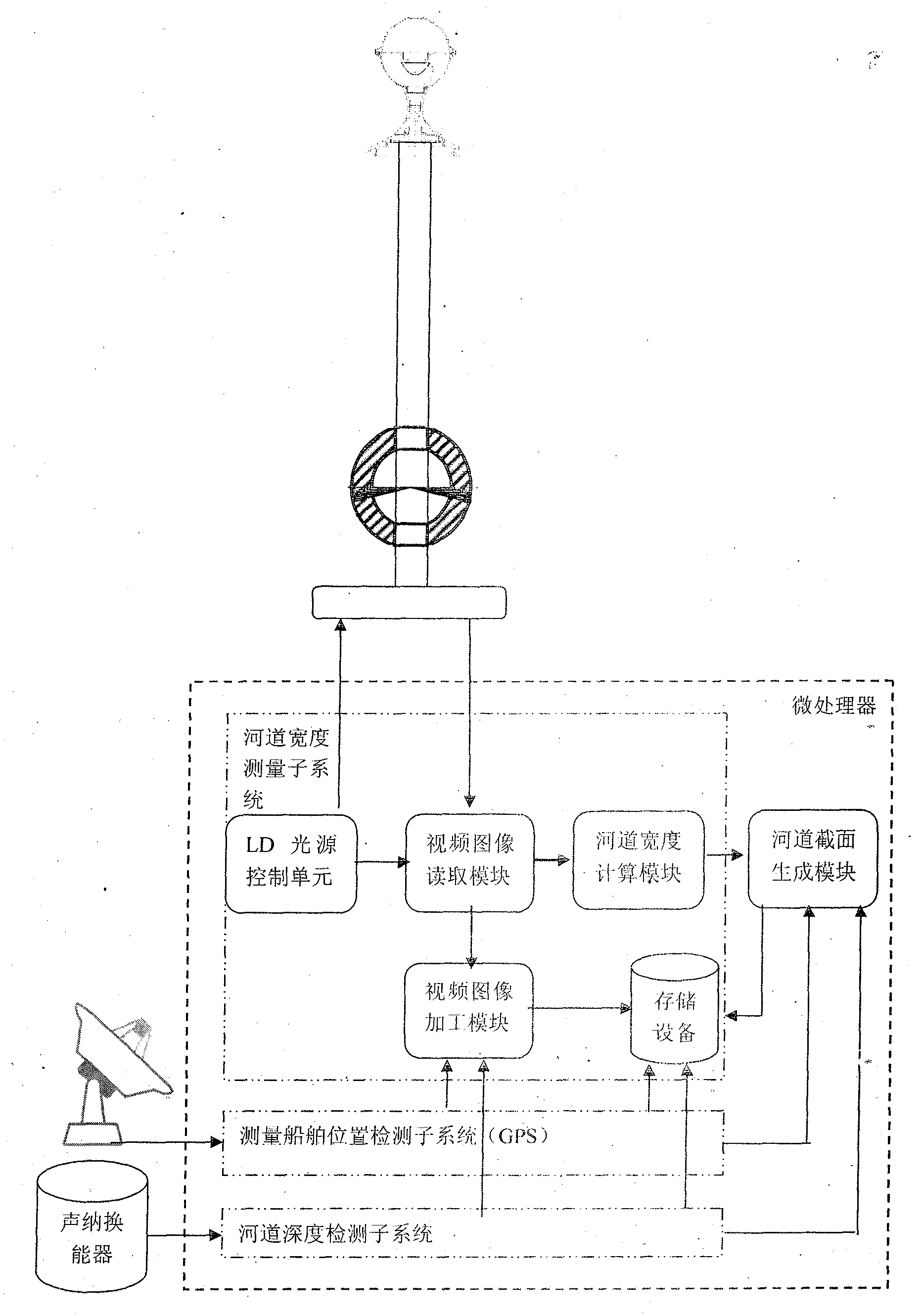

Image

  • Active three-dimensional omnidirectional vision-based river width measuring device
  • Active three-dimensional omnidirectional vision-based river width measuring device
  • Active three-dimensional omnidirectional vision-based river width measuring device

Examples


Embodiment 1

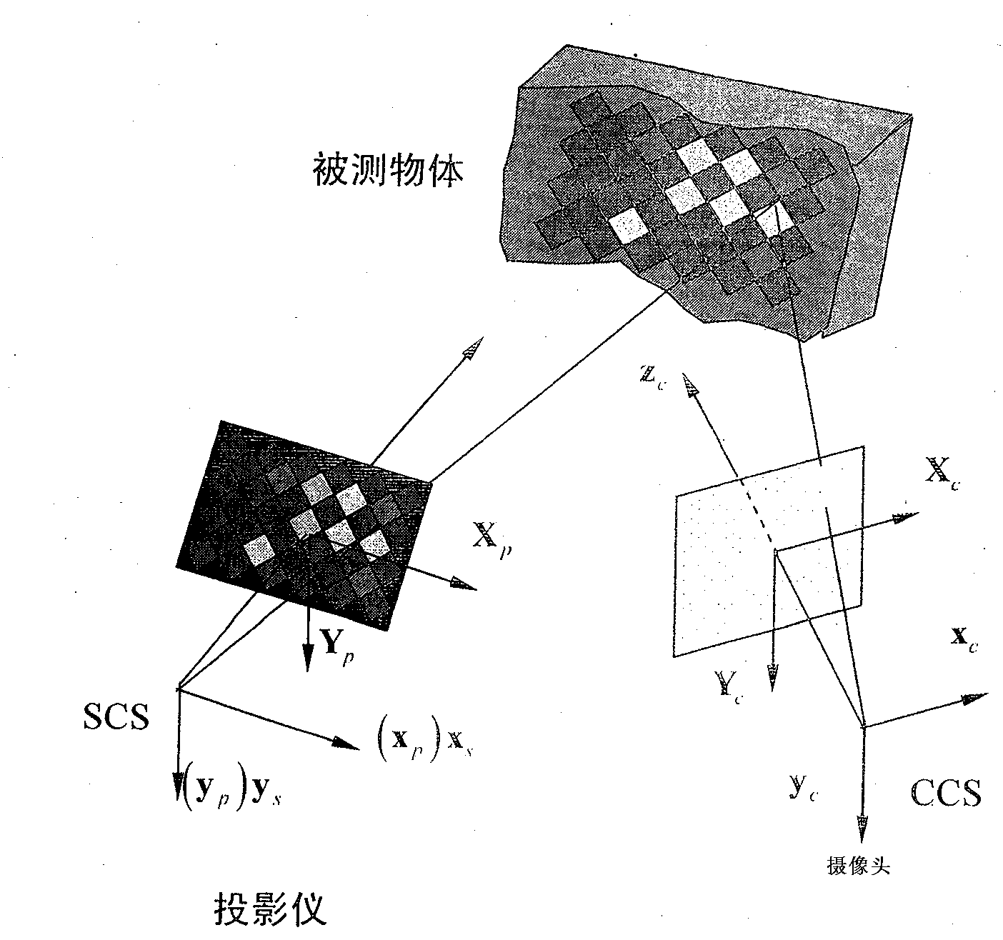
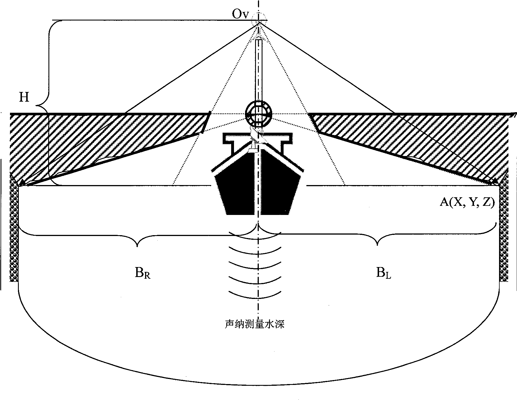
[0082] refer to Figure 1-7 , Figures 13 to 14 , a river channel width measurement device based on active stereo panoramic vision, including an omnidirectional vision sensor with a fixed single point of view, a panoramic color volume structured light generator with a fixed single emission center point, and a three-dimensional stereo camera for measuring the channel width , river course map data acquisition, and a microprocessor for fusion with river course depth data, the viewpoint of the omnidirectional visual sensor and the emission center point of the panoramic color volume structured light generator are arranged on the same axis line; the described The channel width measurement device based on active stereo panoramic vision, the GPS sensor and the sonar sensor configuration are all fixed on the same pole extension line, as attached Figure 4 As shown, the pole is fixed at the center of the measuring ship and is perpendicular to the horizontal plane;

[0083] Described o...


PUM


Abstract

The invention discloses an active three-dimensional omnidirectional vision-based river width measuring device, which comprises a GPS sensor, a sonarprobe, an ominidirectional vision sensor with a fixed and single viewpoint, a full-view color body structure optical generator with fixed and single transmitting central point, and a microprocessor used for carrying out three-dimensional photographic measurement on the river width, acquiring river map data and fusing river depth data; the viewpoint of the omnidirectional vision sensor and the transmitting central point of the full-view color body structure optical generator are configured in the same axis line; and the omnidirectional vision sensor, the full-view color body structure optical generator, the GPS sensor and the sonarprobe are fixed in the extended line of the same upright post. The active three-dimensional omnidirectional vision-based river width measuring device has the advantages of quick measurement, good real-time, strong practicability and high robustness.

Description

technical field [0001] The invention relates to the application of semiconductor laser, omnidirectional vision, GPS and computer vision technology in the real-time measurement of river channel width, belonging to digital camera measurement technology. Background technique [0002] River surveying is a long-term and important basic work. At present, the measurement methods of river channels are still relatively backward, and there are problems such as high measurement labor intensity, low efficiency, slow measurement speed, and low accuracy, which cannot meet the needs of current river channel development and management and flood control decision-making. There is an urgent need to adopt new technologies and methods and to adopt advanced instruments and equipment. In recent years, a breakthrough has been made in the real-time measurement of the depth of the river channel. A GPS system and a sonar depth detector are installed on the survey ship, and the position of the ship an...

Claims


Application Information

Patent Timeline
IPC IPC(8): G01C13/00
CPCY02A90/30
Inventor 汤一平严献颉周超汤晓燕俞立
Owner ZHEJIANG UNIV OF TECH
Why Eureka
Eureka Blog
Learn More