Field environment barrier detection method fusing distance and image information

A technology of image information and environmental obstacles, applied in the field of field environmental obstacle detection, can solve the problems of lack of environmental understanding, fusion detection effect decline, etc.

Inactive Publication Date: 2011-02-16
BEIJING INSTITUTE OF TECHNOLOGYGY
View PDF1 Cites 157 Cited by
  • Summary
  • Abstract
  • Description
  • Claims
  • Application Information

AI Technical Summary

Problems solved by technology

However, when the colors of obstacles and bushes are very close, the effect of fusion detection will decrease, and the drivable area is not divided according to the determined undrivable area, lacking a more specific understanding of the environment
To sum up, the exi

Method used


Image

  • Field environment barrier detection method fusing distance and image information
  • Field environment barrier detection method fusing distance and image information
  • Field environment barrier detection method fusing distance and image information

Examples


Embodiment Construction

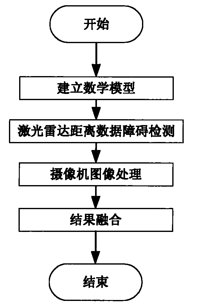
[0097] A kind of field environment obstacle detection method of fusion distance and image information of the present invention is introduced below in conjunction with accompanying drawing and embodiment:

[0098] Such as figure 1 As shown, a field environment obstacle detection method that fuses distance and image information includes the following steps:

[0099] The first step: establish a mathematical model;

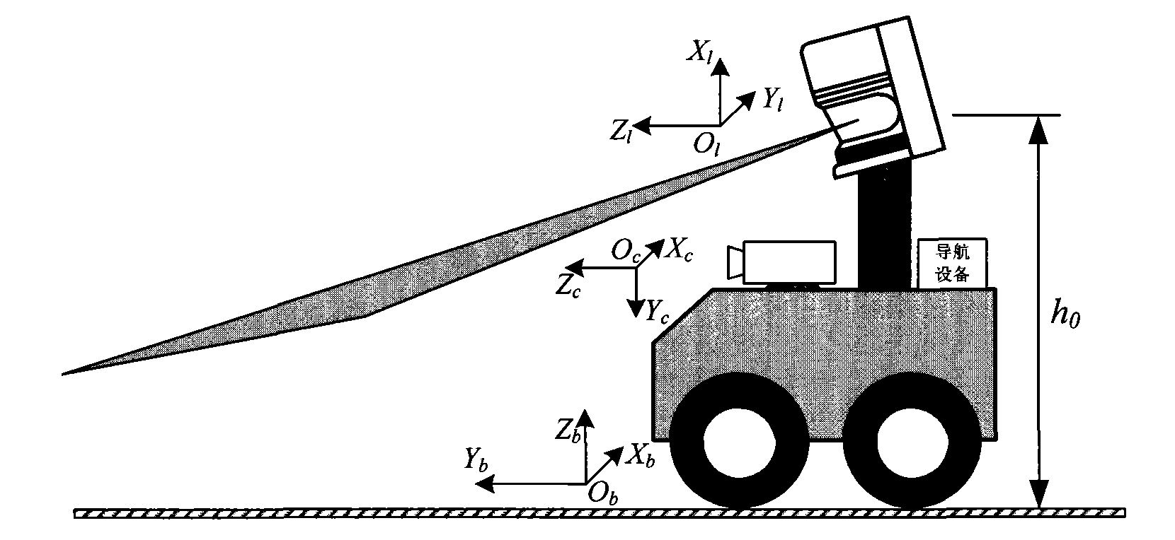
[0100] When establishing a vehicle perception model, it is necessary to establish the vehicle body, lidar, camera, and inertial navigation coordinate system, and correlate these coordinate systems with each other, including the following steps:

[0101] (1) Establish car body coordinate system O b x b Y b Z b ;

[0102] Establish a car body coordinate system that is fixedly connected with the vehicle body, and it moves with the vehicle. The body coordinate system is defined as: the origin O b Located at a fixed point on the car body, the designated origin is t...


PUM


Abstract

The invention belongs to the technical field of barrier detection, particularly relates to a field environment barrier detection method fusing distance and image information and aims to provide a method for detecting the common barriers under the field driving condition of an unmanned vehicle so as to plan a driving route for the vehicle and enhance the independent field driving capability of theunmanned vehicle. The method comprises the following steps of: establishing a mathematical model; detecting a laser radar distance data barrier; and fusing the image processing of a video camera and a result. By the method, the common barriers such as grasslands, roads, trees, bushes and the like under the field driving condition of the unmanned vehicle can be detected and recognized and color modeling is performed on a driving region, so that an abnormal part of the driving region is further detected. The environment around the vehicle can be partitioned into a non-driving region, the driving region, an unknown region and the like, so that the planning of the driving route of the vehicle is facilitated and the independent field driving capability of the unmanned vehicle is enhanced.

Description

technical field [0001] The invention belongs to the technical field of obstacle detection, and in particular relates to a method for detecting obstacles in a field environment by fusing distance and image information. Background technique [0002] Obstacle detection of unmanned vehicles on the road is an important part of the research field of environmental perception technology. In the application of obstacle detection, commonly used sensors include lidar, camera, millimeter wave radar, ultrasonic sensor, etc. LiDAR measures distance by measuring the time difference between when light is emitted and when it is reflected from an object's surface. It can directly obtain the distance data and provide convenient and intuitive environment description information for the vehicle. There are many specific applications of lidar, such as object positioning and tracking, environmental modeling and obstacle avoidance, localization and map construction (SLAM), classification of terrai...

Claims


Application Information

Patent Timeline
IPC IPC(8): G01S17/89G01S7/48G01C11/36
Inventor 付梦印杨建孟红刘进杨毅
Owner BEIJING INSTITUTE OF TECHNOLOGYGY
Why Eureka
Try Eureka