Unmanned helicopter three-dimensional positioning and mapping method based on laser detection and image recognition

An unmanned helicopter and laser detection technology, applied in surveying and navigation, photogrammetry/video metrology, measuring devices, etc., can solve the problems of expensive lidar, heavy weight, obstacle collision, etc., to increase flight safety The effect of high reliability, low cost and easy modification

Inactive Publication Date: 2011-04-20
TSINGHUA UNIV
View PDF2 Cites 47 Cited by
  • Summary
  • Abstract
  • Description
  • Claims
  • Application Information

AI Technical Summary

Problems solved by technology

For unmanned helicopters flying in unknown environments, changing the flight altitude may cause collisions with obstacles
In addition, lidar is expensive and heavy, not the best choice for unmanned helicopters

Method used


Image

  • Unmanned helicopter three-dimensional positioning and mapping method based on laser detection and image recognition
  • Unmanned helicopter three-dimensional positioning and mapping method based on laser detection and image recognition
  • Unmanned helicopter three-dimensional positioning and mapping method based on laser detection and image recognition

Examples


Embodiment Construction

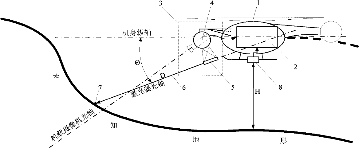
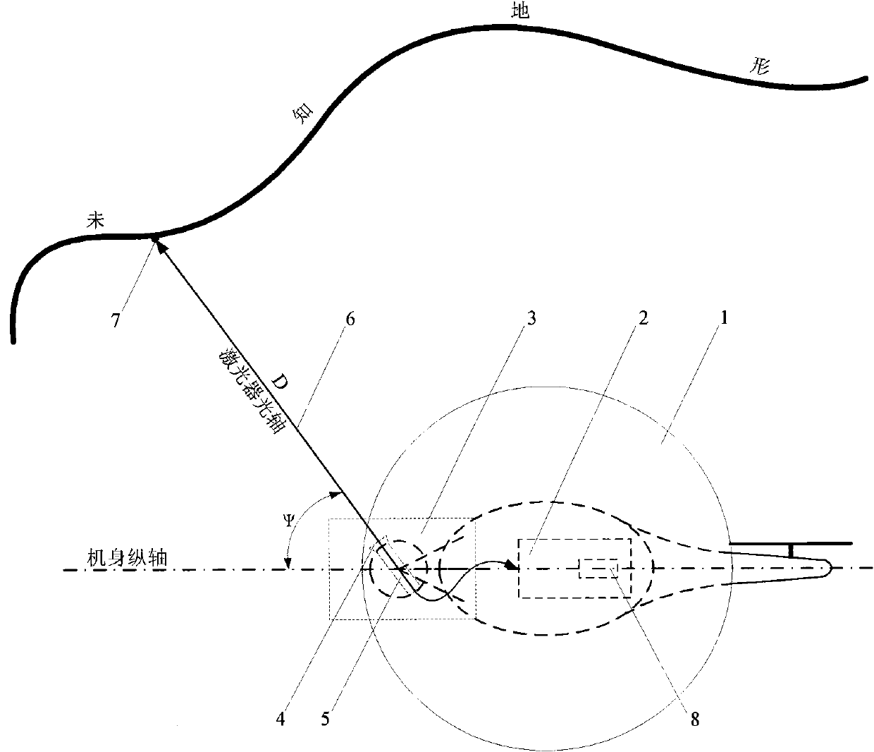
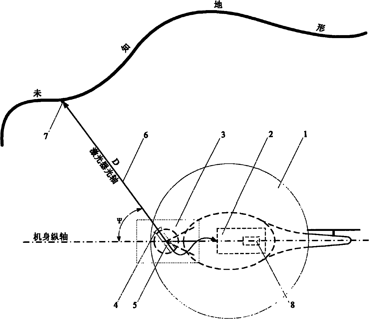
[0011] The three-dimensional positioning and mapping method of the unmanned helicopter based on laser detection and image recognition requires the cooperation of a distance measuring sensor (3), an altitude sensor (8) and a flight control computer (2) based on laser detection and image recognition. Among them, the ranging sensor (3) based on laser detection and image recognition is used to detect the distance D between the unmanned helicopter (1) and the surrounding obstacles, and the height sensor (8) is used to measure the flight of the unmanned helicopter (1). At height H, the flight control computer (2) is used to calculate sensor data, and complete the three-dimensional positioning and mapping of the unmanned helicopter (1) in a complex and unknown environment.

[0012] The ranging sensor (3) based on laser detection and image recognition is composed of an airborne camera (4) and a laser transmitter (5). The airborne camera (4) and the laser emitter (5) deflect synchronou...


PUM


Abstract

The invention relates to an unmanned helicopter three-dimensional positioning and mapping method based on laser detection and image recognition, which belongs to the technical field of application of unmanned aerial vehicles. A distance measurement sensor based on laser detection and image recognition, an altimetric sensor and a flight control computer are comprised, wherein the distance measurement sensor consists of a vehicle-mounted camera and a laser emitter and used for detecting the distance from the unmanned helicopter to obstacles around. The distance measurement sensor is used for detecting and measuring distance for the around environment of the unmanned helicopter by means of changing the angle of pitch and the angle of yaw. The altimetric sensor is used for measuring the flight altitude from the unmanned helicopter to the ground. The distance measurement data obtained from the measurement under different angles of altitude, angles of yaw and flight altitudes can realize three-dimensional synchronous positioning and mapping of unknown environment by the unmanned helicopter. In the invention, the around environment can be rapidly, simply and reliably detected during the flying by carrying the distance measurement sensor based on laser detection and image recognition on the unmanned helicopter.

Description

technical field [0001] The invention is a method for positioning and detection of an unmanned helicopter in a complex unknown environment, and can realize three-dimensional synchronous positioning and surveying and mapping of the unmanned helicopter in a complex unknown environment with high precision. It is mainly used in technical fields such as aerospace, drones and robots. Background technique [0002] Three-dimensional simultaneous positioning and mapping in complex and unknown environments is one of the important intelligent functions of unmanned helicopters. Its main purpose is to complete positioning, detection and mapping in unknown environments, and to assist unmanned helicopters in highly autonomous flight. Traditional three-dimensional simultaneous positioning and mapping flights are mostly completed with the assistance of terrain detection radar. Due to the heavy weight of terrain detection radar, small unmanned helicopters are difficult to equip. Therefore, u...

Claims


Application Information

Patent Timeline
Patent Type & Authority Applications(China)
IPC IPC(8): G01C11/00G01C11/36
Inventor 王冠林朱纪洪
Owner TSINGHUA UNIV
Why Eureka
Try Eureka