Method for three-dimensional measurement of panoramic real scenes

A technology of stereo measurement and real scene, which is applied in the directions of measuring devices, photogrammetry/video metrology, surveying and mapping and navigation, etc., to achieve the effect of reducing workload, simple and friendly user interface, and large amount of information

Inactive Publication Date: 2011-05-11
沈阳迅景科技有限公司
View PDF0 Cites 34 Cited by
  • Summary
  • Abstract
  • Description
  • Claims
  • Application Information

AI Technical Summary

Problems solved by technology

However, the stereo measurement method with the

Method used


Image

  • Method for three-dimensional measurement of panoramic real scenes
  • Method for three-dimensional measurement of panoramic real scenes
  • Method for three-dimensional measurement of panoramic real scenes

Examples


Embodiment Construction

[0046] In this embodiment, the urban environment is used as the surveying and mapping scene, and the urban environment is surveyed and mapped using the panoramic real-scene stereo measurement method of the present invention.

[0047] The stereo measurement method of panoramic real scene comprises the following steps:

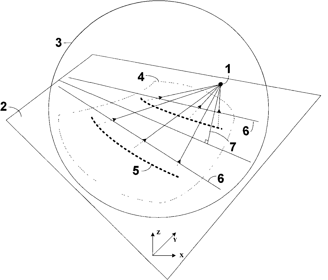
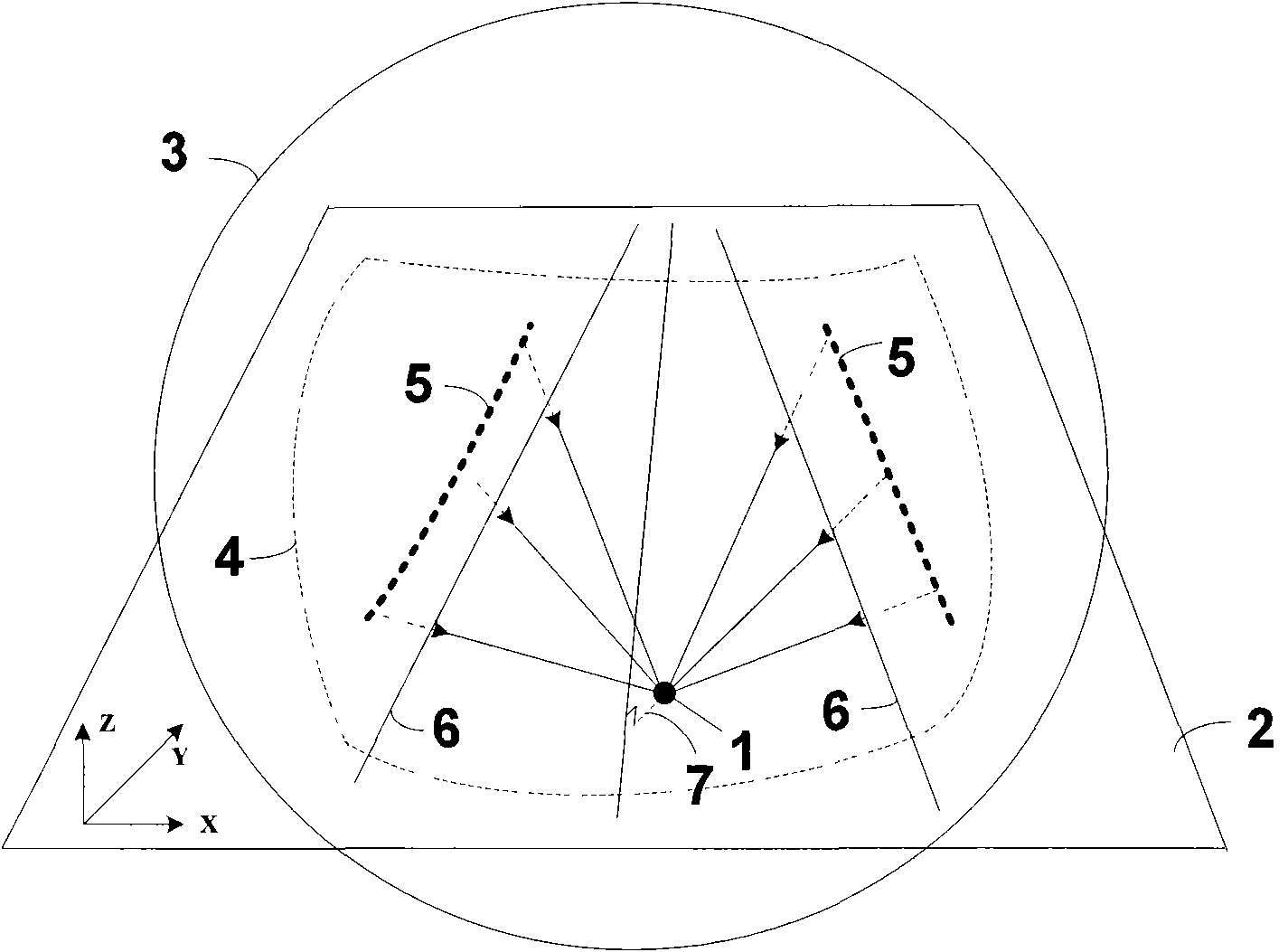
[0048] 1. Collect panoramic real-scene images and record geographic information data of image collection points

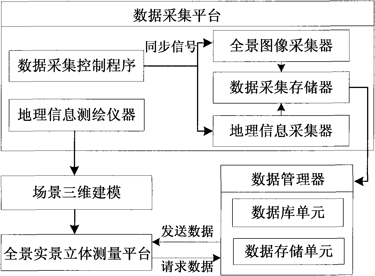
[0049] Such as figure 1 As shown, firstly, a data collection platform is built to collect panoramic real-scene image data and geographic information data (including the longitude, latitude and altitude of the panoramic real-scene image collection point positions). The data collection platform consists of a panoramic image collector, a geographic information collector (the present embodiment uses a GPS system), a data collection control program, a data collection memory, and a geographic information surveying and mapping instrument (for surveying and...


PUM


Abstract

The invention relates to a method for three-dimensional measurement of panoramic real scenes. The method comprises the following steps: acquiring a panoramic real picture, and recording the geographic information data of a picture acquisition site; creating a panoramic real three-dimensional measurement platform on a computer; measuring the profile data and geographic information of scenery in a real scene, and establishing a three-dimensional scene model; importing the three-dimensional scene model into the panoramic real three-dimensional measurement platform; and organically integrating the three-dimensional scene model with the panoramic real picture, thereby realizing the three-dimensional measurement of the scenes. The method provided by the invention has the advantages that the combination of the panoramic real picture and the three-dimensional modeling technology based on scene surveying and mapping is realized, so that a user can carry out the accurate measurement on any visible position in a space, therefore, the method provides a new efficient approach for the fields such as urban planning, land survey and the like which are required to be subjected to scene surveying and mapping.

Description

technical field [0001] The invention relates to a stereo measurement technology, in particular to a panoramic real-scene stereo measurement method. Background technique [0002] Geographical information is used to describe the spatial location and distribution of various objects in the real world, and it is one of the most important and basic information resources for human beings. In human social practice, people usually use measurement methods to obtain geographic information of the real world. With the development of society, due to the actual needs of urban construction, land planning, project site selection, and even military and other fields, the surveying and mapping technology of geographic information is also constantly improving. [0003] Early surveying and mapping used simple tools such as rope rulers and step bows for measurement. These measuring tools are all mechanical, and mainly focus on measuring distance, and the measurement accuracy is low. The inventi...

Claims


Application Information

Patent Timeline
IPC IPC(8): G01C11/00G06F17/30G06T15/00
Inventor 佟国峰姜斌薛秋艳刘汀侯文博渠瀛
Owner 沈阳迅景科技有限公司
Why Eureka
Try Eureka