A method for obtaining 3D graphics data of cultural relics
A technology of three-dimensional graphics and data, applied in image data processing, measuring devices, 3D modeling, etc., can solve problems such as accelerated cultural relics, damage, and limited accuracy of manual measurement
- Summary
- Abstract
- Description
- Claims
- Application Information
AI Technical Summary
Problems solved by technology
Method used
Image
Examples
Embodiment Construction
[0017] The present invention will be further described in detail below in conjunction with the accompanying drawings, so that those skilled in the art can implement it with reference to the description.
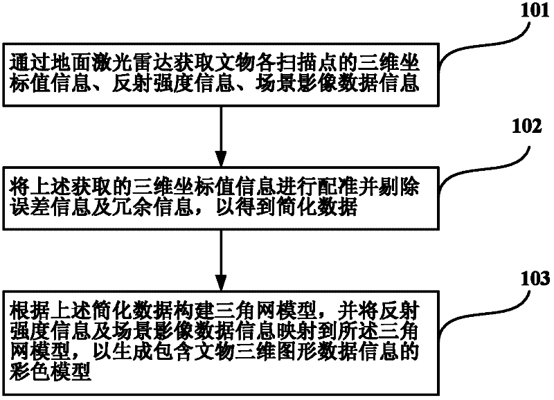
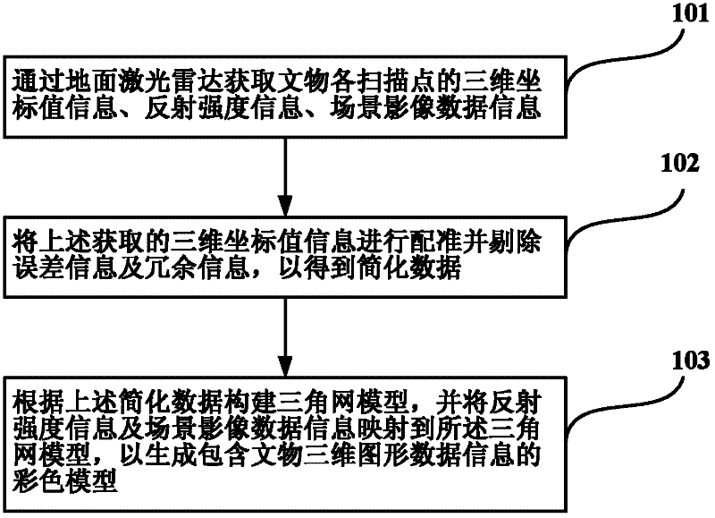
[0018] In the method for acquiring three-dimensional graphic data of cultural relics described in the present invention, laser radar technology is applied. Ground-based lidar is a new type of surveying and mapping instrument that integrates a variety of high-tech. It adopts non-contact high-speed laser measurement method to obtain array geometry data of terrain and three-dimensional surface of complex objects in the form of point cloud. The instrument mainly includes a laser ranging system and a laser scanning system, and also integrates CCD digital photography and instrument internal calibration systems. Its working principle is: the scanner emits laser light on the target, calculates the distance between the corresponding measured point and the scanner according to the time...
PUM
 Abstract
Description
Claims
Application Information
 - R&D
- Intellectual Property
- Life Sciences
- Materials
- Tech Scout
- Unparalleled Data Quality
- Higher Quality Content
- 60% Fewer Hallucinations
Browse by: Latest US Patents, China's latest patents, Technical Efficacy Thesaurus, Application Domain, Technology Topic, Popular Technical Reports.
© 2025 PatSnap. All rights reserved.Legal|Privacy policy|Modern Slavery Act Transparency Statement|Sitemap|About US| Contact US: help@patsnap.com


