Autonomous orbit determination method for satellite based on synthetic aperture radar

A technology of synthetic aperture radar and autonomous orbit determination, which is applied in the directions of radio wave reflection/re-radiation, utilization of re-radiation, measuring devices, etc. It can solve the problem of poor real-time performance, affect the accuracy of orbit determination, and cannot achieve high-precision real-time low-orbit satellites. Issues such as autonomous orbit determination

Inactive Publication Date: 2012-01-18
HEILONGJIANG PATENT TECH DEV
View PDF3 Cites 19 Cited by
  • Summary
  • Abstract
  • Description
  • Claims
  • Application Information

AI Technical Summary

Problems solved by technology

However, the existing satellite autonomous orbit determination method needs to send the orbit information and control commands to the satellite through the uplink remote control launch equipment, and then correct the satellite’s orbit parameter

Method used


Image

  • Autonomous orbit determination method for satellite based on synthetic aperture radar
  • Autonomous orbit determination method for satellite based on synthetic aperture radar
  • Autonomous orbit determination method for satellite based on synthetic aperture radar

Examples


specific Embodiment approach 1

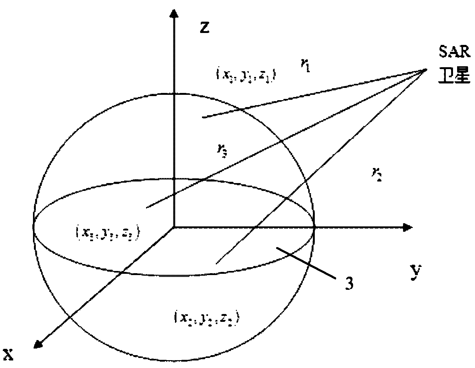
[0071] Specific implementation mode one: see Figure 1~4 As shown, the satellite autonomous orbit determination method based on synthetic aperture radar described in this embodiment: first, design the artificial ground marker points, including their material, shape, and arrangement, and then place the ground marker points, and measure their The position information in the ground-fixed coordinate system is built into a library and stored in the on-board computer; when the satellite is in orbit, the synthetic aperture radar is used to image the ground. At this time, these ground marking points are recognized by image recognition methods, and are matched with the library stored by the on-board computer to obtain the position information of the marking points, and then the real-time orbit determination of the satellite is completed using the orbit determination equation proposed by the present invention;

[0072] The specific process is:

[0073] Step A, designing the artificial ...

specific Embodiment approach 2

[0138] Embodiment 2: In the satellite autonomous orbit determination method based on synthetic aperture radar described in this embodiment, in step A, the material of the artificial ground marking points is metal.

specific Embodiment approach 3

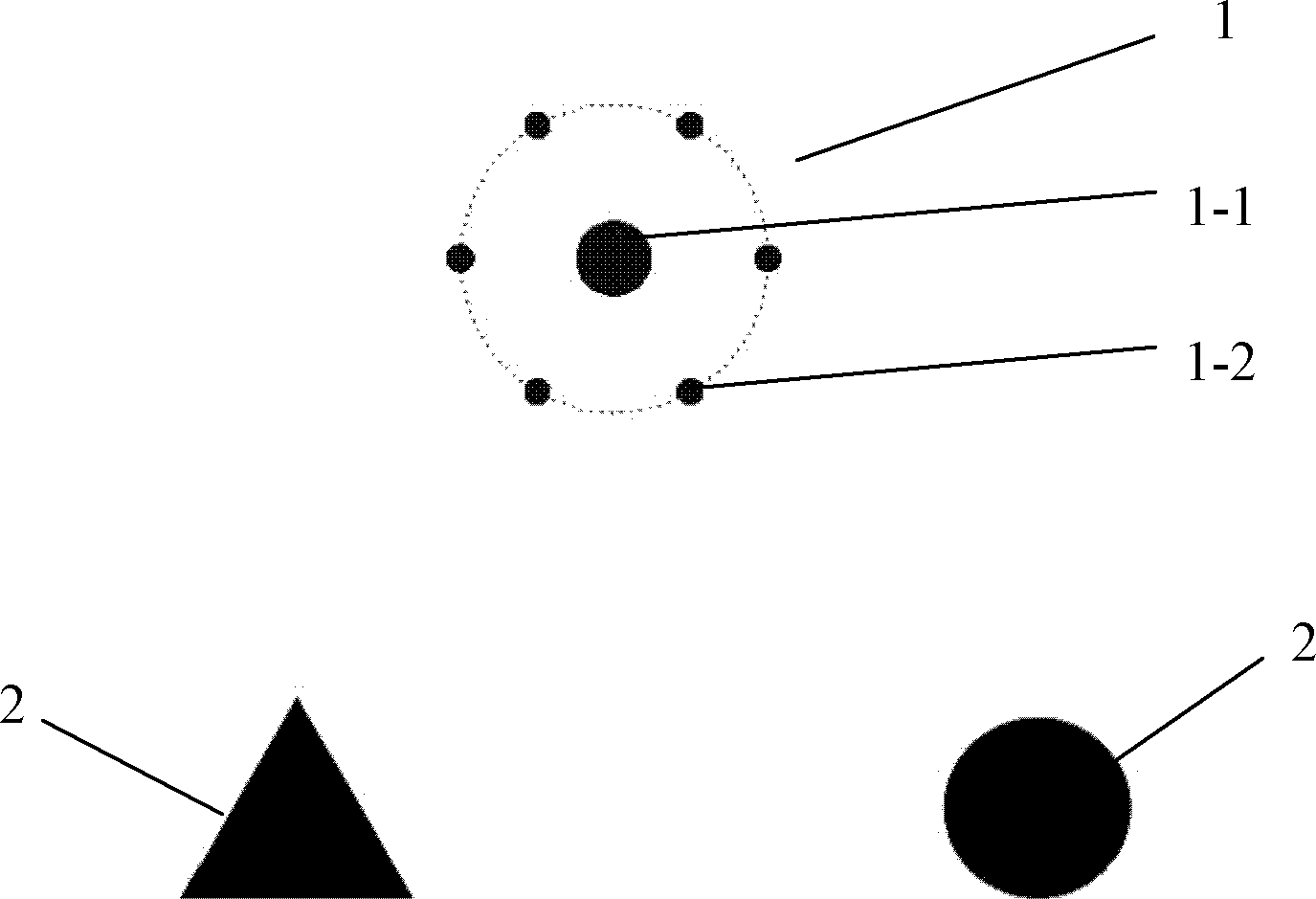
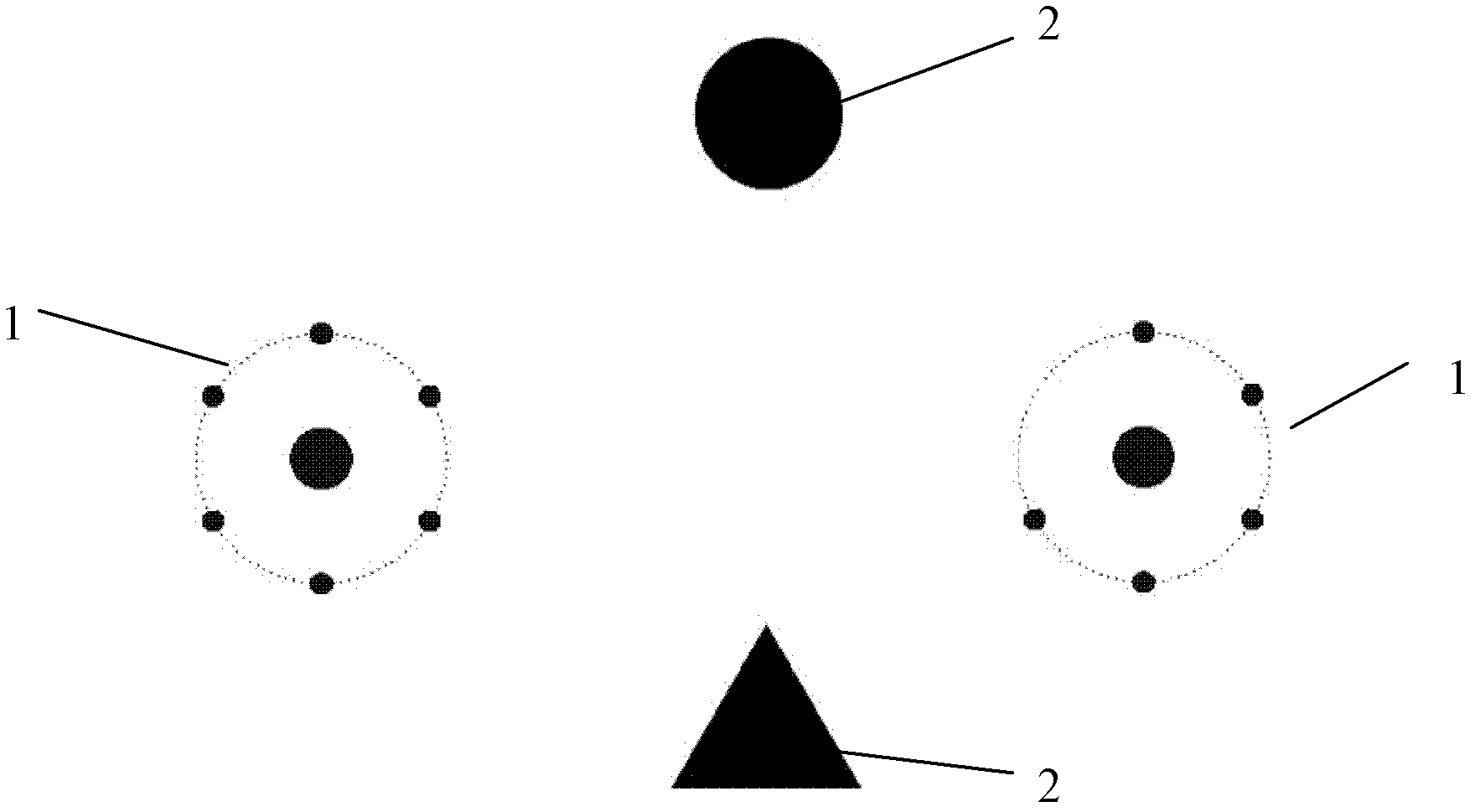
[0139] Specific implementation mode three: see Figure 1~2 As shown, in the satellite autonomous orbit determination method based on synthetic aperture radar described in this embodiment, in step B, the positioning marker point 1 is a coded positioning marker point, and the coded positioning marker point is composed of a central circle point 1 -1 and a number of small dots 1-2 evenly distributed on its outer circumference; the shape of the two auxiliary marking points 2 is triangle or circle. Other steps are the same as those in Embodiment 1 or 2.


PUM


Abstract

The invention discloses an autonomous orbit determination method for a satellite based on synthetic aperture radar, which belongs to the technical field of autonomous orbit determination of satellites and aims at achieving high-precision and real-time autonomous orbit determination of a low-orbiting satellite without being supported by a ground tracking telemetry and command station. The method comprises the following specific steps of: designing the shape and the material of a manual ground identification point; designing an arrangement mode of the ground identification point, arranging the ground identification point and measuring the position of the ground identification point in an earth-fixed coordinate system; storing information of the ground identification point in a space-borne computer; and after a space-borne synthetic aperture radar remotely senses the ground and identifies a ground identification, deriving the information of the ground identification point from a ground identification library on the satellite, applying an orbit determination equation to obtain the position and the speed of the satellite and further finish the real-time autonomous orbit determination of the satellite. The autonomous orbit determination technology for the satellite provides a novel autonomous orbit determination method for the satellite, which can be used for realizing high-precision real-time autonomous orbit determination of the low-orbiting satellite. The method disclosed by the invention is suitable for real-time autonomous orbit determination of a near earth satellite.

Description

technical field [0001] The invention belongs to the technical field of autonomous orbit determination of satellites and is suitable for real-time autonomous orbit determination of near-earth satellites. Background technique [0002] At present, the orbit determination of satellites at home and abroad is mostly done by ground equipment. First, the measurement system, such as optical measurement system and radio measurement system, tracks and measures the satellite, and then the ground computer calculates and obtains the orbit information of the satellite. Finally, the orbit information and control commands are sent to the satellite through the uplink remote control launch equipment, and the orbital parameters and operating status of the satellite are corrected to ensure that the orbital parameters and operating status of the satellite are within the allowable range of error, so that the satellite can work normally. [0003] With the continuous development of space missions, a...

Claims


Application Information

Patent Timeline
IPC IPC(8): G01S13/90G01S13/58
Inventor 张迎春李晓磊耿云海汪瑞良
Owner HEILONGJIANG PATENT TECH DEV
Why Eureka
Try Eureka