Method for compiling geological display map of chamber

A technology for displaying maps and geology, which is applied in the field of cavern geological display map compilation, can solve problems such as low data reuse rate, heavy workload of graphic drawing and data input, cumbersome map labeling and format layout, etc., and achieve automation The degree of improvement, the convenience of multiple times and various forms of utilization, and the effect of improving the efficiency of modification and update

Active Publication Date: 2012-02-22
POWERCHINA HUADONG ENG COPORATION LTD
View PDF2 Cites 24 Cited by
  • Summary
  • Abstract
  • Description
  • Claims
  • Application Information

AI Technical Summary

Problems solved by technology

[0004] The technical problem to be solved by the present invention is: in view of the above-mentioned status quo, the present invention aims to provide a method for compiling cavern geological display maps to solve the problem of heavy workload in graphic drawing and data input, cumbersome drawing labeling and format layout, and the need to modify Problems such as difficult update and low data reuse rate, improve the efficiency of compilation and data use of cavern geological display maps

Method used


Image

  • Method for compiling geological display map of chamber
  • Method for compiling geological display map of chamber
  • Method for compiling geological display map of chamber

Examples


Embodiment Construction

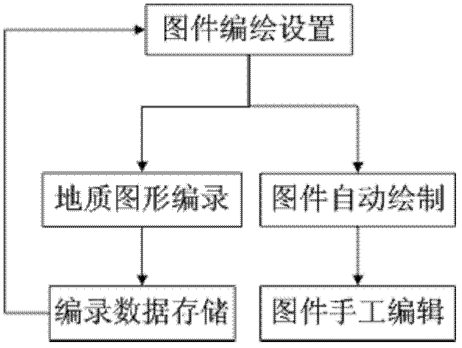
[0025] Such as figure 1 As shown, this embodiment takes the compilation and drawing of the geological display map of Pingdong Cave as an example, and further introduces the present invention in detail.

[0026] This example uses Bentley's MicroStation software as a computer-aided design (CAD) platform, and stores the basic parameters of flat tunnels, graphical attribute data and professional attribute data of geological objects in the SQL Server database.

[0027] In this embodiment, according to the editing and drawing method described in the present invention, the editing and drawing of the flat cave display map mainly includes the following steps: editing and drawing settings of the flat cave display map, geological graphic cataloging, catalog data storage, flat cave display Maps are automatically drawn, and subsequent manual editing of maps is performed according to the special needs of users.

[0028] 1. Drawing editing settings for flat hole display map
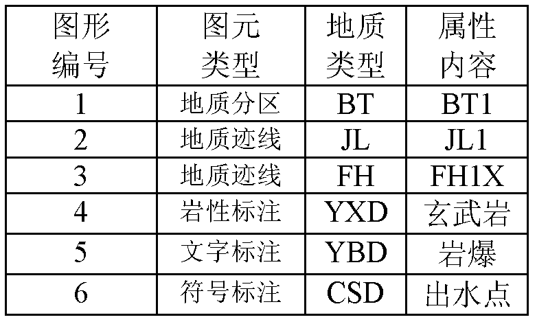
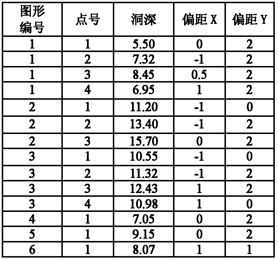
[0029] Set ma...


PUM


Abstract

The invention relates to a method for compiling a geological display map of a chamber and aims to solve the problems of high working load in graphic depiction and data input, complexity in drawing marking and format type-setting, difficulty in revising and updating, low data reusability and the like so as to improve the compilation efficiency of the geological display map of the chamber and the using efficiency of data. The invention adopts the technical scheme that: the method for compiling the geological display map of the chamber is characterized by comprising the following steps of: 1.1, setting map compilation; 1.2, recording geological graphs; 1.3, storing the recorded data, and repeatedly performing the steps 1.1 to 1.3, complementing and updating the recorded data for the previousoperation by the subsequent operation until the requirements for forming of the complete geological display map of the chamber are met; and 1.4, automatically drawing the map. The method is applicable to the fields of engineering geology and mining geology in the industries of hydropower, water conservancy, highway, railway and the like.

Description

technical field [0001] The invention relates to a method for compiling and drawing geological display maps of caverns. It is suitable for engineering geology and mine geology in hydropower, water conservancy, highway, railway and other industries. Background technique [0002] The cavern geological display map is the most basic map of engineering geology and mine geological work results. It takes a lot of time and energy for geological engineers to compile and draw, accounting for about half of the workload in the geological office. In projects with huge underground caverns Even more so. The current method of computer-aided drawing of cavern geological display maps is that engineers use computer CAD tools and programming to draw two-dimensional maps semi-automatically and semi-manually. This drawing method has played a huge role in the past 20 years , but at the same time there are disadvantages such as heavy graphics drawing and data input workload, cumbersome drawing lab...

Claims


Application Information

Patent Timeline
Patent Type & Authority Applications(China)
IPC IPC(8): G06F17/50
Inventor 王国光刘臻熙陈健王金锋蒋海峰张业星唐海涛李成翔徐震双喜
Owner POWERCHINA HUADONG ENG COPORATION LTD
Why Eureka
Try Eureka