Description of a road segment using iso 17572-3

A technology of roads and road sections, which can be used to uniquely identify all areas in the geographic database, and can solve the problems of not including, difficult to use TMC codes, etc.

Active Publication Date: 2012-09-19
HARMAN BECKER AUTOMOTIVE SYST
View PDF4 Cites 8 Cited by
  • Summary
  • Abstract
  • Description
  • Claims
  • Application Information

AI Technical Summary

Problems solved by technology

[0004] However, if the traffic event occurs on a road class with a very low road class number, for example, on the least important road in a given road network, it

Method used


Image

  • Description of a road segment using iso 17572-3
  • Description of a road segment using iso 17572-3
  • Description of a road segment using iso 17572-3

Examples


Embodiment Construction

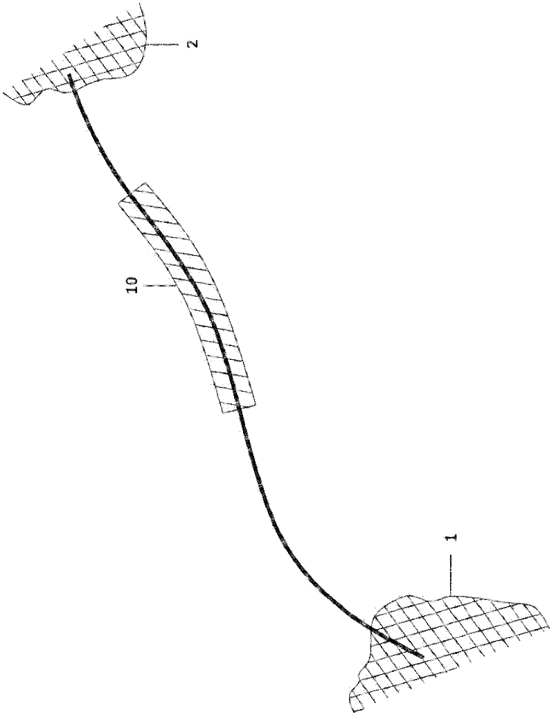
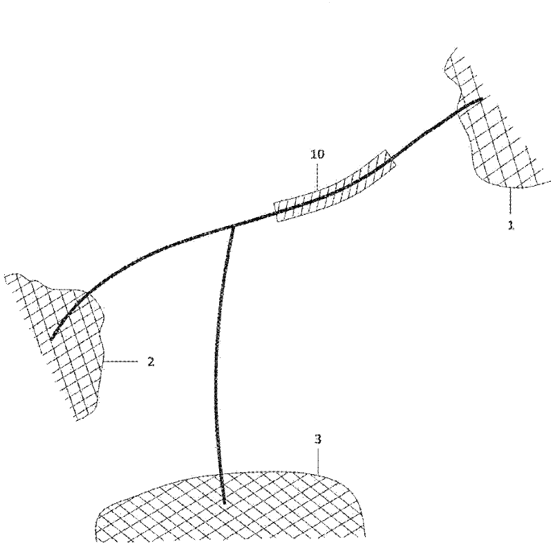
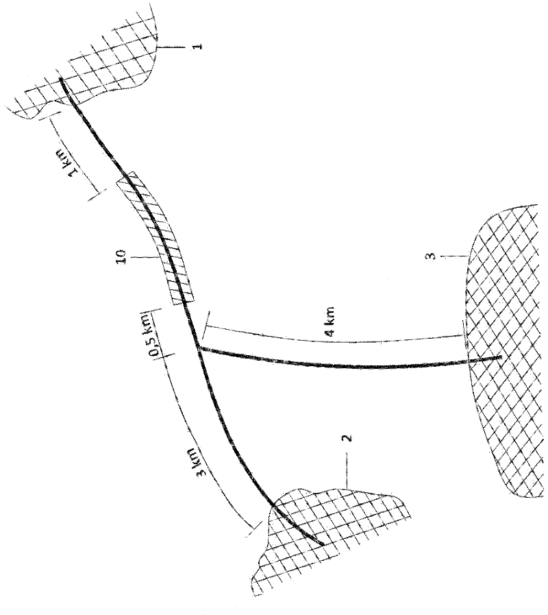
[0026] exist figure 1 An example is shown in which a road segment 10 between two villages, villages 1 and 2, is closed. exist figure 1 In the embodiment of , the road segment description can be easily obtained even using TMC messages, assuming villages 1 and 2 are included in the location table used by the TMC decoder. Since the road between village 1 and village 2 has no road intersection, this road segment can be identified as the road segment located between village 1 and 2. exist figure 2 In the example shown, the situation has become more complicated since it has to be determined whether the road segment is described as lying between village 1 and village 2 or between village 1 and village 3 . If village 2 is closer to the closed part than village 3 (see image 3), then the closed road segment can be described as being located between village 1 and village 2. Another criterion used to describe the section of closed roads could be the number of people living in these...


PUM


Abstract

The present invention relates to a method for providing a description of a road segment using locations stored in a geographic database, the description of the road segment being output to a user, the road segment being identified in the geographic database on the basis of location reference points allowing a unique identification of said road segment in the geographic database based on a dynamic Location references technique according to ISO 17572-3. The method comprises the steps of: providing two first location reference points with which a greater road section including said road segment is described, wherein one of the two first location reference points corresponds to a first end of said greater road section and the other of the two first location reference points corresponds to a second end of said greater road section; providing two second location reference points with which the subparts and the positions of the road segment within said greater road section are described.

Description

technical field [0001] The invention relates to a method of using the positions of a geographic database to provide a description of a road segment, which is output to the user, based on the use of dynamic positions according to ISO 17572-3 (also known as DLR-1) With reference to the technique, positional reference points of said road segment can be uniquely identified in a geographic database, based on which positional reference points the road segment is identified in the geographic database. The invention also relates to a system for generating a road segment description and to a receiver for receiving traffic information which outputs the road segment description to a user. Background technique [0002] Traffic information for the vehicle plays an important role for both the user and the navigation system for determining a route to a predefined destination location. ISO 14819-1 describes a protocol designed to provide end users with event-oriented messages that can be p...

Claims


Application Information

Patent Timeline
IPC IPC(8): G06F17/30
CPCG01C21/32G06F17/30241G08G1/0962G06F16/29G08G1/0969G01C21/34
Inventor O.辛兹
Owner HARMAN BECKER AUTOMOTIVE SYST
Why Eureka
Try Eureka