Method for confirming coal mining sunken surface soil peeling space time based on geographic information system (GIS) grid unit
A technology for mining subsidence and grid cells, which is applied in surface mining, earthwork drilling, underground mining, etc. The effect of sustainable development, improving the rate of reclaimed arable land, and facilitating construction and implementation
- Summary
- Abstract
- Description
- Claims
- Application Information
AI Technical Summary
Problems solved by technology
Method used
Image
Examples
Embodiment
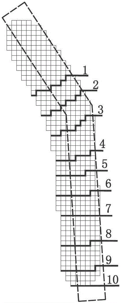
[0047] This embodiment is a mining area with a high water level, the average thickness of the coal seam is 9.0m, and the burial depth is 800m; ° between. In the embodiment of the present invention, the schematic diagram of the ground unit of topsoil stripping at each stage is as follows figure 2 As shown, "1-10" in the figure indicates the range of topsoil stripping in each mining stage, the grid is the ground unit, and the dotted line is the mining face.
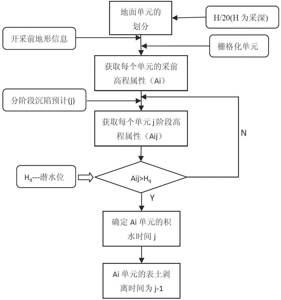
[0048] In this embodiment, the steps of the method for determining the time and space of coal mining subsidence surface soil stripping based on GIS grid cells through computer simulation technology are as follows:
[0049] 1) Divide the ground unit: Divide the ground into grid units, which are determined by H / 20. For the convenience of subsequent calculations, the length of each side of the grid unit is rounded to an integer of 10 digits of the number obtained by H / 20; H is the average mining depth, The unit is meter; th...
PUM
 Abstract
Description
Claims
Application Information
 - R&D
- Intellectual Property
- Life Sciences
- Materials
- Tech Scout
- Unparalleled Data Quality
- Higher Quality Content
- 60% Fewer Hallucinations
Browse by: Latest US Patents, China's latest patents, Technical Efficacy Thesaurus, Application Domain, Technology Topic, Popular Technical Reports.
© 2025 PatSnap. All rights reserved.Legal|Privacy policy|Modern Slavery Act Transparency Statement|Sitemap|About US| Contact US: help@patsnap.com


