
Emergency landing method of unmanned aerial vehicle based on radio and laser guiding

A laser guidance and UAV technology, applied in three-dimensional position/channel control and other directions, can solve the problems of stopping the guidance system, reducing the safe landing of the UAV, affecting the safe landing of the UAV, and achieving the effect of improving safety.

Inactive Publication Date: 2013-06-12
CHINA ACAD OF AEROSPACE AERODYNAMICS
View PDF5 Cites 11 Cited by
  • Summary
  • Abstract
  • Description
  • Claims
  • Application Information

AI Technical Summary

Problems solved by technology

However, once the onboard GPS equipment fails or the GPS signal is interfered and lost, the entire guidance system will stop working, which will affect the safe landing of the UAV. In severe cases, the UAV may even be lost and crashed.
At present, in the safe recovery of taxiing, take-off and landing UAVs, few UAVs have an emergency landing guidance system. Less accurate radio guidance to land the drone, which greatly reduces the chances that the drone can land safely

Method used


Image

  • Emergency landing method of unmanned aerial vehicle based on radio and laser guiding
  • Emergency landing method of unmanned aerial vehicle based on radio and laser guiding
  • Emergency landing method of unmanned aerial vehicle based on radio and laser guiding

Examples


Embodiment Construction

[0019] The present invention will be described in detail below in conjunction with the accompanying drawings. In order to better understand the present invention, the equipment on which the present invention relies will be firstly explained below.

[0020] The devices upon which the invention is based include laser scanners, laser receivers and data processors;

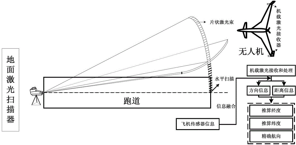
[0021] The laser scanner is installed at the end of one end of the runway, and the scanning center is aligned with the centerline of the runway, and emits a sheet-shaped laser beam with a scanning range of plus or minus 5 degrees to plus or minus 10 degrees, and the scanning frequency is constant.

[0022] Two laser receivers are installed at the two ends of the UAV's wing, and are connected to the data processor through a cable. The data processor is installed in the equipment compartment of the UAV, and connected to the flight control computer through a serial port.

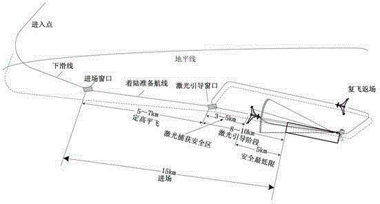
[0023] Such as Figure 5 As shown, when the UAV...


PUM


Abstract

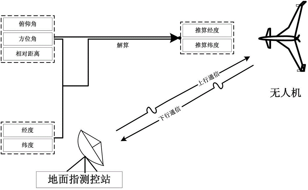
The invention relates to an emergency landing method of an unmanned aerial vehicle based on radio and laser guiding. Equipment in the method comprises a laser scanner, laser receivers and a data processor; the laser scanner is arranged at the end of one end of a runway, a scanning center aligns to the center line of the runway, and a flake laser beam is emitted out in a scanning range of plus-minus five degrees to plus-minus ten degrees; two laser receivers are arranged at both ends of the wings of the unmanned aerial vehicle, and are connected with the data processor through cables; and the data processor is arranged inside an equipment compartment of the unmanned aerial vehicle. When a flight control system of the unmanned aerial vehicle judges that received GPS (Global Positioning System) data is in failure, the emergency landing of the unmanned aerial vehicle is realized through the combination of long-distance radio guiding and short-distance laser guiding.

Description

technical field [0001] The invention relates to a method for a UAV to land safely and accurately when the GPS device fails or the GPS signal is interfered and lost, which increases the safety of the UAV when it lands and improves the security conditions of the airport. Background technique [0002] When the UAV lands, it must approach the runway at a specific heading angle and altitude to land accurately. In this process, the traditional landing process is that the UAV uses the position information, altitude information, speed and direction information given by GPS to carry out navigation. track controlled. However, once the onboard GPS equipment fails or the GPS signal is interfered and lost, the entire guidance system will stop working, which will affect the safe landing of the UAV, and in severe cases, the UAV may even be lost and crashed. At present, in the safe recovery of taxiing, take-off and landing UAVs, few UAVs have emergency landing guidance systems. Less accur...

Claims


Application Information

Patent Timeline
IPC IPC(8): G05D1/10
Inventor 蔡永恒王刚李刚
Owner CHINA ACAD OF AEROSPACE AERODYNAMICS
Learn More