Full-path remote-sensing image thematic charting method

A remote sensing image and thematic mapping technology, which is applied in image data processing, 2D image generation, maps/plans/charts, etc., can solve the disadvantages of rapid technology popularization of thematic mapping, slow operation of GIS desktop systems, and inability to realize special effects, etc. Problems, to achieve the effect of easy to grasp the drawing steps, convenient modification, and small data redundancy

Active Publication Date: 2013-10-09
CHINA RAILWAY DESIGN GRP CO LTD
View PDF6 Cites 6 Cited by
  • Summary
  • Abstract
  • Description
  • Claims
  • Application Information

AI Technical Summary

Problems solved by technology

At present, the drawing method of thematic maps mainly relies on the GIS desktop system, and the symbol library of the GIS desktop system cannot meet the needs of all industries, and the special effects required by some thematic maps cannot be realized in the GIS desktop system; in addition, the GIS desktop system Slow running, complex operation, high hardware configuration requirements, and difficult modification after output
The problems existing in the existing thematic map drawing methods are not conducive to the rapidity of thematic map making and the popularization of this technology

Method used


Image

  • Full-path remote-sensing image thematic charting method

Examples


Embodiment Construction

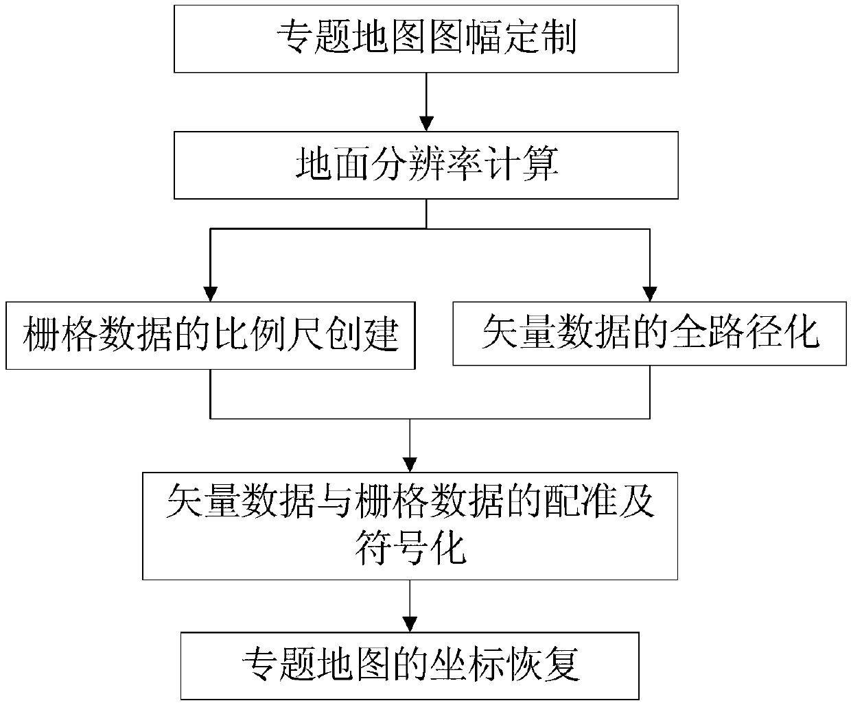
[0022] The technical solution of the present invention will be further described in conjunction with the accompanying drawings. Such as figure 1 As shown, the technical steps of the thematic mapping method for full-path remote sensing images in the present invention include: customization of thematic map frame, ground resolution calculation, scale creation of raster data, full-path transformation of vector data, and integration of vector data and grid Data registration and symbolization, coordinate recovery of thematic maps.

[0023] S 1 , Thematic map layout customization

[0024] Customize the map frame and map frame rotation angle according to the general direction of the route, the approximate scope of the task area and the scale of the map (for example, 1:500,000). The angle is an integer (for example, 35 degrees clockwise), and select the map frame specification (in 0.9 meters as an example), determine the real geographic space size of the map (for example: width 420K...


PUM


Abstract

The invention discloses a full-path remote-sensing image thematic charting method which technically comprises the following steps of determining a thematic map mapsheet, calculating the ground resolution rate, creating a raster data measuring scale, enabling vector data to be in full-path, registering and signifying vector data and raster data, and recovering thematic map coordinates. The P-L formula is used for quickly and accurately calculating the ground resolution rate of a finished map, the raster data measuring scale is created, the vector data is made to be in full-path, vector data of various industries are signified through a more complete symbolic library to achieve automation and lot sizing, and the whole charting process is made to be more smooth and efficient and faster.

Description

technical field [0001] The invention relates to thematic mapping technology, in particular to a method for thematic mapping of full-path remote sensing images. Background technique [0002] Thematic maps have a certain degree of artistry and strong practicality, and are widely used in various industries of national economic construction. At present, the drawing method of thematic maps mainly relies on the GIS desktop system, and the symbol library of the GIS desktop system cannot meet the needs of all industries, and the special effects required by some thematic maps cannot be realized in the GIS desktop system; in addition, the GIS desktop system The operation is slow, the operation is complex, the hardware configuration requirements are high, and it is difficult to modify the results after output. The problems existing in the existing thematic map drawing methods are not conducive to the rapidity of thematic map making and the popularization of this technology. Contents...

Claims


Application Information

Patent Timeline
Patent Type & Authority Applications(China)
IPC IPC(8): G06T11/00G09B29/00
Inventor 杜辉周世弘高文峰李平苍林勇威史中心
Owner CHINA RAILWAY DESIGN GRP CO LTD
Why Eureka
Try Eureka