Seasat remote sensing observation data matching method and system
A technology of observation data and satellite remote sensing, applied in the field of remote sensing surveying and mapping, can solve the problem of large data processing amount, and achieve the effect of small calculation amount
- Summary
- Abstract
- Description
- Claims
- Application Information
AI Technical Summary
Problems solved by technology
Method used
Image

Examples
Embodiment Construction
[0054] The present invention will be described in further detail below through specific implementation examples and in conjunction with the accompanying drawings.
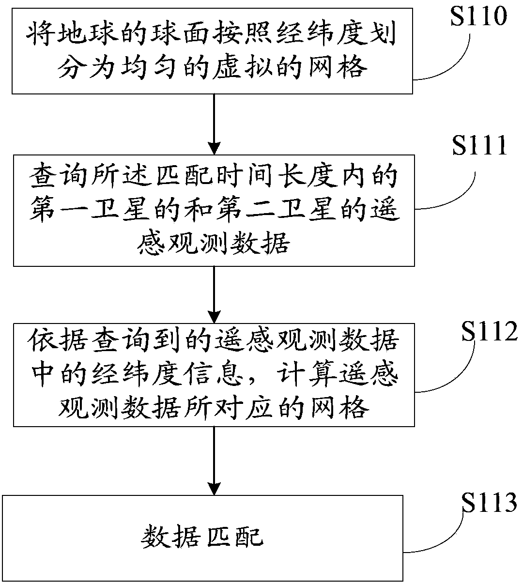
[0055] An embodiment of the present invention provides a method for matching ocean satellite remote sensing observation data, see figure 1 shown, including steps:
[0056] Step S110: Preset the time matching threshold, the spatial matching threshold and the matching time length, and divide the spherical surface of the earth into uniform virtual grids according to the latitude and longitude according to the spatial matching threshold.
[0057]Wherein, the temporal matching threshold and the spatial matching threshold are the reference basis for dividing the size of the grid, which can be specifically determined by those skilled in the art according to the actual situation, and the embodiments of the present invention do not list them one by one. Preferably, as an implementable manner, the time matching threshold is...
PUM
 Abstract
Description
Claims
Application Information
 - Generate Ideas
- Intellectual Property
- Life Sciences
- Materials
- Tech Scout
- Unparalleled Data Quality
- Higher Quality Content
- 60% Fewer Hallucinations
Browse by: Latest US Patents, China's latest patents, Technical Efficacy Thesaurus, Application Domain, Technology Topic, Popular Technical Reports.
© 2025 PatSnap. All rights reserved.Legal|Privacy policy|Modern Slavery Act Transparency Statement|Sitemap|About US| Contact US: help@patsnap.com