Grid method for drawing city map and application thereof

A grid method and grid technology, which is applied to the grid method for drawing city maps and its application fields, can solve problems such as difficulty in finding out bus routes, inability to implement, difficulty in finding blocks, and difficulty in place names.

Inactive Publication Date: 2014-02-12
袁明千
View PDF5 Cites 10 Cited by
  • Summary
  • Abstract
  • Description
  • Claims
  • Application Information

AI Technical Summary

Problems solved by technology

Longitude and latitude lines are generally marked for large-scale map drawing, and most of the small-area city maps are not marked, but they all abide by the rule of going up north and down south. The area is too large, there are many streets and place names, and the bus line network is dense, so that the map is so dense that it is difficult to find out the direction of the bus route with a magnifying glass. It is also difficult to find blocks

Method used


Image

  • Grid method for drawing city map and application thereof
  • Grid method for drawing city map and application thereof
  • Grid method for drawing city map and application thereof

Examples


Embodiment Construction

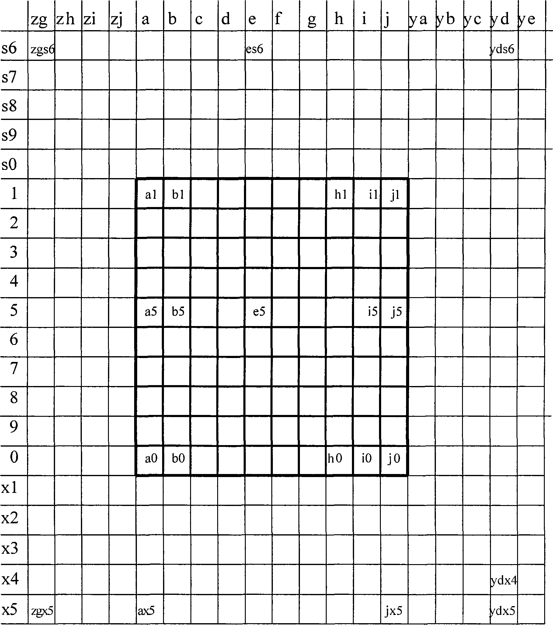
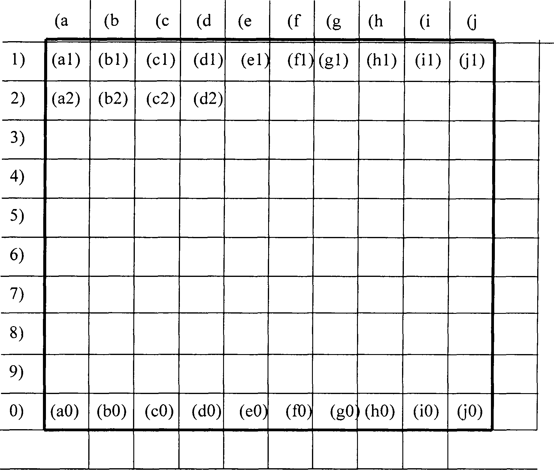
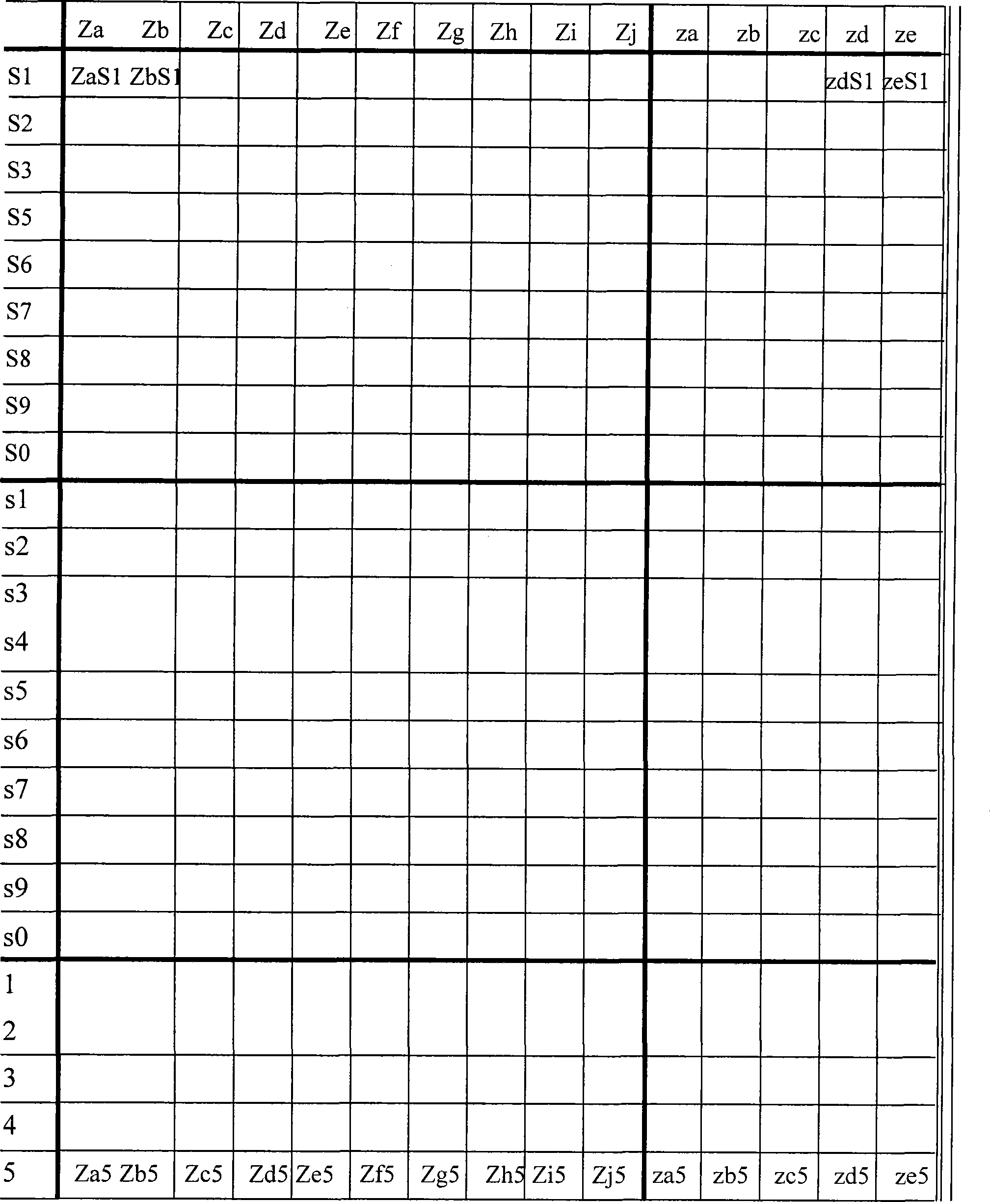
[0070] 1. Grid map is an innovative map drawing technology. In order to let people accept it, it is necessary to strengthen publicity, so that the general public can understand the advantages of this patented technology, know how to use it, and like to use it.

[0071] 2. The adoption of this technology has strong commercial motivation, but it involves many government actions, such as giving streets, communities, and buildings naming codes. If this technology is used in public security, municipal, and military affairs, it also involves a lot of The issue of naming codes requires the participation of the government. Therefore, in order to promote this new technology, the government must do a good job. It is expected that the government will take a positive attitude, because this technology will bring urban management to a new level!

[0072] 3. It is generally enough for small and medium-sized cities to use this technology to use only one grid cell in the central area, but for l...


PUM


Abstract

The invention provides a grid method for drawing a city map and application of the grid method. The grid method for drawing the city map is characterized in that Yuan grids are designed through the grid technology, decimalism is determined, grid measurement units such as a grid cell, a basic unit and a subunit are created, wherein each basic unit represents the actual area of 1km*1km=1km<2>, and each basic unit is 100 times larger than a last-level basic unit; according to the technical feature of the earth meridians and parallels, the conclusion that the actual meridians and parallels of the city map are similar to grid lines of the Yuan grids is drawn according to the calculus theory, the city grid map is drawn based on the conclusion, and each information name on the map must obtain a unique regular grid code name; then auxiliary charts are developed, and therefore a larger amount of map information can be transferred to the auxiliary charts from map pictures. In this way, the contradiction between continuous increase of the information amount of a printing map and a limited area of the picture of the printing map can be solved, and due to the fact that the grid map and the digital technology are docked, it is predicted that the grid method for drawing the city map can provide support for municipal engineering, national defense and military and urban modern management.

Description

Technical field: [0001] Belongs to the subject of geography, professional map drawing. technical background: [0002] There are many types of map drawing, such as world map drawing, country map drawing, provincial map drawing, city map drawing, ---. Longitude and latitude lines are generally marked for large-scale map drawing, and most of the small-area city maps are not marked, but they all abide by the rule of going up north and down south. The area is too large, there are many streets and place names, and the bus line network is dense, so that the map is so dense that it is difficult to find out the direction of the bus route with a magnifying glass. It is also difficult to find blocks and place names, which brings inconvenience to citizens. The outsiders are even more miserable---! The above photo is still a case where a large amount of information has been deleted. There were many large companies and sub-important public facilities that should have been on the map, bu...

Claims


Application Information

Patent Timeline
IPC IPC(8): G09B29/00
Inventor 袁明千
Owner 袁明千
Why Eureka
Try Eureka