Automatic scale segmentation parameter selection method for object remote sensing image analysis

A technology of segmentation parameters and remote sensing images, applied in the field of remote sensing geoscience analysis, can solve the problems of single, difficult to understand the global image of images, and achieve the effect of high theoretical reliability, wide practicability, and work efficiency.

Inactive Publication Date: 2014-03-19
CHINA UNIV OF GEOSCIENCES (BEIJING)
View PDF2 Cites 33 Cited by
  • Summary
  • Abstract
  • Description
  • Claims
  • Application Information

AI Technical Summary

Problems solved by technology

In addition, the surface system is a complex system composed of different levels of subsystems. Since the objects contained in the images are of different sizes, they need to be reflected at different

Method used


Image

  • Automatic scale segmentation parameter selection method for object remote sensing image analysis
  • Automatic scale segmentation parameter selection method for object remote sensing image analysis
  • Automatic scale segmentation parameter selection method for object remote sensing image analysis

Examples


Embodiment Construction

[0039]The specific implementation manners of the present invention will be further described in detail below in conjunction with the accompanying drawings and embodiments. The following examples are used to illustrate the present invention, but are not intended to limit the scope of the present invention.

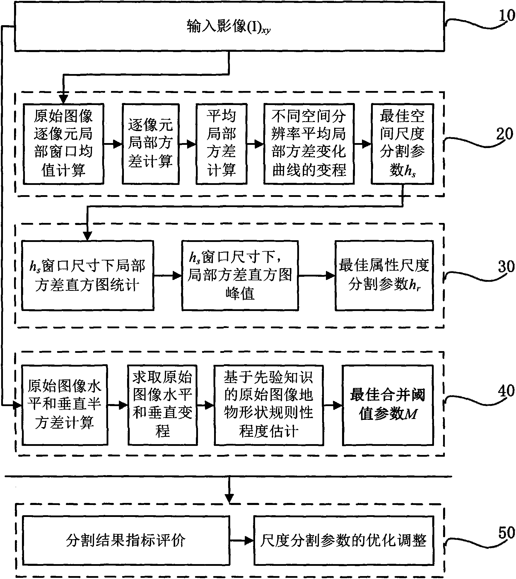
[0040] like figure 1 As shown, it is a flow chart of the method for automatically selecting scale segmentation parameters in the object-oriented remote sensing image analysis of the embodiment of the present invention. This embodiment includes the following steps:

[0041] Step 10: Input the remote sensing image, which is a panchromatic image.

[0042] This embodiment takes panchromatic images as an example, but the method and idea proposed by the present invention are also applicable to the selection of scale segmentation parameters of multispectral remote sensing images.

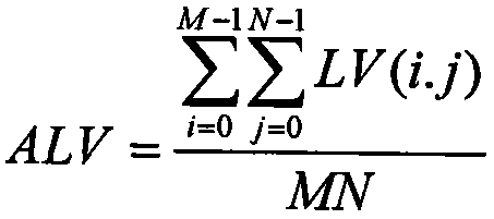
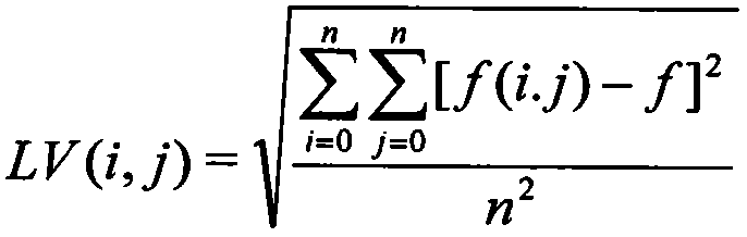
[0043] Step 20: Automatic selection of spatial scale segmentation parameters.

[0044] The automa...


PUM


Abstract

The invention discloses an automatic scale segmentation parameter selection method for object remote sensing image analysis. Optimum space scale segmentation parameters are determined through calculating an average local variance curve range method; optimum attribute scale segmentation parameter are determined through a local variance histogram estimation method; optimum merging threshold parameters are determined by employing anisotropy space correlation statistics to calculate horizontal and vertical ranges; scale effect evaluation and scale segmentation parameter optimization adjustment on a segmentation result are carried out by employing an index evaluation method. In combination with the geological spatial statistics and a mode identification theory method, the automatic scale segmentation parameter selection method realizes automatic selection of the optimum scale segmentation parameters before segmentation, can clearly explain the determined optimum scale segmentation parameters based on statistics theories, has higher theory credibility and improves information extraction and analysis efficiency and precision for object remote sensing images.

Description

technical field [0001] The invention relates to the field of remote sensing geoscience analysis methods, in particular to an automatic selection method of scale segmentation parameters in object-oriented remote sensing image analysis. Background technique [0002] The research on Object-Oriented Remote Sensing Image Processing and Analysis (GEOBIA) is still in its infancy, and the academic community has not yet clearly defined the concept of object-oriented scale. According to the definition of image objects in mainstream object-oriented commercial software—an image object is a connected region composed of pixels with the same attributes, the superficial meaning of scale in object-oriented image processing and analysis is the size of image objects or object details in terms of spatial span; From the perspective of image object extraction algorithm, that is, image segmentation algorithm, the scale selection in object-oriented image processing and analysis mainly corresponds t...

Claims


Application Information

Patent Timeline
IPC IPC(8): G06T7/00
Inventor 明冬萍
Owner CHINA UNIV OF GEOSCIENCES (BEIJING)
Why Eureka
Try Eureka