Method and device for shale bed marking in satellite image
A technology of satellite images and shale layers, applied in the field of remote sensing applications, can solve problems such as low accuracy, and achieve the effect of improving accuracy and shortening marking time
- Summary
- Abstract
- Description
- Claims
- Application Information
AI Technical Summary
Problems solved by technology
Method used
Image

Examples
Embodiment 1
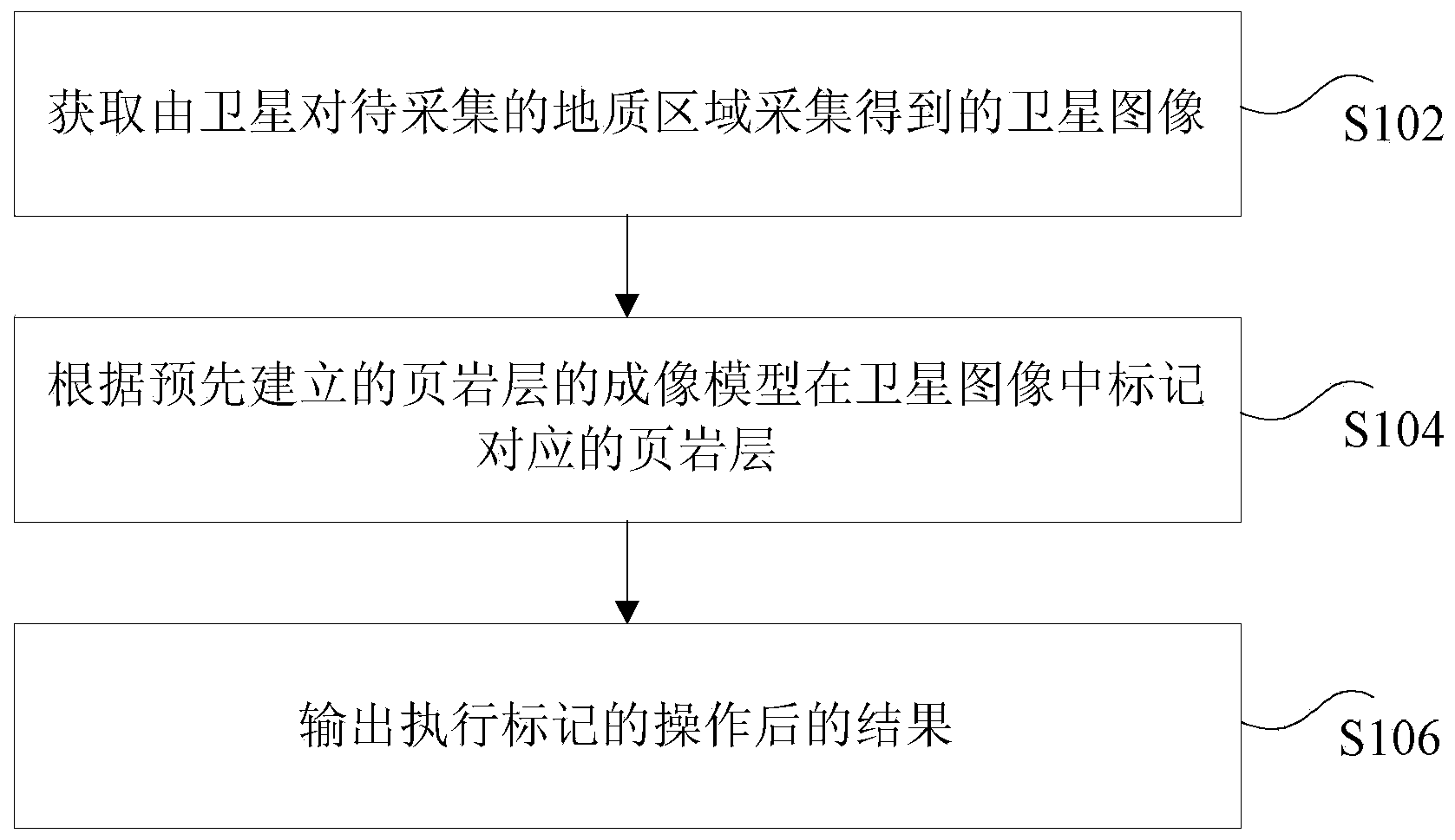
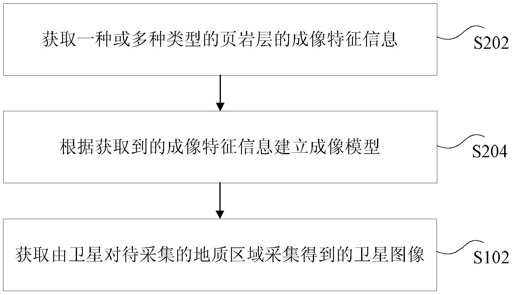
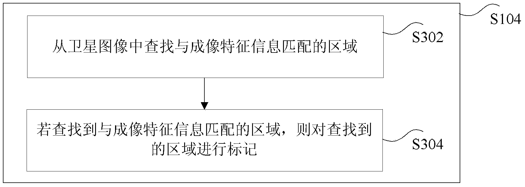
[0033] According to an embodiment of the present invention, a method for marking shale formations in satellite images is provided, such as figure 1 As shown, the method includes:
[0034] S102, acquiring the satellite image collected by the satellite for the geological area to be collected;
[0035] Optionally, in this embodiment, the above scenario is applied to a terminal, for example, a computer, but this application is not limited thereto.
[0036] Optionally, in this embodiment, the above-mentioned satellites include but are not limited to: Ziyuan No. 3 satellite. Among them, Ziyuan No. 3 satellite is my country's first civil high-resolution optical transmission stereoscopic mapping satellite, which integrates surveying, mapping and resource survey functions. The front, rear, and front-facing cameras on Ziyuan-3 can obtain three-dimensional image pairs from different observation angles in the same area, which can provide rich three-dimensional geometric information. Th...
Embodiment 2
[0078] According to an embodiment of the present invention, a device for implementing the above-mentioned marking of shale layers in satellite images is also provided, such as Figure 6 As shown, the device includes:
[0079] 1) The first acquisition unit 602 is used to acquire the satellite image collected by the satellite for the geological area to be collected;
[0080] Optionally, in this embodiment, the above scenario is applied to a terminal, for example, a computer, but this application is not limited thereto.
[0081] Optionally, in this embodiment, the above-mentioned satellites include but are not limited to: Ziyuan No. 3 satellite. Among them, Ziyuan No. 3 satellite is my country's first civil high-resolution optical transmission stereoscopic mapping satellite, which integrates surveying, mapping and resource survey functions. The front, rear, and front-facing cameras on Ziyuan-3 can obtain three-dimensional image pairs from different observation angles in the sam...
PUM
 Abstract
Description
Claims
Application Information
 - R&D
- Intellectual Property
- Life Sciences
- Materials
- Tech Scout
- Unparalleled Data Quality
- Higher Quality Content
- 60% Fewer Hallucinations
Browse by: Latest US Patents, China's latest patents, Technical Efficacy Thesaurus, Application Domain, Technology Topic, Popular Technical Reports.
© 2025 PatSnap. All rights reserved.Legal|Privacy policy|Modern Slavery Act Transparency Statement|Sitemap|About US| Contact US: help@patsnap.com