

Vegetation parameter fitting method based on middle-high resolution remote sensing
A high-resolution, high-resolution technology, applied in image data processing, instrumentation, computing, etc., can solve problems such as unbearable, lack of image time, affecting the application of medium and high-resolution remote sensing data, and achieve the effect of enriching research methods
- Summary
- Abstract
- Description
- Claims
- Application Information
AI Technical Summary
Problems solved by technology
Method used
Image

Examples
Embodiment Construction
[0010] The present invention will be further described below in conjunction with the accompanying drawings and embodiments.
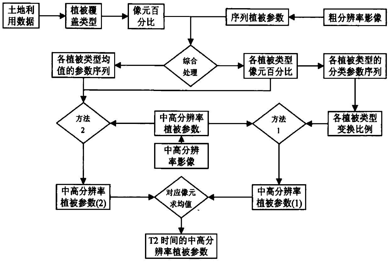
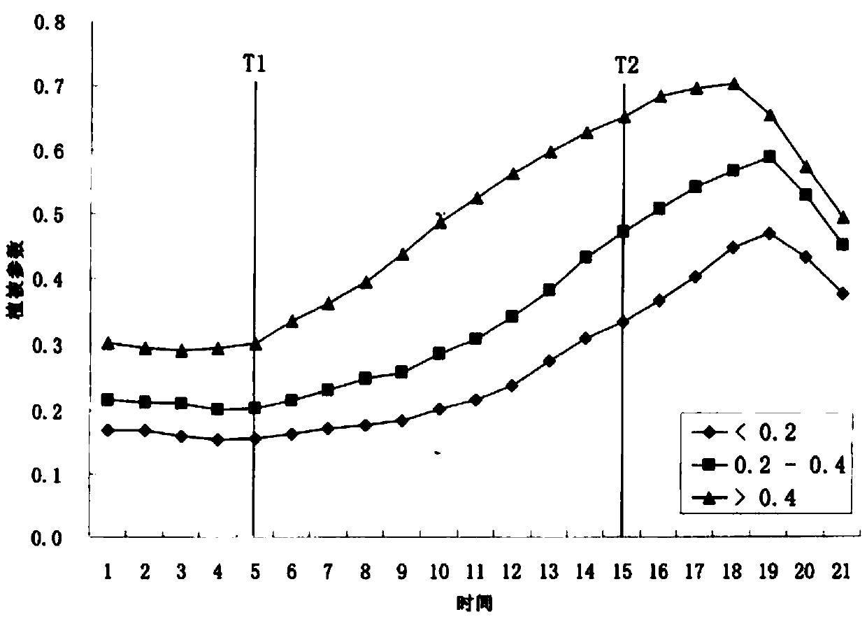
[0011] refer to figure 1 , the problem to be solved in the present invention is to use the medium and high resolution vegetation remote sensing parameters obtained at time T1 to simulate the medium and high resolution vegetation remote sensing parameters at time T2. The implementation of this method requires two other data: (1) medium and high resolution land use map or vegetation type map; (2) coarse resolution remote sensing data of time series.
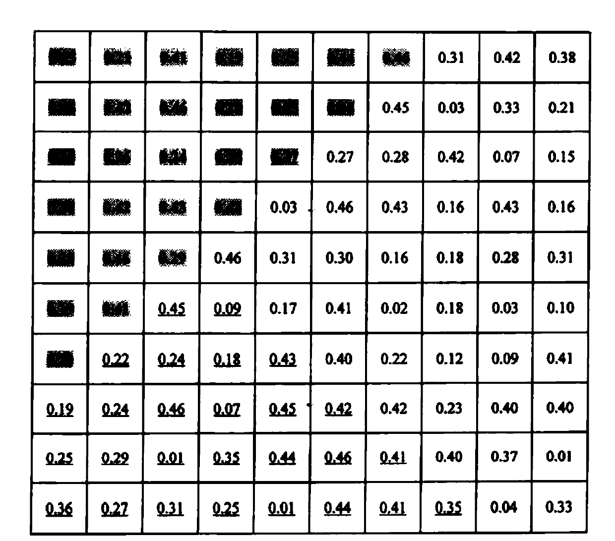
[0012] Use the data (1) to divide the vegetation coverage types as detailed as possible, and combine the GIS aggregation method to obtain the area percentage data of each vegetation coverage type in each pixel of the coarse resolution, and then obtain the pure pixel of each vegetation coverage type , and then combined with the data (2), the time series of vegetation remote sensing parameters of pure pixels ...
PUM
 Abstract
Description
Claims
Application Information