Visual information based real-time calculation method of spatial position of flying unmanned aircraft

A visual information and spatial location technology, applied in navigation computing tools, measuring devices, instruments, etc., can solve problems such as being easily controlled by other countries, limited precision of inertial navigation/GPS integrated navigation, and susceptible to interference of GPS signals, so as to achieve concealment Good results

Active Publication Date: 2014-05-28
北京北航天宇长鹰无人机科技有限公司
View PDF4 Cites 49 Cited by
  • Summary
  • Abstract
  • Description
  • Claims
  • Application Information

AI Technical Summary

Problems solved by technology

[0005] GPS signals are susceptible to interference and control by other countri

Method used


Image

  • Visual information based real-time calculation method of spatial position of flying unmanned aircraft
  • Visual information based real-time calculation method of spatial position of flying unmanned aircraft
  • Visual information based real-time calculation method of spatial position of flying unmanned aircraft

Examples


Embodiment Construction

[0020] Specific embodiments of the present invention will be described in detail below in conjunction with the accompanying drawings.

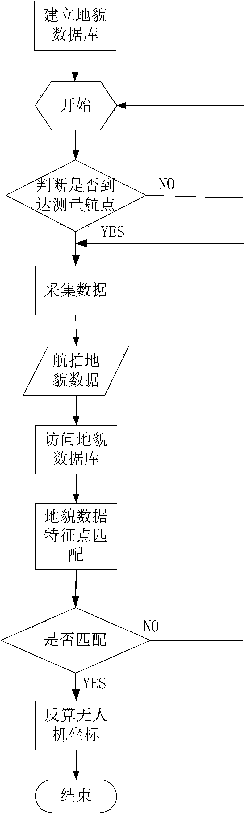
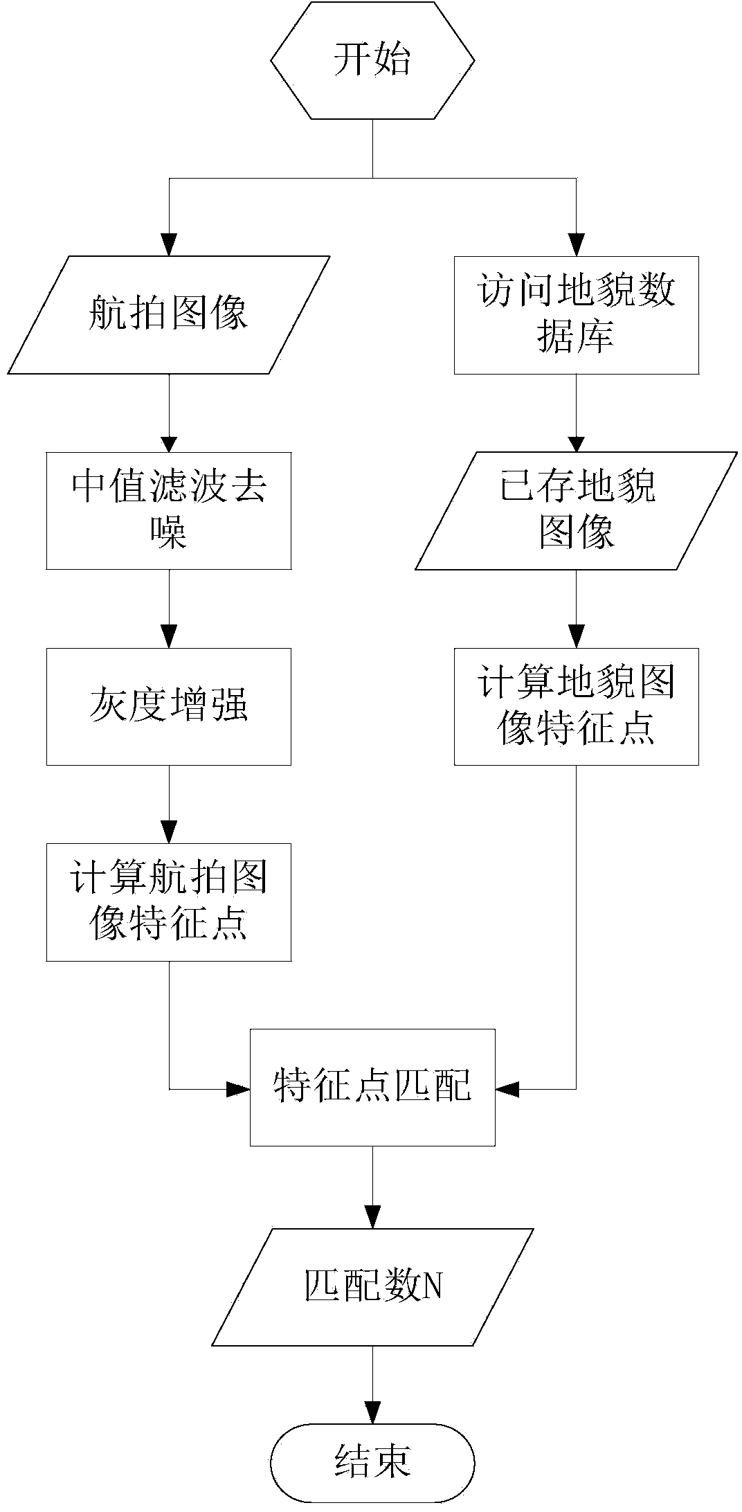
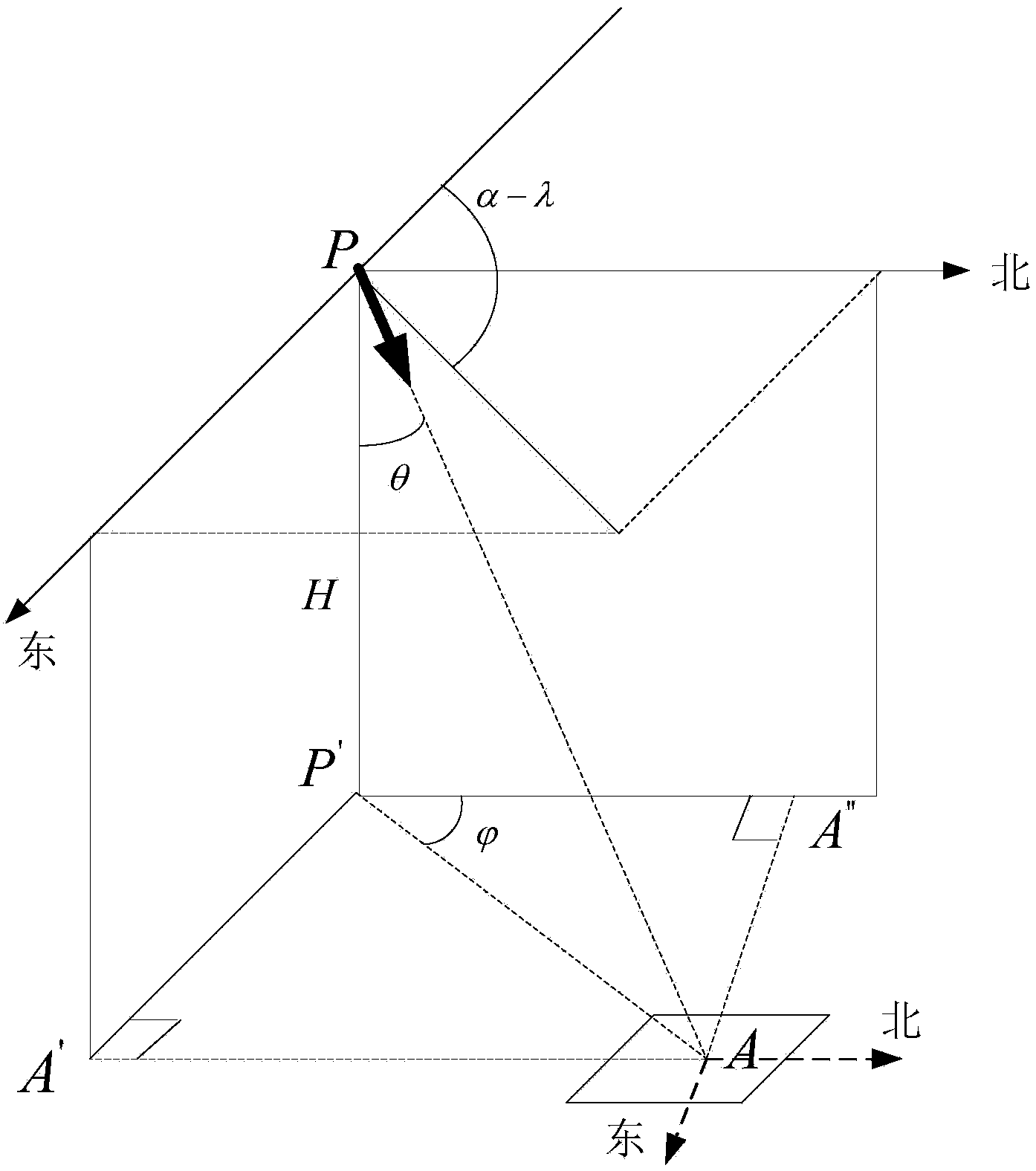
[0021] The real-time calculation method of the space position in the flight of the UAV based on visual information of the present invention, the process is as follows figure 1 shown, including the following steps:

[0022] Step 1, establishing a geomorphological database of the flight route of the UAV;

[0023] According to the pre-planned route of the UAV, within the continuously observable field of view of the UAV, images and location information of various landform environments such as residential areas, vegetation, roads, waters, etc. are extracted, and the color, color, and location information of the landform image are calculated. Various features such as texture, straight line, corner point, SIFT, etc. are stored in the database;

[0024] Specifically: first collect waypoints for the planned route, that is, building landmarks such as ...


PUM


Abstract

The invention discloses a visual information based real-time calculation method of spatial position of a flying unmanned aircraft, belonging to the technical field of digital video image processing. The method is mainly based on aerial photography image information, elevation information, combines unmanned aircraft flight parameter information to analyze and identify the spatial position of an unmanned aircraft. According to the method, images are rectified by using aerial photography images of an unmanned aircraft and combining flight parameters such as the elevation information of the unmanned aircraft, comparative analysis with prior information is conducted, so that the present location information of the unmanned aircraft can be obtained via the aerial photography images through inverse computation. The visual information based unmanned aircraft flight spatial location real-time calculation method aims to the characteristics of the unmanned aircraft, fully utilizes the visual information and improves the independence of the unmanned aircraft.

Description

technical field [0001] The invention belongs to the technical field of digital video image processing, and in particular relates to a method for real-time calculation of the spatial position of an unmanned aerial vehicle based on visual information. Background technique [0002] In recent years, with the continuous development of drone technology, drones have not only been widely used in the military, but also gradually extended to civilian applications. In the military, it can be used for aerial reconnaissance, electronic jamming, communication relay, target positioning, battlefield surveillance and border patrol, etc. In civilian use, it can be used for aerial photography, disaster monitoring, geophysical prospecting, aerial photography, etc. [0003] In the past, UAVs mainly relied on inertial navigation system (Inertial Navigation System, INS) and global positioning system (Global Position System, GPS) for navigation. It is not always available, and even when it is avai...

Claims


Application Information

Patent Timeline
IPC IPC(8): G01C21/20G01C21/00
CPCG01C21/00G01C21/20
Inventor 丁文锐康传波向锦武李红光袁永显
Owner 北京北航天宇长鹰无人机科技有限公司
Why Eureka
Try Eureka