
Scrambling and recovery method for GIS (Geographic Information System) vector data line and plane graphic layer

A vector data, line-surface layer technology, applied in the field of geographic information security, can solve problems that do not fully meet the requirements of finite fields

Inactive Publication Date: 2014-06-18
NANJING NORMAL UNIVERSITY
View PDF4 Cites 4 Cited by
  • Summary
  • Abstract
  • Description
  • Claims
  • Application Information

AI Technical Summary

Problems solved by technology

However, the line-surface layer of GIS vector data is composed of line elements with different numbers of point elements, which belongs to an unsaturated matrix and does not fully meet the requirements of finite fields.

Method used

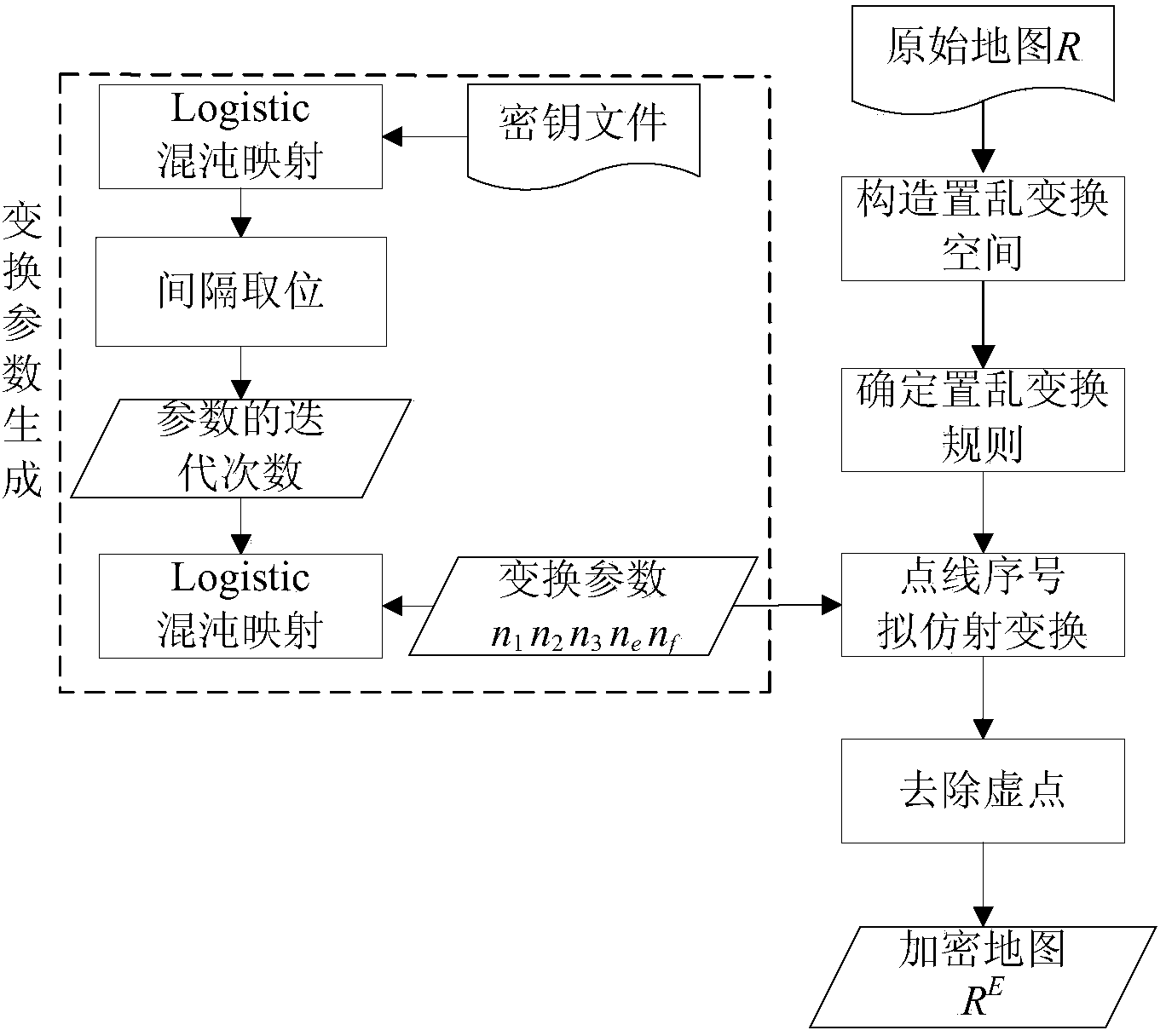
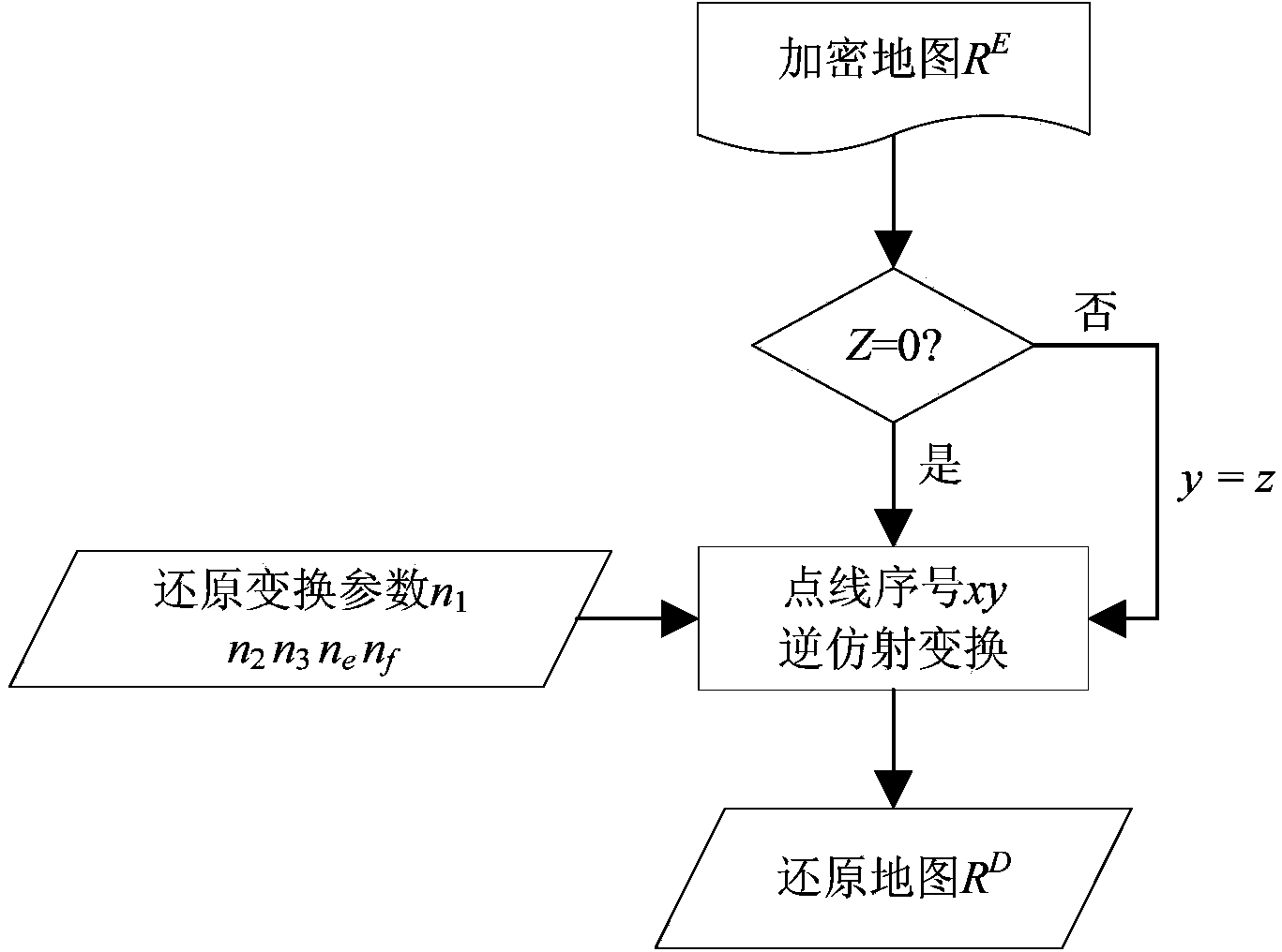
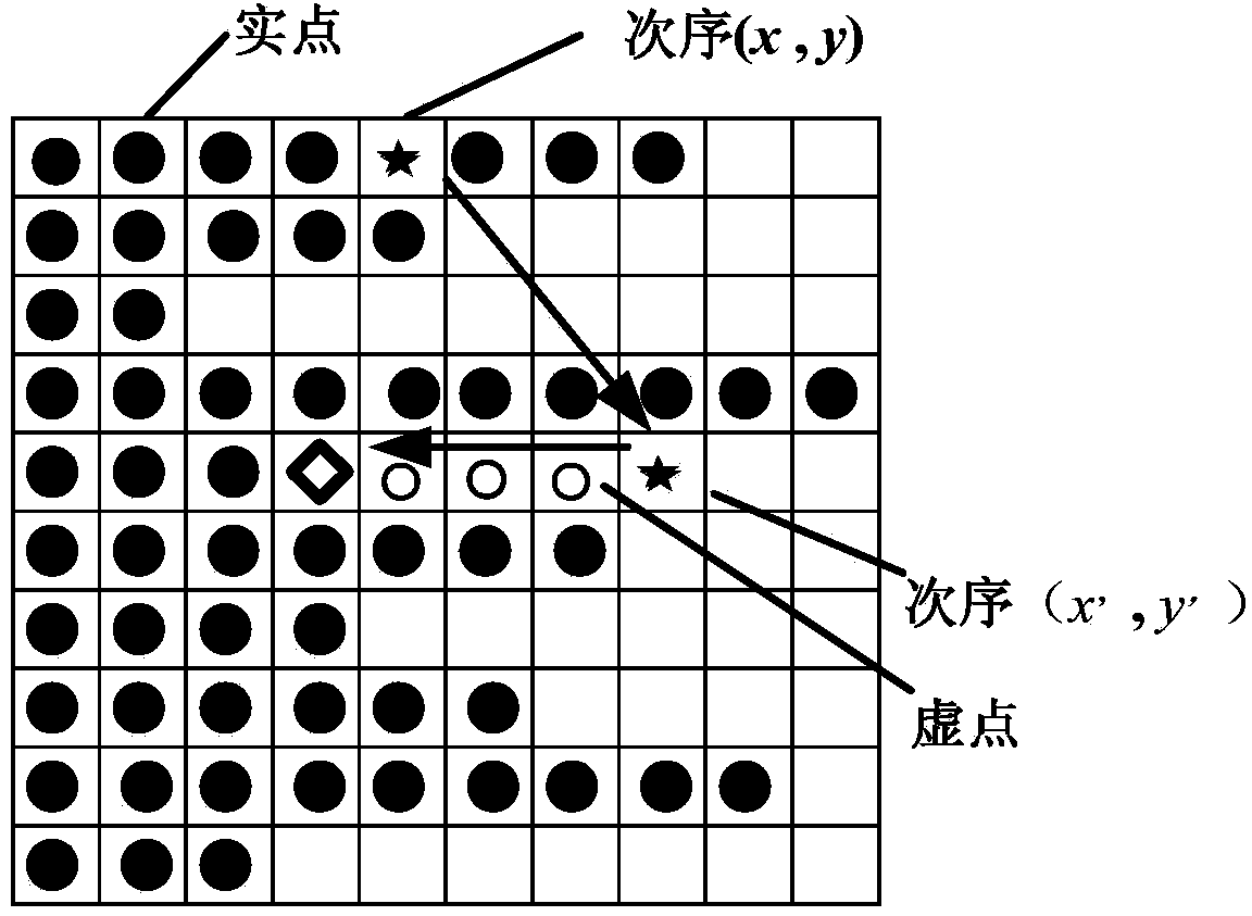

Image

  • Scrambling and recovery method for GIS (Geographic Information System) vector data line and plane graphic layer
  • Scrambling and recovery method for GIS (Geographic Information System) vector data line and plane graphic layer
  • Scrambling and recovery method for GIS (Geographic Information System) vector data line and plane graphic layer

Examples


Embodiment Construction

[0059] Further detailed description will be given below in conjunction with the accompanying drawings and embodiments.

[0060] In this embodiment, a typical shp line layer data R is selected, and the entire process of generating transformation parameters, scrambling and restoring vector data (the same method can be used for surface layer data) is used to further describe the present invention. In this example, the vector data in shp format is selected as the 1:4 million province boundary layer in China (such as Figure 4 ) as experimental data.

[0061] (1) Scrambling process for line layer data

[0062] Step 11: Construct the finite field scrambling transformation space

[0063] a) Open the shp line layer data, and read the information of the point elements contained in each line element in the line layer data in turn. In this embodiment, the total number of line elements I is 1785, and the point elements of the line containing the most points The number J is 500;

[006...


PUM


Abstract

The invention discloses a scrambling and recovery method for a GIS (Geographic Information System) vector data line and plane graphic layer and belongs to the field of geographic information security. The method is based on quasi-affine transformation in a finite integer field and mainly comprises the following processes: 1) a scrambling process, which comprises the steps of constructing a vector data finite field scrambling transformation space, determining transformation rules, generating transformation parameters, performing global scrambling, removing virtual points, forming scrambled vector data and the like; 2) a recovery process, which comprises the steps of generating inverse transformation parameters, performing global anti-scrambling, forming and displaying recovered vector data and the like. The method disclosed by the invention has the characteristics of randomness, reversibility and the like, the recovery transformation has a simple analytical expression, recovery can be realized without performing periodic iteration and effectively technical means are provided for safe transmission, packaging and storage of geographic spatial data.

Description

technical field [0001] The invention belongs to the field of geographic information security, and in particular relates to a method for scrambling and restoring GIS vector data line and surface layers based on quasi-affine transformation on a finite integer domain, which can realize safe transmission and access of vector data in the geographic information system field . Background technique [0002] GIS vector data has the incomparable advantages of high precision, mass, easy storage, automatic processing, and lossless scaling and other traditional paper maps, and has an extremely wide range of applications. However, in the process of network storage and transmission, GIS vector data is easily intercepted and illegally. Tampering, therefore, research on the security of GIS vector data is crucial. At present, the existing encryption methods mainly implement encryption for the change of coordinate accuracy, and most of the encryption granularity levels are relatively coarse, ...

Claims


Application Information

Patent Timeline
IPC IPC(8): G06F17/30H04L9/28
CPCG06F16/29
Inventor 李安波王海荣周卫
Owner NANJING NORMAL UNIVERSITY
Learn More