Multipoint geologic statistics method based on geologic vector information

A statistical method, a technique of geological statistics, applied in the field of multi-point geostatistics based on geological vector information, can solve problems such as discontinuity, instability, and differences in edge splicing of geological bodies, so as to improve reliability and rationality, and widely Applied effect

Active Publication Date: 2014-06-25
CHINA UNIV OF PETROLEUM (BEIJING)
View PDF3 Cites 16 Cited by
  • Summary
  • Abstract
  • Description
  • Claims
  • Application Information

AI Technical Summary

Problems solved by technology

This method cannot fundamentally solve the problem of instability, but also brings another problem: after each block is simulated separately, there are great differences in the splicing of the edges of each sub-block, and there are discontinuous geological bodies and splicing methods. Principles of non-composite sedimentology and other issues
Although this type of method is reasonable to a certain extent, mechanically splitting the simulation block will bring greater problems

Method used


Image

  • Multipoint geologic statistics method based on geologic vector information
  • Multipoint geologic statistics method based on geologic vector information
  • Multipoint geologic statistics method based on geologic vector information

Examples


Embodiment Construction

[0067] The specific embodiments of the invention will be further described below in conjunction with the accompanying drawings. The following examples are only used to illustrate the technical solution of the present invention more clearly, but not to limit the protection scope of the present invention.

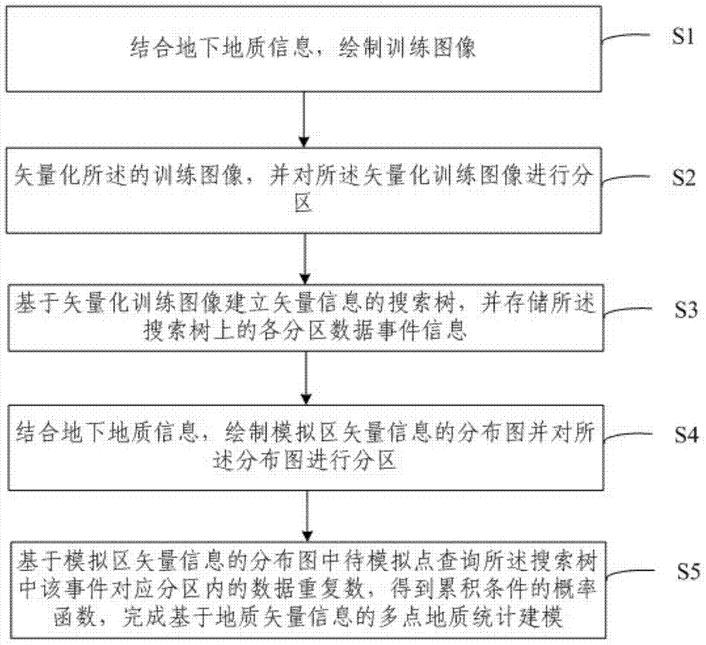
[0068] The embodiment of the present invention provides a method for implementing a customizable water-saving irrigation Internet of Things system, such as figure 1 As shown, the method includes the following steps:

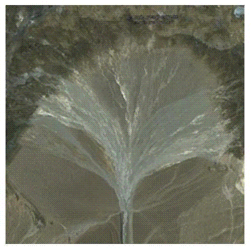
[0069] S1. Combining underground geological information, draw training images;

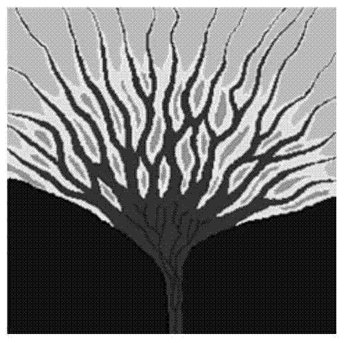
[0070] S2. Vectorize the training image, and partition the vectorized training image;

[0071] S3. Establish a search tree of vector information based on the vectorized training image, and store the data event information of each partition on the search tree;

[0072] S4. Combining the underground geological information, draw a distribution map of the vector information in the si...


PUM


Abstract

The invention provides a multipoint geologic statistics method based on geologic vector information. The multipoint geologic statistics method based on the geologic vector information comprises the steps that vectorization partition is conducted on a training image and a modeling area, so that multiple stable sub-blocks are obtained, stochastic simulation is conducted based on comprehensive geologic research achievements, the problem that according to a multipoint geologic statistics modeling method in the prior art, the instability of a training image and condition data is hard to overcome is solved, the reliability and rationality of a geologic model are effectively improved, and the method can be widely applied to the fields such as the geological exploration field, and the environmental monitoring field.

Description

technical field [0001] The invention relates to the field of geological exploration, in particular to a multi-point geological statistical method based on geological vector information. Background technique [0002] The traditional geostatistical modeling method is represented by the two-point geostatistical method, and its core is to use the variogram to characterize the variability of regionalized variables in a certain spatial range under different distance relationships. The variation characteristics of the variables in the area to be simulated are obtained through the variogram fitting process of the conditional data, and the kriging interpolation process is applied to complete the estimation of the unknown points. Algorithms based on variogram and kriging interpolation methods can be collectively referred to as two-point geostatistical methods. [0003] The variogram can only count the variability between any two points in the three-dimensional space, but the geologic...

Claims


Application Information

Patent Timeline
IPC IPC(8): G06F19/00
Inventor 冯文杰吴胜和岳大力印森林李俊飞于斌
Owner CHINA UNIV OF PETROLEUM (BEIJING)
Why Eureka
Try Eureka