Device and method used for real-time positioning and map building

A technology for map construction and mobile electronic equipment, applied to road network navigators, etc., can solve the problems of small number of feature points, poor robustness, limited laser line sampling points, etc., and achieve the goal of increasing the number of feature points and improving positioning capabilities Effect

Active Publication Date: 2014-07-02
LENOVO (BEIJING) CO LTD
View PDF3 Cites 52 Cited by
  • Summary
  • Abstract
  • Description
  • Claims
  • Application Information

AI Technical Summary

Problems solved by technology

The feature points based on two-dimensional (2D) laser sensors mostly use geometric features. Due to the limited sampl

Method used


Image

  • Device and method used for real-time positioning and map building
  • Device and method used for real-time positioning and map building
  • Device and method used for real-time positioning and map building

Examples


Embodiment Construction

[0038] Various preferred embodiments of the present invention will be described below with reference to the accompanying drawings. The following description with reference to the accompanying drawings is provided to assist understanding of example embodiments of the invention as defined by the claims and their equivalents. It includes various specific details to aid in understanding but they are to be regarded as exemplary only. Accordingly, those of ordinary skill in the art will recognize that various changes and modifications of the embodiments described herein can be made without departing from the scope and spirit of the invention. Also, detailed descriptions of functions and constructions well-known in the art will be omitted to make the description clearer and more concise.

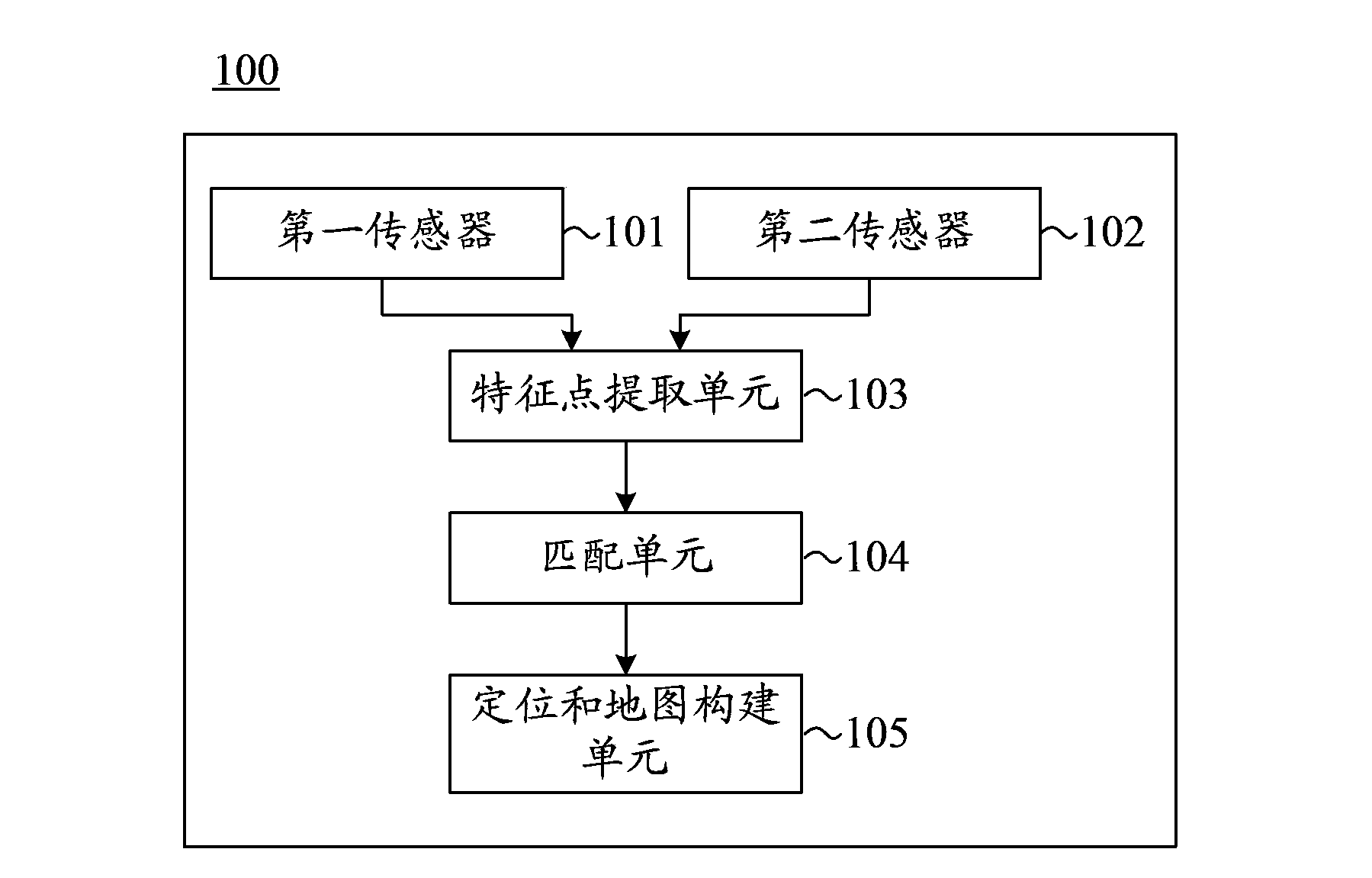
[0039] First, refer to figure 1 A mobile electronic device for positioning and mapping in unknown environments according to an embodiment of the present invention is described.

[0040] Such as ...


PUM


Abstract

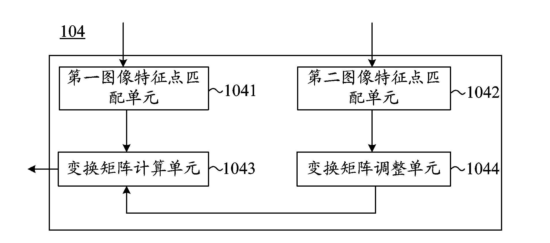
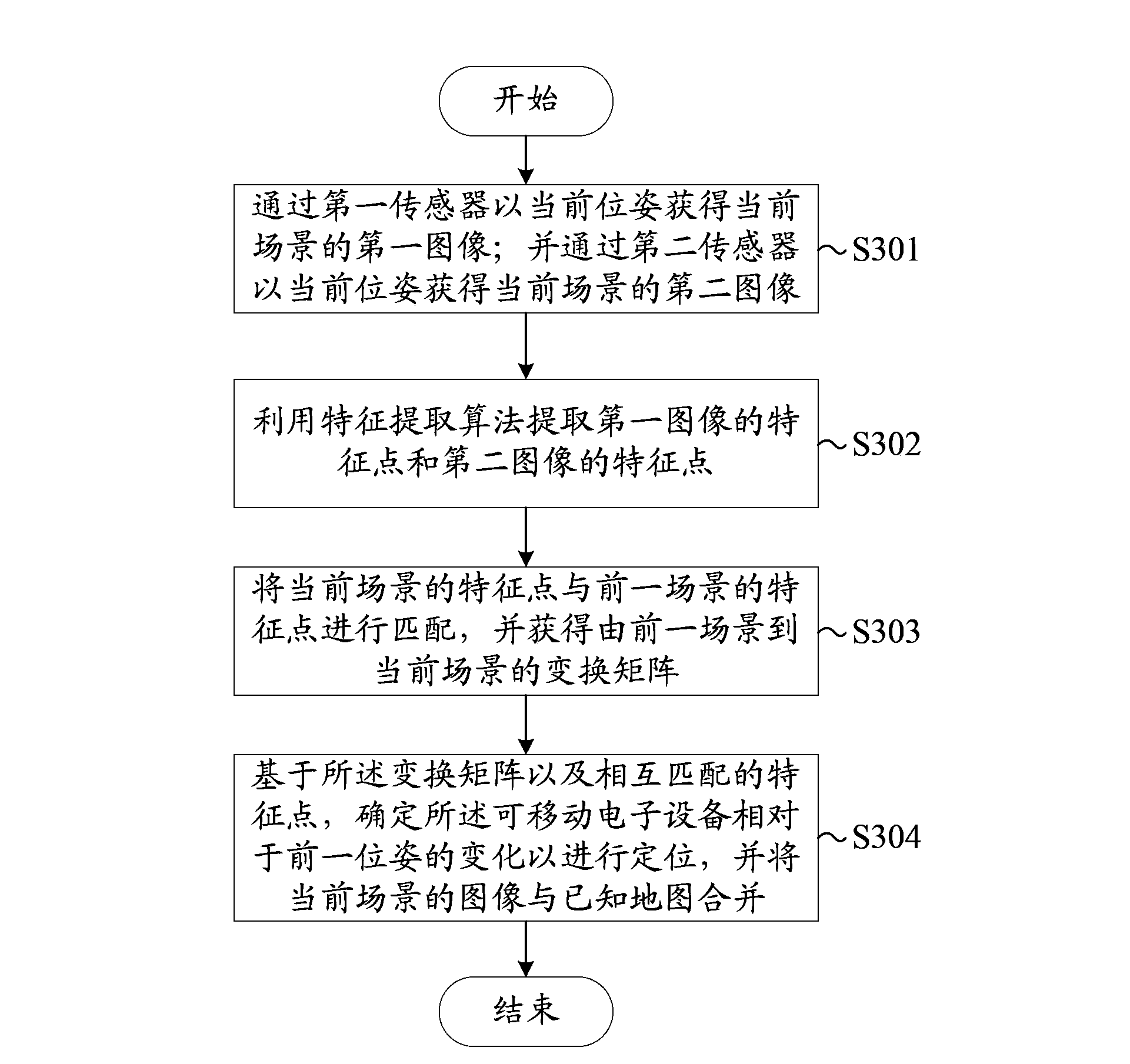
A mobile electron device is used for positioning and map building in an unknown environment. The mobile electron device comprises: a first sensor, a second sensor, a feature point extraction unit, a matching unit, and a positioning and map building unit, wherein the first sensor is used for acquiring a first image of the current scene with the current position and orientation; the second sensor is used for acquiring a second image of the current scene with the current position and orientation; the feature point extraction unit is used for extracting feature points of the first image and feature points of the second image by utilization of a feature extraction algorithm; the matching unit is used for matching the feature points of the current scene and feature points of a previous scene, and acquiring a transformation matrix from the previous scene to the current scene; and the positioning and map building unit is used for, based on the transformation matrix and the matched feature points, determining changes on position and orientation of the mobile electron device relative to the previous position and orientation so as to perform positioning, and is also used for combining the images of the current scene with a known map.

Description

technical field [0001] The present invention relates to a device and method for instant positioning and map construction, and more particularly, to a device and method for instant positioning and map construction capable of improving positioning performance. Background technique [0002] Simultaneous Localization and Mapping (SLAM) is currently a hot research topic in robot localization. The so-called SLAM is the integration of mobile robot positioning and environmental map creation, that is, the robot builds an incremental environmental map according to its own pose estimation and sensor perception of the environment during the movement process, and uses the map to realize its own positioning. [0003] In robot localization, enough environmental feature points are needed for precise localization. The feature points based on two-dimensional (2D) laser sensors mostly use geometric features. Due to the limited sampling points of the laser line, the number of calculated featur...

Claims


Application Information

Patent Timeline
IPC IPC(8): G01C21/32
CPCG01C21/32
Inventor 刘国良张贺李南君
Owner LENOVO (BEIJING) CO LTD
Why Eureka
Try Eureka