Mineral resource multi-information processing method based on GIS and system thereof

An information processing method and information processing system technology, applied in image data processing, data processing applications, 3D modeling, etc., can solve problems such as analysis work that cannot be modeled, and achieve the effect of sharing

Active Publication Date: 2014-07-23
INST OF MINERAL RESOURCES CHINESE ACAD OF GEOLOGICAL SCI
View PDF3 Cites 30 Cited by
  • Summary
  • Abstract
  • Description
  • Claims
  • Application Information

AI Technical Summary

Problems solved by technology

Modeler technology is also provided in ArcGIS9, but the modeler in ArcGIS9 is limited to spatial processing models, and cannot model for more complex analysis work

Method used


Image

  • Mineral resource multi-information processing method based on GIS and system thereof
  • Mineral resource multi-information processing method based on GIS and system thereof
  • Mineral resource multi-information processing method based on GIS and system thereof

Examples


Embodiment Construction

[0062] The present invention will be described in detail below in conjunction with the accompanying drawings and specific embodiments, but not as a limitation of the present invention.

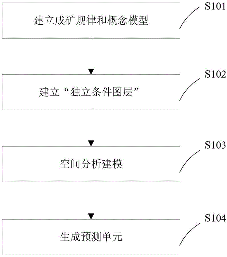
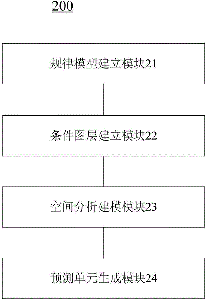
[0063] Such as figure 1 Shown is the flow chart of the GIS-based multivariate information processing method for mineral resources in the present invention. The specific steps of the process are as follows:

[0064] Step 101, establishing metallogenic laws and conceptual models;

[0065] On the basis of in-depth research on regional metallogenic laws, typical deposits and metallogenic models, the optimal combination of ore-controlling elements and ore-controlling indicators is determined.

[0066] The purpose of creating the model includes several aspects: First, it can help people plan and design the spatial analysis process to be carried out, that is, record the design ideas in the form of a flowchart for further modification and implementation; on the basis of process design and determinat...


PUM


Abstract

The invention discloses a mineral resource multi-information processing method based on a GIS and a system thereof. The method comprises that: step one, a mineralization rule and a conceptual model are established; step two, an independent conditional diagram layer is established according to the conceptual model; step three, spatial analysis modeling is performed according to the independent conditional diagram layer; and step four, a prediction unit is generated according to results of the spatial analysis modeling. Automation of the sharing and operation processes of a mineral resource prediction model is realized by the method.

Description

technical field [0001] The invention belongs to the field of mineral resource evaluation, and in particular relates to a GIS-based multivariate information processing method and system for mineral resources. Background technique [0002] Carrying out quantitative evaluation of mineral resources in the technical environment of GIS (Geographic Information System, geographic information system) and realizing the automation, digitization and intelligence of resource evaluation work are important development trends of mineral resource exploration and prediction. In traditional mineral resource evaluation methods, the direct "carrier" of multi-source geological information is paper maps and data tables. Geologists read these maps and tables to record useful information, and then use the existing geological theoretical knowledge to The complex relationship between various information is analyzed and synthesized based on previous work experience, and finally the statistical inferenc...

Claims


Application Information

Patent Timeline
Patent Type & Authority Applications(China)
IPC IPC(8): G06T17/05G06Q10/04
Inventor 阴江宁肖克炎李楠
Owner INST OF MINERAL RESOURCES CHINESE ACAD OF GEOLOGICAL SCI
Why Eureka
Try Eureka