A method for locating personnel and transport vehicles used in grain depots
A technology for transporting vehicles and positioning methods, which is applied to satellite radio beacon positioning systems, measuring devices, instruments, etc., and can solve the problems of complex positioning process, inaccurate positioning results, and difficulty in viewing positioning results.
- Summary
- Abstract
- Description
- Claims
- Application Information
AI Technical Summary
Problems solved by technology
Method used
Image
Examples
Embodiment Construction
[0050] The principles and features of the present invention are described below in conjunction with the accompanying drawings, and the examples given are only used to explain the present invention, and are not intended to limit the scope of the present invention.
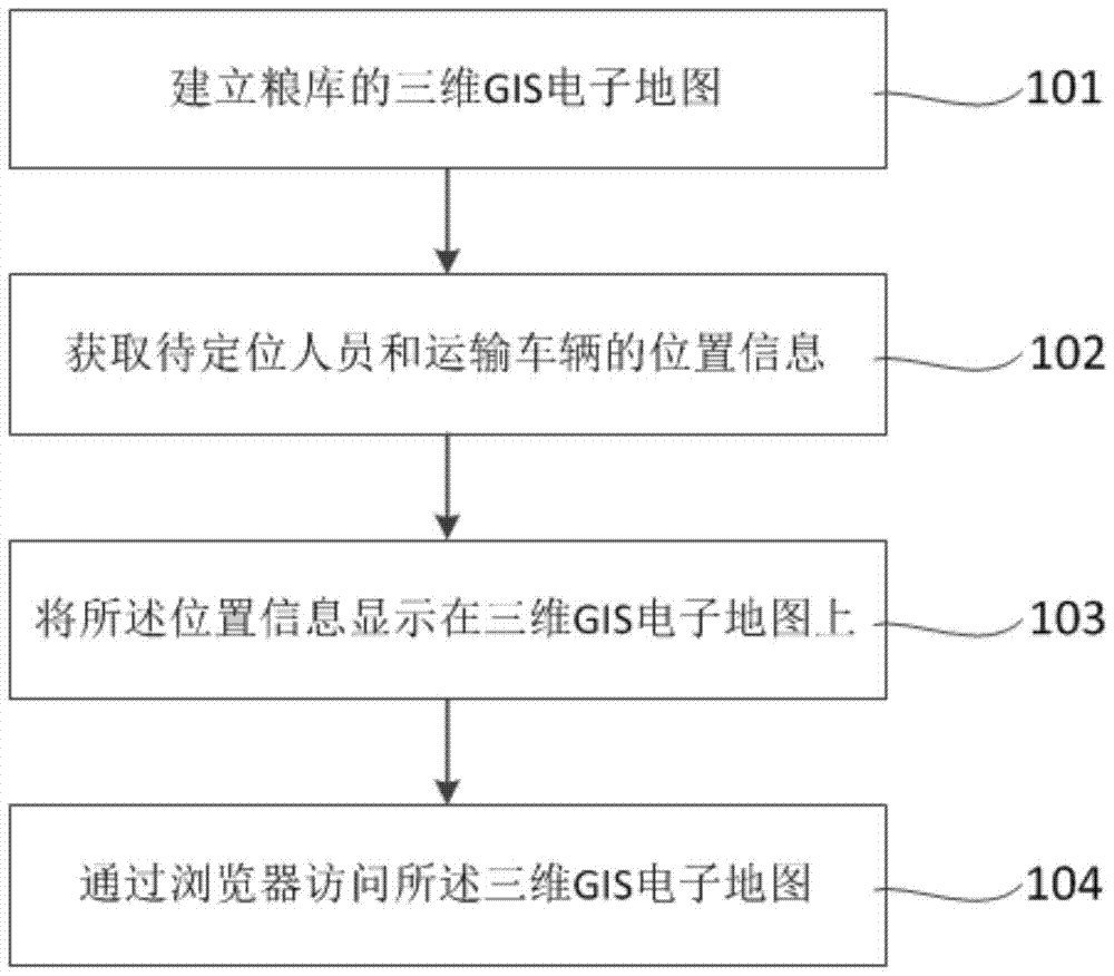
[0051] Such as figure 1 As shown, it is a flow chart of a method for positioning personnel and transport vehicles used in grain depots according to the present invention, including the following steps:
[0052] 101 Establish the 3D GIS electronic map of the grain depot, and deploy the 3D GIS electronic map to the network server in the browser / server mode; this mode unifies the client and concentrates the core part of system function realization on the server , It can be operated anywhere through a browser without installing any special software. The client has zero maintenance and is very convenient to use.
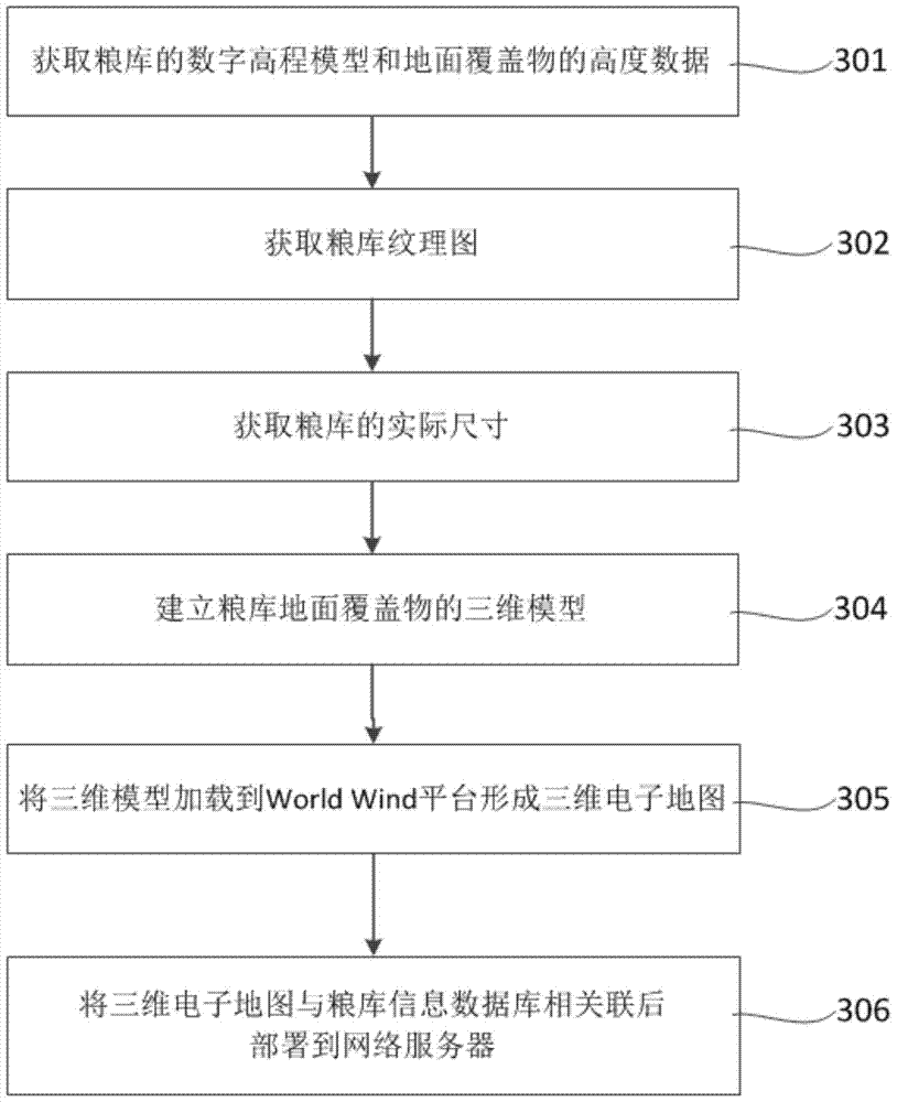
[0053] The specific steps for establishing the three-dimensional GIS electronic map of the grain depot refe...
PUM
 Abstract
Description
Claims
Application Information
 - R&D
- Intellectual Property
- Life Sciences
- Materials
- Tech Scout
- Unparalleled Data Quality
- Higher Quality Content
- 60% Fewer Hallucinations
Browse by: Latest US Patents, China's latest patents, Technical Efficacy Thesaurus, Application Domain, Technology Topic, Popular Technical Reports.
© 2025 PatSnap. All rights reserved.Legal|Privacy policy|Modern Slavery Act Transparency Statement|Sitemap|About US| Contact US: help@patsnap.com


