
GPS navigation map accurate matching system of pilotless automobile, and its operation method

An unmanned vehicle and GPS navigation technology, applied in the field of intelligent transportation industry, can solve problems such as driving into the wrong road, insufficient accuracy, wrong navigation commands, etc., to reduce driving errors and improve accuracy.

Inactive Publication Date: 2014-10-08
BEIJING UNION UNIVERSITY
View PDF6 Cites 35 Cited by
  • Summary
  • Abstract
  • Description
  • Claims
  • Application Information

AI Technical Summary

Problems solved by technology

However, when the roads are dense or the road conditions are relatively complicated, the ordinary map matching system is likely to guide the vehicle into the wrong road due to insufficient accuracy.
Many existing technologies can only control the error to two digits, so when encountering dense roads or complex road conditions, it is likely to issue wrong navigation commands due to insufficient accuracy

Method used

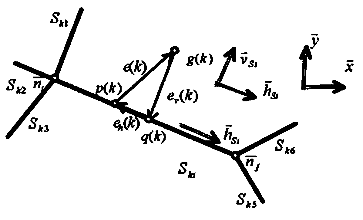

Image

  • GPS navigation map accurate matching system of pilotless automobile, and its operation method
  • GPS navigation map accurate matching system of pilotless automobile, and its operation method
  • GPS navigation map accurate matching system of pilotless automobile, and its operation method

Examples


Embodiment Construction

[0067] The specific implementation of the present invention will be described in further detail below in conjunction with the accompanying drawings and examples, so that those skilled in the art can make and use the present invention. The following examples are used to illustrate the present invention, but are not intended to limit the scope of the present invention.

[0068] In the following description, numerous specific details are given in order to provide a thorough understanding of the present invention. It should be understood, however, that the invention may be practiced without these specific details.

[0069] The term "module" as used herein includes software, hardware or a combination thereof depending on the context in which it is used. For example, the software can be machine code, embedded code, firmware, and application software. For another example, the hardware can be a circuit, a processor, a computer, an integrated circuit, an integrated circuit core, a pr...


PUM


Abstract

The invention relates to a GPS navigation map accurate matching method of a pilotless automobile, and a method thereof. The map accurate matching method comprises the following steps: 1, obtaining road information; 2, determining a start point; 3, obtaining vehicle positioning information; 4, matching and screening the information; and 5, repeating step 1-4 until successful matching. The method and the system can reduce the navigation error to 2m or less, can timely adjust when the navigation error exceeds 2m, and greatly reduces the navigation error.

Description

technical field [0001] The invention belongs to the intelligent transportation industry, and in particular relates to a method and system for accurately matching GPS navigation maps. Background technique [0002] With the rapid development of society and economy, unmanned vehicles have attracted more and more attention. The reason is as follows: unmanned vehicles can replace ordinary vehicles to reduce the occurrence of traffic accidents caused by human factors, and can replace ordinary vehicles to complete special operations. For the driving of unmanned smart cars, navigation is equivalent to the nerve center of the car, and navigation relies on the latitude and longitude points measured in real time by GPS to match the precise electronic map to correct the driving errors of unmanned cars. [0003] Intelligent Vehicle Navigation System (IVLNS) is a new technology in a period of vigorous development, and it is a frontier branch of Intelligent Transportation System (ITS). I...

Claims


Application Information

Patent Timeline
Patent Type & Authority Applications(China)
IPC IPC(8): G01C21/30
CPCG01C21/32G01C21/3415
Inventor 袁家政黄静华刘宏哲周成
Owner BEIJING UNION UNIVERSITY
Learn More