
3D point cloud data processing method

A data processing and point cloud data technology, applied in image data processing, special data processing applications, 3D modeling, etc., can solve problems such as low efficiency and cumbersome steps, and achieve simple data structure, accurate clustering results, and real-time performance Good results

Active Publication Date: 2015-01-21
BEIJING INSTITUTE OF TECHNOLOGYGY
View PDF5 Cites 40 Cited by
  • Summary
  • Abstract
  • Description
  • Claims
  • Application Information

AI Technical Summary

Problems solved by technology

This type of method needs to select sample targets such as vehicles, pedestrians and other objects one by one, circle them, and export them. The steps are cumbersome and the efficiency is low.

Method used


Image

  • 3D point cloud data processing method
  • 3D point cloud data processing method
  • 3D point cloud data processing method

Examples


Embodiment Construction

[0034] The implementation of the present invention will be described in detail below in conjunction with the accompanying drawings and embodiments.

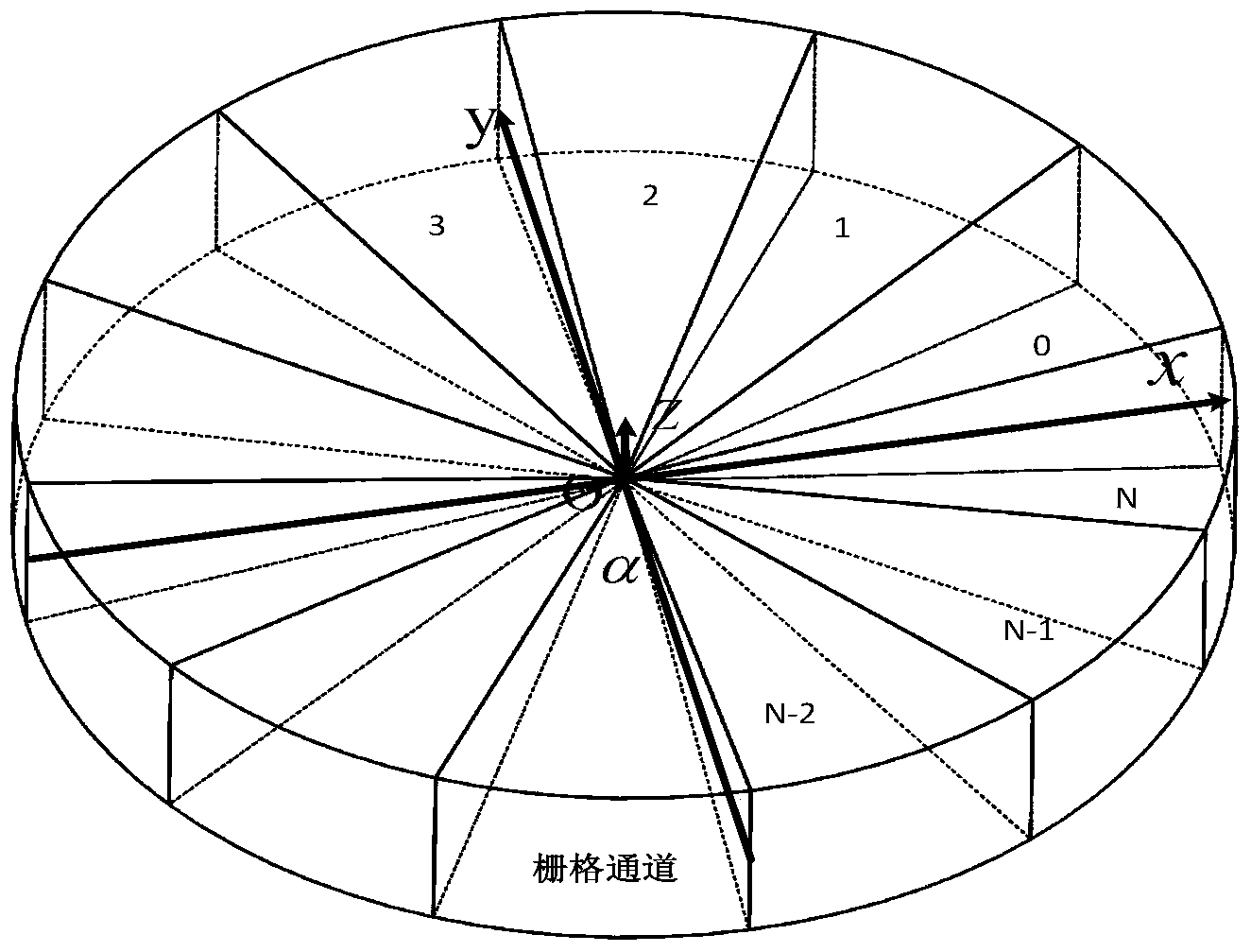
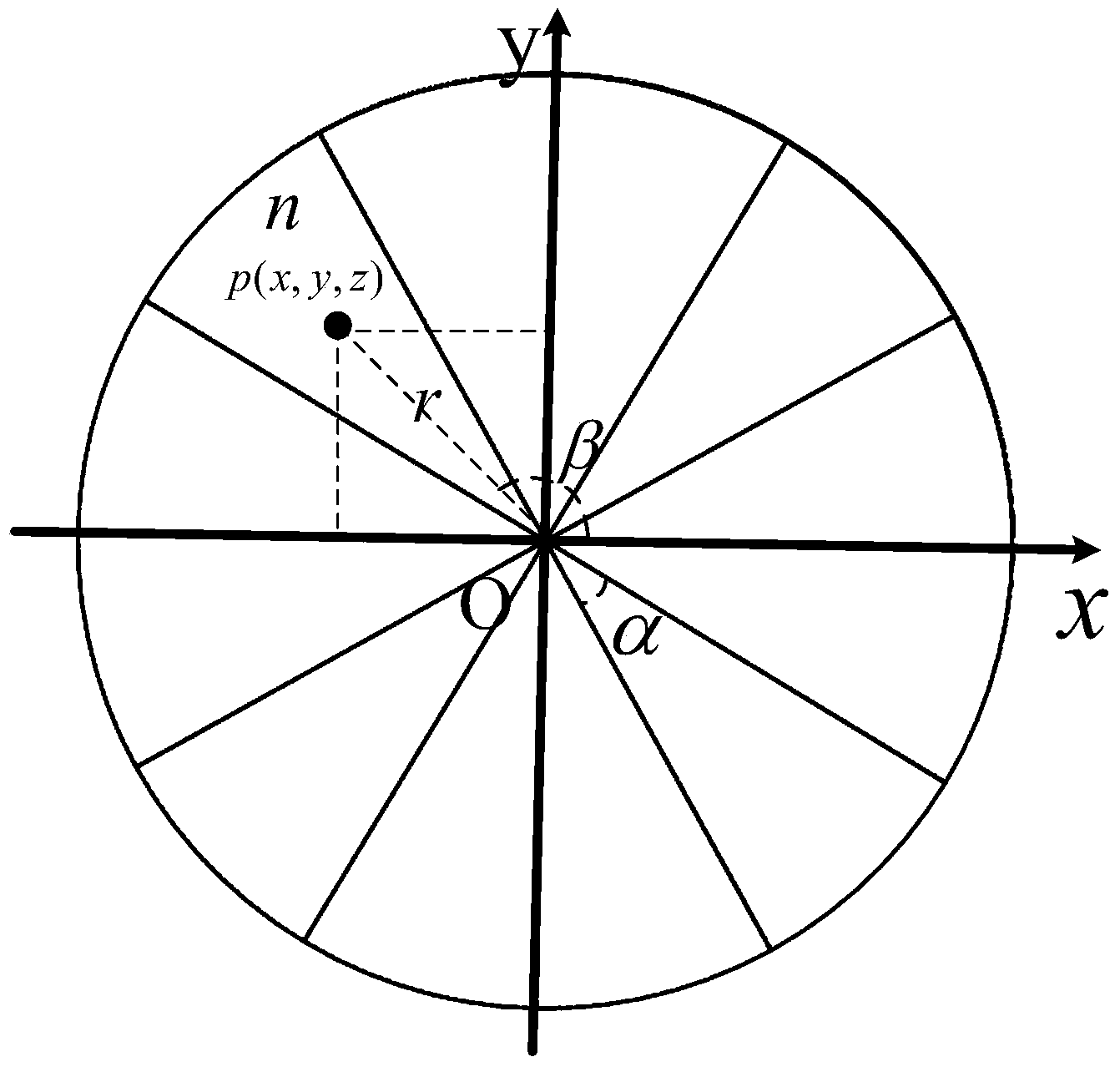
[0035] The method adopted in the present invention is carried out on a sensor mounted in such a way that the axis of rotation of the sensor is perpendicular to the ground. Define the OXYZ coordinate system as a rectangular coordinate system fixed to the sensor, the OZ axis is the vertical center axis of the sensor, perpendicular to the ground plane, the OX axis is the horizontal ray in the scanning starting plane, and the OY axis is composed of the X axis and the Z axis Determined according to the right-hand spiral rule, where the Z axis can reflect the height value of the scanned object.

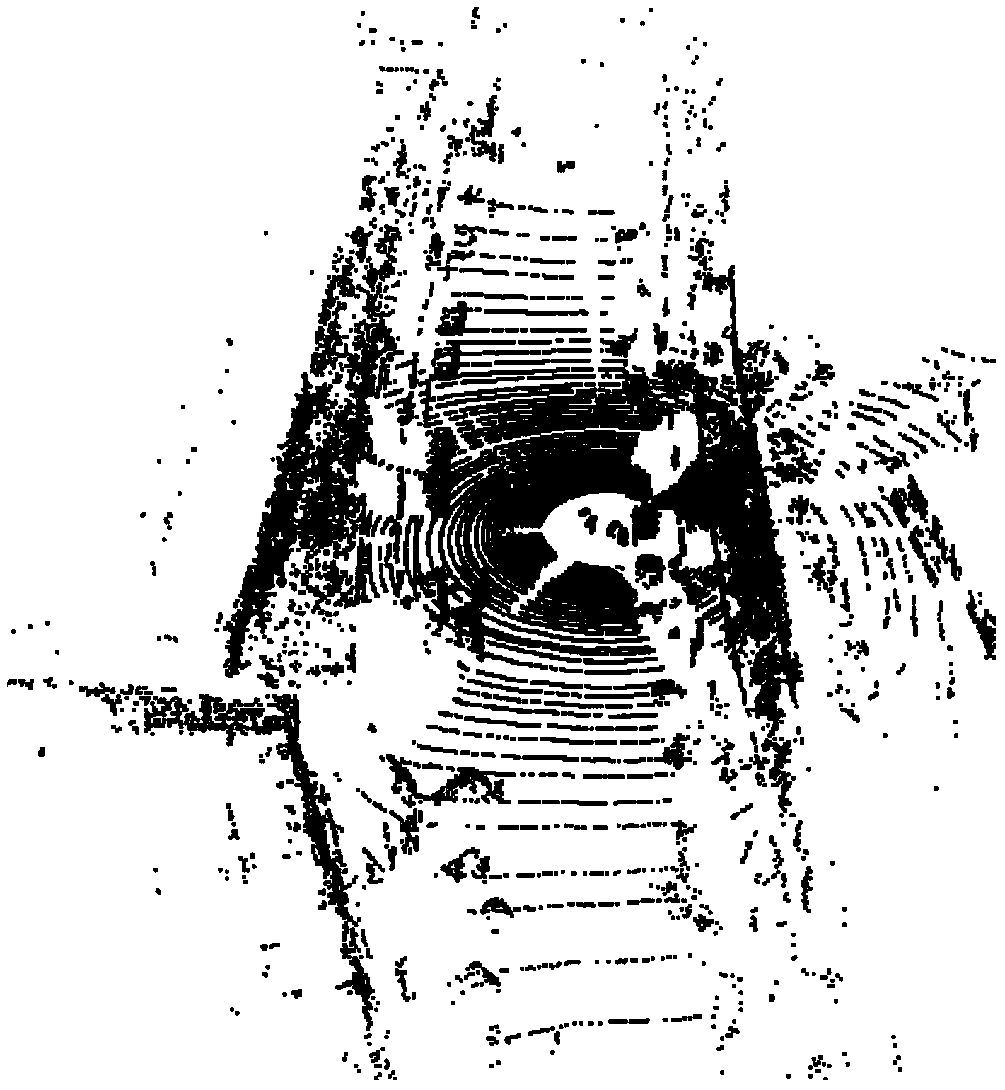
[0036] The surrounding environment is sampled once by the sensor as described above, and the following results are obtained: figure 1 The point cloud data image of the real-world scene to be processed is shown.

[0037] The processing of the...


PUM


Abstract

The invention discloses a 3D point cloud data processing method. A ground filtering method for a 3D point cloud is achieved by establishing a 3D raster map and fitting a ground plane curve, a data structure is simple, the obtained ground plane curve is accurate and reliable, and filtering effect and real-timeliness are very good. A provided partition method adopts a method for clustering search windows in the cylindrical coordinate raster map, the calculation amount in the clustering process is greatly decreased, real-timeliness is good, and a clustering result is accurate. A provided training sample marking method is formed by combining point cloud partition with an appropriate display and storage method and is easy to achieve, multiple categories of samples can be marked in point cloud data of each frame, and sample marking efficiency is greatly improved.

Description

technical field [0001] The invention relates to a 3D point cloud data processing method, belonging to the technical field of 3D point cloud data preprocessing. Background technique [0002] In recent years, with the invention and popularization of 3D laser sensors whose rotation axes are perpendicular to the ground, such as Kinect and Velodyne, the research on 3D depth data processing methods has attracted more and more attention. The 3D point cloud data obtained by scanning and sampling the surrounding environment by lidar sensors such as Velodyne contains reflection data of almost all objects in the surrounding environment of the sensor. The purpose of obstacle detection and recognition can be achieved by processing the scanned 3D point cloud data. However, since the 3D point cloud data is often too large in scale, it will bring real-time problems for subsequent algorithms, so the first problem to be solved is Filter and segment point cloud data to reduce data size. The ...

Claims


Application Information

Patent Timeline
Patent Type & Authority Applications(China)
IPC IPC(8): G06K9/62G06T17/00
CPCG06F16/29G06F16/337
Inventor 杨毅闫光朱昊周耿屈新
Owner BEIJING INSTITUTE OF TECHNOLOGYGY
Learn More