
Riverway flood inundation simulation method based on water level monitoring data

A technology for water level monitoring and simulation methods, applied in simulators, instruments, control/regulation systems, etc., and can solve problems such as few sample points

Active Publication Date: 2015-03-25
CHANGJIANG RIVER SCI RES INST CHANGJIANG WATER RESOURCES COMMISSION
View PDF5 Cites 22 Cited by
  • Summary
  • Abstract
  • Description
  • Claims
  • Application Information

AI Technical Summary

Problems solved by technology

[0008] Aiming at the problems existing in the prior art, the present invention provides a river channel flood submersion simulation method based on water level monitoring data, which can effectively solve the problem of too few sample points in flood water level interpolation by conventional spatial interpolation methods, and at the same time fully consider the channel morphological changes, and thus can reasonably calculate the flood submerged range and submerged water depth

Method used


Image

  • Riverway flood inundation simulation method based on water level monitoring data
  • Riverway flood inundation simulation method based on water level monitoring data
  • Riverway flood inundation simulation method based on water level monitoring data

Examples


Embodiment Construction

[0041] The technical solutions in the present invention will be clearly and completely described below in conjunction with the accompanying drawings in the present invention.

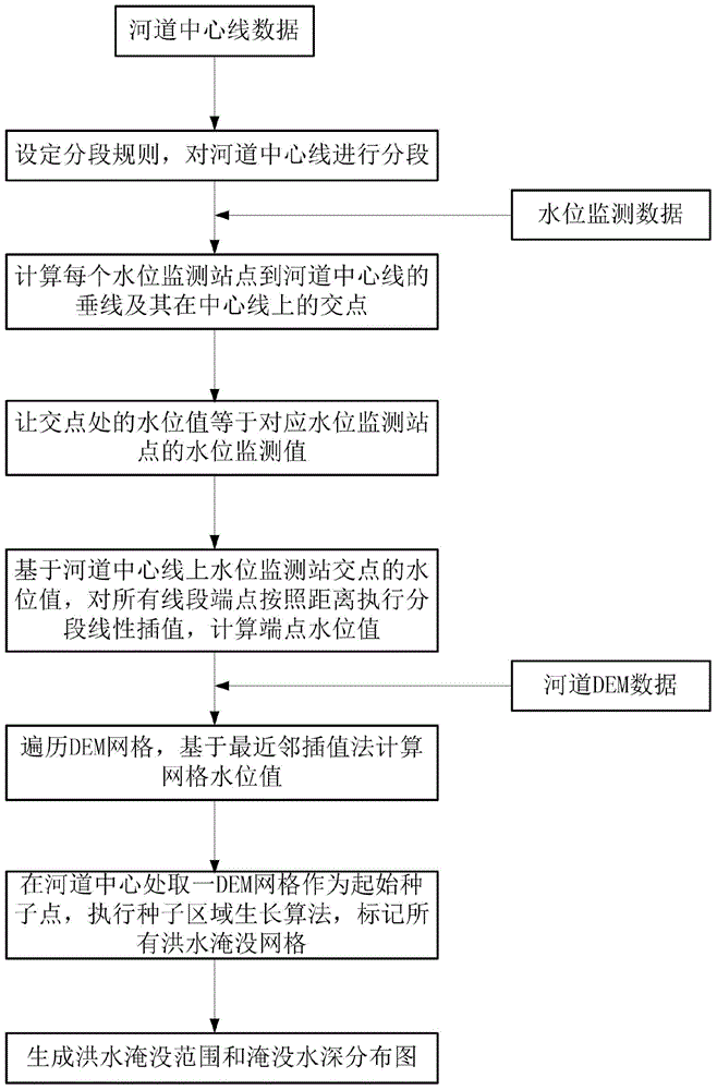
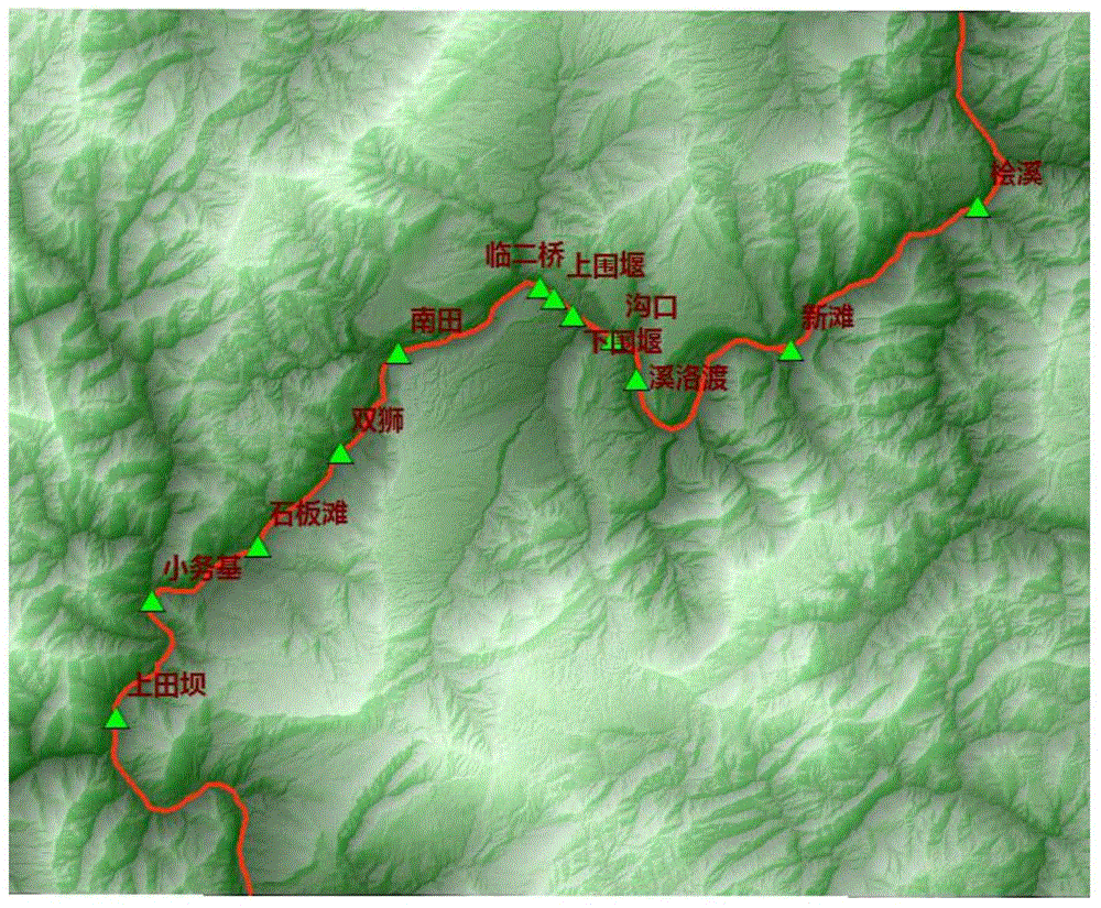
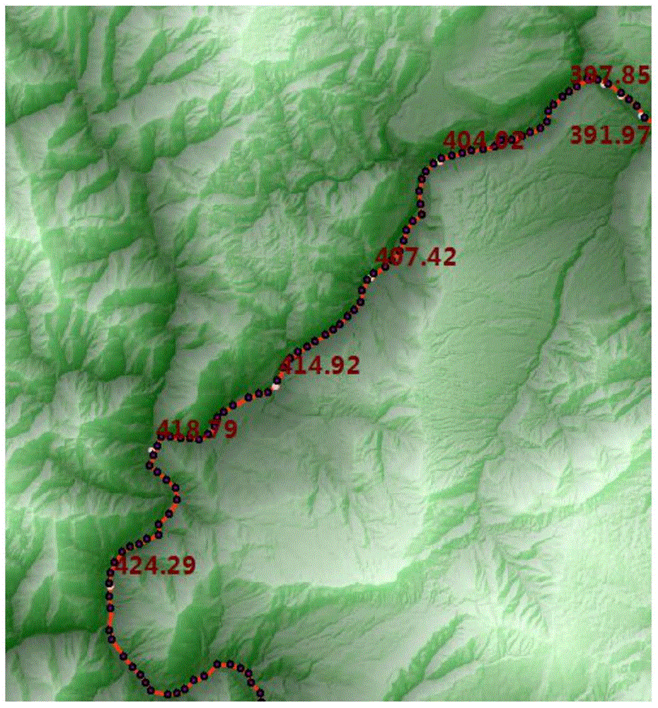
[0042] figure 1 Shown is a schematic flowchart of an embodiment of a method for simulating flood inundation of a river course based on water level monitoring data in the present invention. figure 2 An example of DEM data and water level monitoring stations of a certain river course is given. The spatial resolution of the DEM data is 25 meters. A total of 12 water level monitoring stations are arranged on this section of the river course. image 3 Partial screenshot for piecewise linear interpolation along the channel centerline, Figure 4 is the flood inundation extent map generated using nearest neighbor interpolation and seed region growing, Figure 5 A map of the distribution of flood depths.

[0043] Embodiments of the present invention provide a method for simulating river flood inundation base...


PUM


Abstract

The invention discloses a riverway flood inundation simulation method based on water level monitoring data. According to the method based on the scattered water level monitoring data collected along a riverway, firstly, piecewise linear interpolation is carried out on a center line of the riverway, and water level values of all places along the center line of the riverway are obtained; secondly, on a riverway DEM, the flood water level of each DEM box is worked out according to the nearest neighbor interpolation; lastly, the actual inundation range and the actual inundation water depth distribution of riverway flood are calculated according to the seed region growing method in the riverway. According to the riverway flood inundation simulation method, the natural form change of riverway winding up and down is fully taken into consideration, interpolation is carried out on the value of the riverway water level between water level monitoring stations according to distance parameters, and the interpolation water level distortion problem can be effectively avoided. Meanwhile, the riverway flood inundation simulation method can effectively solve the problem that due to the fact that the number of the flood water level monitoring stations distributed on the riverway is too small, and water level monitoring data sample points are insufficient, a conventional flood water level space interpolation method based on overall areas is hard to apply.

Description

technical field [0001] The invention relates to the field of earth sciences, in particular to a method for simulating river flood inundation based on water level monitoring data. Background technique [0002] Flood disaster is one of the most important natural disasters on the earth. In recent decades, the occurrence of global flood disasters has been showing a continuous increase trend. The occurrence of flood is an extremely complicated process, which is affected by many aspects such as rainfall, geology, water source conditions, topography and landform, among which river flood is the most typical type of flood. There are many reasons for river floods. It may be flood disasters caused by local heavy rains that cause precipitation to gather too quickly into low-lying places such as river channels, or it may be caused by dam failures that cause water to pour down from the breach and cause damage to the downstream. flood. As far as its occurrence mechanism is concerned, it ...

Claims


Application Information

Patent Timeline
IPC IPC(8): G05B17/02
Inventor 沈定涛张煜叶松曹波黄俊芦云峰李云帆黄艳芳杨胜梅黄晓贞陈文龙
Owner CHANGJIANG RIVER SCI RES INST CHANGJIANG WATER RESOURCES COMMISSION
Learn More