A method for acquiring thematic map of river underwater topography

An underwater terrain and acquisition method technology, applied in image data processing, 3D image processing, 3D modeling and other directions, can solve the problems of lack, strong professional requirements, single content form, etc., to achieve low production cost, strong usability, The effect of high drawing efficiency

Inactive Publication Date: 2017-09-19
HOHAI UNIV
View PDF3 Cites 0 Cited by
  • Summary
  • Abstract
  • Description
  • Claims
  • Application Information

AI Technical Summary

Problems solved by technology

[0004] The research on the evolution and improvement of the river bed is inseparable from the visualization of the river topography. At present, the river topographic map is used to describe the river channel information. The content and form are single, the expression is not intuitive enough, and the professional requirements are strong. It is very necessary to make a topographic map with good visualization effect to show the topographic changes of the river bed and the changing trend of the river topography.
However, in the prior art, this aspect is still very lacking.

Method used


Image

  • A method for acquiring thematic map of river underwater topography
  • A method for acquiring thematic map of river underwater topography
  • A method for acquiring thematic map of river underwater topography

Examples


Embodiment Construction

[0030] The following part of the underwater terrain data of Baguazhou in the Nanjing section of the Yangtze River is selected, and the data is obtained from the underwater terrain survey at the Nanjing River. The implementation of the present invention will be further described in conjunction with the accompanying drawings and examples, but the implementation and inclusion of the present invention are not limited thereto.

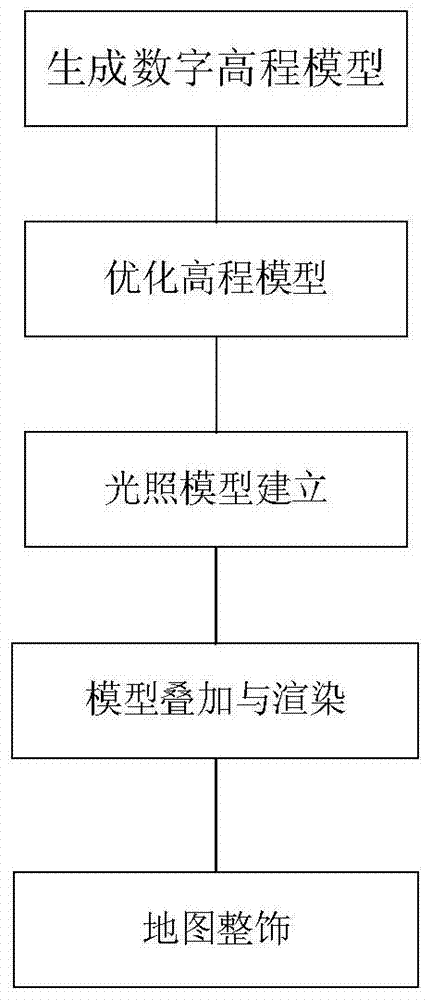
[0031] Such as figure 1 Shown, the river course underwater terrain thematic map acquisition method provided by the present invention comprises the following steps:

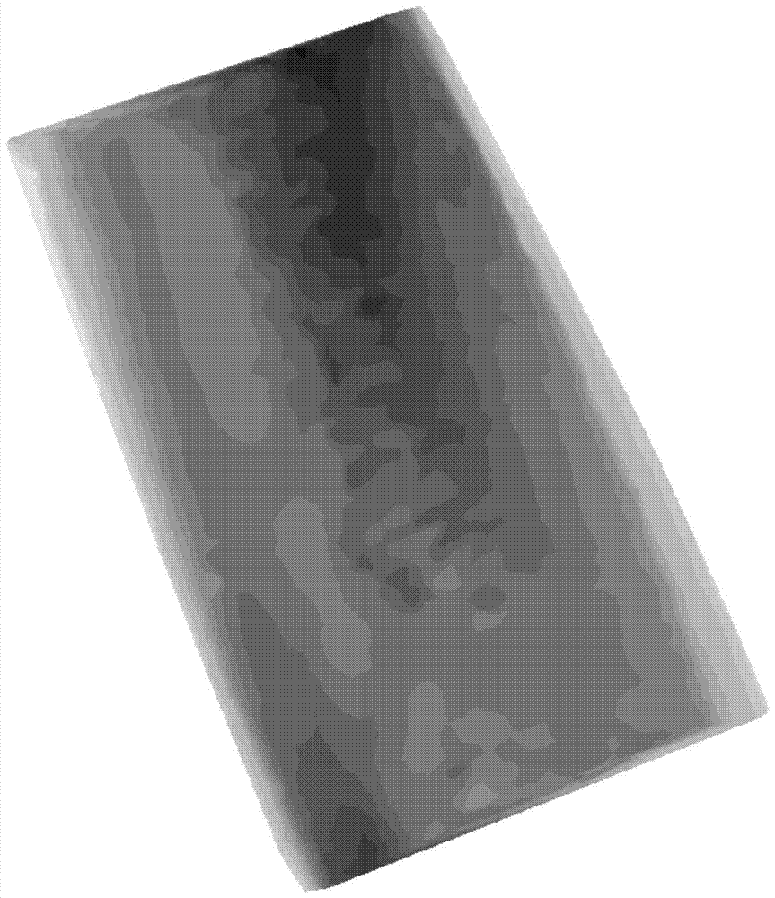
[0032] Step 1: Generate a digital elevation model; it mainly includes the following steps:

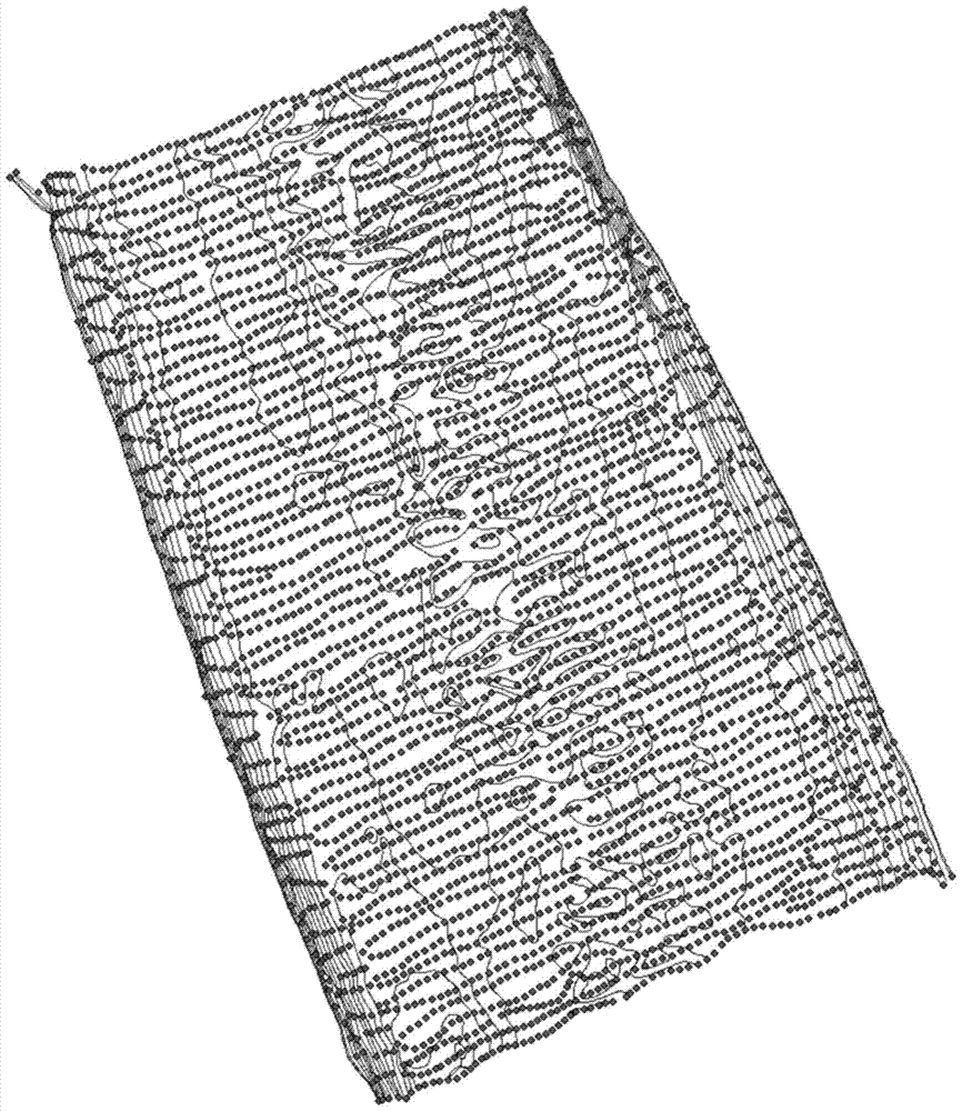
[0033] Step 101, such as figure 2 As shown, the elevation point and contour line data obtained from the underwater topographic survey are obtained from the Nanjing River, the elevation value in the attribute is selected as the height source, the contour line is used as the hard partition line, and th...


PUM


Abstract

The invention discloses a method for obtaining a thematic map of river underwater topography, comprising the following steps: step 1: creating a digital elevation model according to TIN data generated from elevation point and contour data; step 2: comparing the digital elevation model obtained in step 1 Carry out optimization processing; step 3: establish a lighting model, and use the lighting model to perform lighting model processing on the digital elevation model optimized in step 2; step 4: model overlay and rendering and display. The present invention can obtain a more vivid, more intuitive and three-dimensional thematic map of the river; at the same time, it can directly reflect the changing trend of the river terrain, and has strong usability in actual production, and at the same time, it can be appreciated; moreover, the drawing efficiency of the present invention is High, low production cost, can complete batch drawing according to thematic map parameters with the program.

Description

technical field [0001] The invention belongs to the technical field of river channel mapping, and the invention relates to a method for acquiring a river channel underwater terrain thematic map. technical background [0002] Thematic maps, also known as special maps, are maps that focus on one or several natural elements or socioeconomic phenomena. The content of the thematic map consists of two parts: ①Thematic content. Natural or socio-economic phenomena and their associated characteristics highlighted on the map. ②Geographic basis. Common map content used to indicate the spatial location and geographical background of thematic elements mainly includes graticules, water systems, boundaries, and residential areas. [0003] The river topography thematic map is a special map that reflects river topography information, highlighting the river topography information. Thematic river topographic maps play an important role in the development and improvement of rivers, flood co...

Claims


Application Information

Patent Timeline
Patent Type & Authority Patents(China)
IPC IPC(8): G06T17/05G06T15/50
Inventor 许捍卫李正学徐静波金文韬王海君
Owner HOHAI UNIV
Why Eureka
Try Eureka