Space-time information visualizing method based on geographic information space system

A geographic information and spatial technology, applied in image data processing, 3D image processing, electrical digital data processing, etc., can solve problems such as not intuitive enough, lack of spatial and temporal elements of geographic information, etc., and achieve powerful effects

Active Publication Date: 2015-05-13
GEOVIS CO LTD
View PDF7 Cites 38 Cited by
  • Summary
  • Abstract
  • Description
  • Claims
  • Application Information

AI Technical Summary

Problems solved by technology

The traditional method is to transmit information through two-dimensional multimedia (including pictures, text, audio and video, etc.). The information displayed on the two-dimensional graphical interface is very abstract, not intuitive enough, and lacks the expression of geographical information, time and space elements

Method used


Image

  • Space-time information visualizing method based on geographic information space system
  • Space-time information visualizing method based on geographic information space system
  • Space-time information visualizing method based on geographic information space system

Examples


Embodiment Construction

[0049] The realization steps of the present invention are as follows:

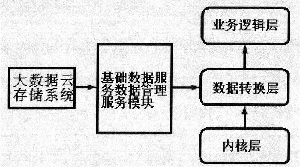
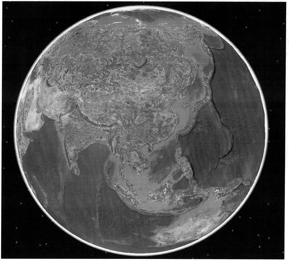
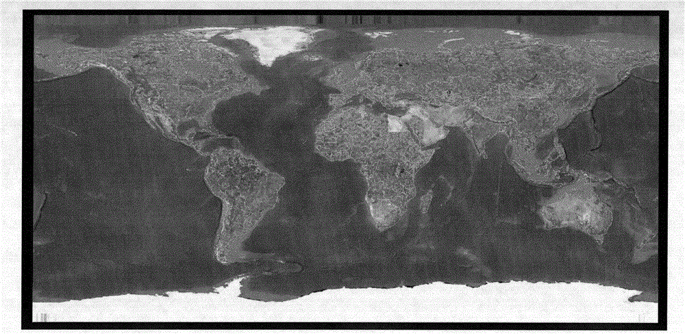
[0050] 1. According to figure 1 As shown, first establish a document-style scene management method and an object tree page element management mechanism, that is, build a two-dimensional and three-dimensional integrated rendering engine, that is, the kernel layer, which supports three-dimensional spherical projection and two-dimensional plane projection; figure 2 , image 3 As shown, at the same time, the kernel layer can build local 3D scenes; the kernel layer drives different data types by providing plug-in dynamic libraries, such as models, icons, particles, undershoots, and images;

[0051]2. Encapsulate the two-dimensional and three-dimensional integrated rendering engine as a control layer and embed it in the WPF main form, and associate the data conversion layer with the control layer through data template and dependency attribute binding, and save each page by screenshot The state of the running ...


PUM


Abstract

The invention discloses a space-time information visualizing method based on a geographic information space system. The method specifically comprises the steps of creating a document type scene management method and an object tree page element management mechanism, namely constructing a two-dimension and three-dimension integrated render engine; packaging the two-dimension and three-dimension integrated render engine into a control layer to be embedded into a WPF main window and other four steps. According to the method, the two-dimension and three-dimension integrated visual representation method is adopted, the ability to representing multi-dimensional geographic space information elements is realized, and fascinating simulation scenes with powerful functions can be established quickly.

Description

technical field [0001] The invention relates to a method for visualizing spatio-temporal information, in particular to a method for visualizing spatio-temporal information based on a geographic information space system. Background technique [0002] With the development of multimedia technology and the rapid improvement of computer performance, the speed and scale of information collection and dissemination have reached an unprecedented level. From the vast ocean of information, we can quickly and accurately obtain the information we need for integration, extraction, and visualization. It has become an urgent need to display it in a way to facilitate communication and learning among various personnel. Since humans know how to understand and transform the world through information, information mainly exists in the form of graphics. The traditional way is to transmit information through two-dimensional multimedia (including pictures, text, audio and video, etc.). The informat...

Claims


Application Information

Patent Timeline
Patent Type & Authority Applications(China)
IPC IPC(8): G06F17/30G06T13/20G06T15/00G06T3/00
Inventor 唐德可熊兆李博黄玉甫
Owner GEOVIS CO LTD
Why Eureka
Try Eureka