

Area coverage detecting method and area coverage detecting device
A technology for determining the method and scope, applied in the field of the method and device for determining the area scope, can solve problems such as poor accuracy, and achieve the effects of improving efficiency, ensuring accuracy, and improving accuracy
- Summary
- Abstract
- Description
- Claims
- Application Information
AI Technical Summary
Problems solved by technology
Method used
Image

Examples
Embodiment 1
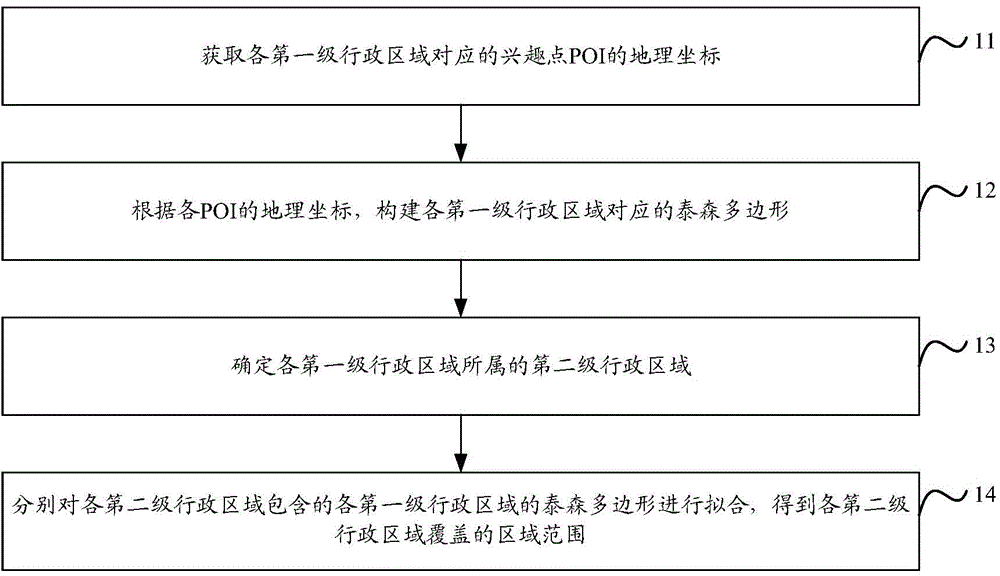
[0060] like figure 1 As shown, it is a flow chart of the method for determining the area range proposed in Embodiment 1 of the present invention, and its specific processing flow is as follows:
[0061] In step 11, the geographic coordinates of POIs corresponding to each first-level administrative region are obtained.
[0062] In the embodiment of the present invention, the first-level administrative area may be a village-level administrative area or a neighborhood committee-level administrative area, and the second-level administrative area may be a township-level administrative area or a street-level administrative area. Moreover, each village-level administrative region or neighborhood committee-level administrative region corresponds to one POI data in the preset POI database. Embodiment 1 of the present invention proposes that the attribute information of POI data is stored in the preset POI database, including: name, type, address, geographical coordinates, administrati...
Embodiment 2
[0089] The algorithm of Thiessen polygon fitting for the second-level administrative area is introduced below.
[0090] like Figure 10 As shown, it is a schematic diagram of the algorithm of Thiessen polygon fitting for the second-level administrative area. The specific algorithm flow is as follows:
[0091] In step 101, a set A is formed from the sides of the Thiessen polygons corresponding to the first-level administrative regions included in the second-level administrative regions.
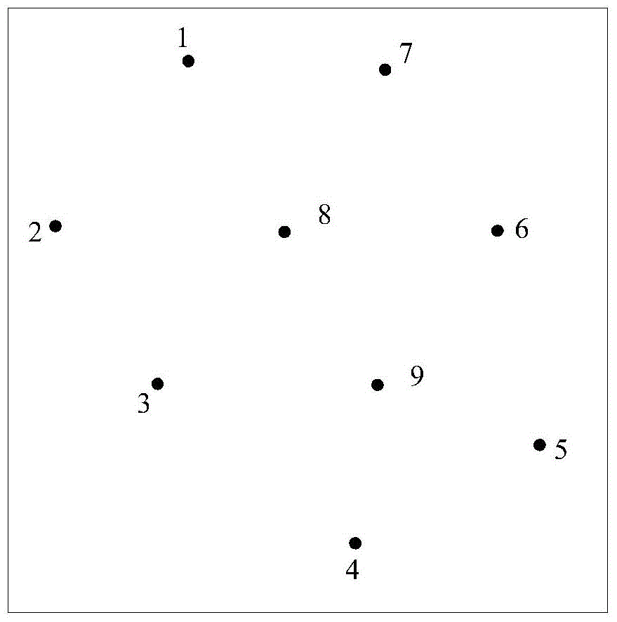
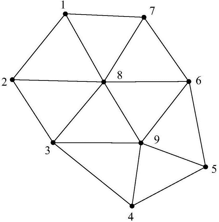
[0092] Assume that the second-level administrative region corresponds to 7 Thiessen polygons, which are polygons 1 to 7, such as Figure 7 As shown, the set A contains 28 edges.
[0093] Among them, each edge has two endpoints, so the latitude and longitude coordinates of the two endpoints can be used to represent an edge, for example, a certain edge has an endpoint x and an endpoint y, and the latitude and longitude coordinates of the endpoint x are (lon x , lat x ), the latitude and long...
Embodiment 3
[0106] Corresponding to the method for determining the area range proposed in the first embodiment of the present invention, the third embodiment of the present invention proposes a device for determining the area range, the structure of which is as follows Figure 11 shown, including:
[0107] Geographic coordinate acquisition unit 111, configured to acquire the geographic coordinates of POIs corresponding to each first-level administrative region;
[0108] Thiessen polygon construction unit 112, for constructing the Thiessen polygon corresponding to each first-level administrative region according to the geographic coordinates of each POI obtained by geographic coordinate acquisition unit 111;
[0109] An administrative area determining unit 113, configured to determine the second-level administrative area to which each first-level administrative area belongs;
[0110] The area range determination unit 114 is configured to respectively fit the Thiessen polygons of each firs...
PUM
 Abstract
Description
Claims
Application Information