A Registration Method of Remote Sensing Satellite Multispectral Images
A multispectral image and remote sensing satellite technology, which is applied in the registration of multispectral images of remote sensing satellites and the registration field of multispectral images of remote sensing satellites, can solve the problems of difficult registration and large gray scale differences
- Summary
- Abstract
- Description
- Claims
- Application Information
AI Technical Summary
Problems solved by technology
Method used
Image
Examples
Embodiment Construction
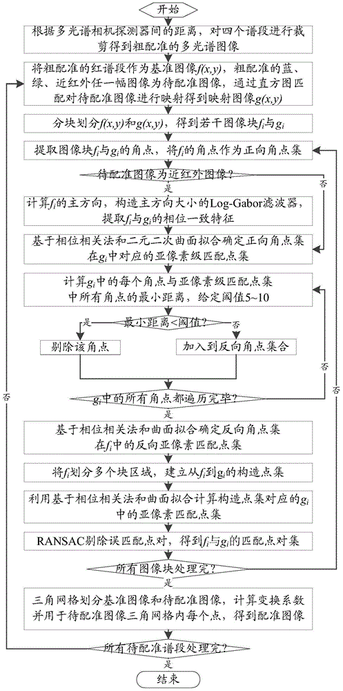
[0043] A remote sensing satellite multispectral image registration method, the specific steps are as follows figure 1 As shown, the method is implemented by the following steps:
[0044] 1. According to the distance between the blue, green, red, and near-infrared spectral detectors of the multispectral camera, the obtained four spectral images are respectively cropped to obtain a coarsely registered multispectral image.
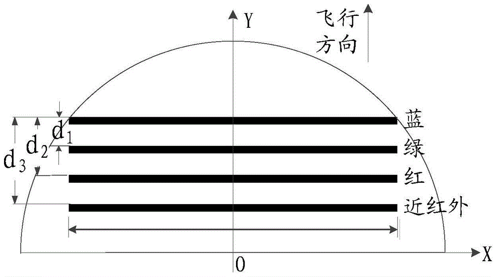
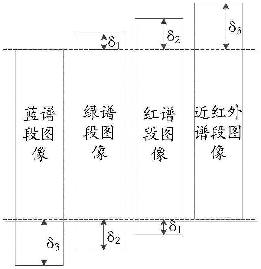
[0045] For the multispectral camera, the spectroscopic prism is used to obtain multispectral images. There is no offset between the four spectral segments, and there is no need to crop the input four spectral segment images. The obtained four spectral segment images are coarsely registered. Multi-spectral image; for multi-spectral cameras, multi-color CCD detectors are integrated on one device to obtain multi-spectral images, such as Figure 2a As shown, the distances from the blue-band detector on the focal plane to the green, red and near-infrared detector...
PUM
 Abstract
Description
Claims
Application Information
 - R&D
- Intellectual Property
- Life Sciences
- Materials
- Tech Scout
- Unparalleled Data Quality
- Higher Quality Content
- 60% Fewer Hallucinations
Browse by: Latest US Patents, China's latest patents, Technical Efficacy Thesaurus, Application Domain, Technology Topic, Popular Technical Reports.
© 2025 PatSnap. All rights reserved.Legal|Privacy policy|Modern Slavery Act Transparency Statement|Sitemap|About US| Contact US: help@patsnap.com


