

Positioning method and system based on satellite base stations
A technology of satellite base station and positioning method, which is applied in the field of positioning method and system based on satellite base station, which can solve the problems of high energy consumption, inability to complete positioning in places with weak satellite signals, long calculation time of receivers, etc., and achieve simple positioning method, The effect of the process of avoiding the reception of satellite signals
- Summary
- Abstract
- Description
- Claims
- Application Information
AI Technical Summary
Problems solved by technology
Method used
Image

Examples
Embodiment 1
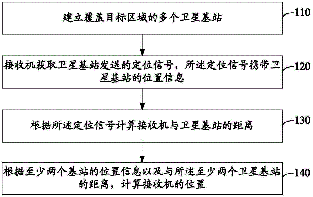
[0040] Please refer to figure 1 , an embodiment of the present invention provides a positioning method based on a satellite base station, which may include:
[0041] 110. Establish multiple satellite base stations covering the target area.
[0042] In the embodiment of the present invention, a plurality of satellite base stations covering the target area such as the whole country or the whole world are constructed firstly, and the said satellite base stations may be but not limited to GPS base stations or Beidou base stations. The satellite base station can be used to receive satellite signals, process the signals, collect satellite information, and detect the status of satellites. It is equivalent to a monitoring station and plays the role of part or all of the control terminal in the GPS system. The position coordinates of the satellite base stations are known, and each satellite base station knows its own position information. Signals in a specific format communicate betw...
other Embodiment approach
[0047] In other implementation manners, the satellite base station may also periodically send positioning signals by broadcasting. When the receiver needs to locate, it receives the positioning signal sent by the nearby satellite base station.
[0048] 130. Calculate the distance between the receiver and the satellite base station according to the positioning signal.
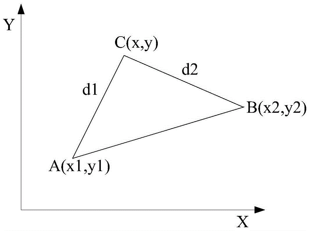
[0049] After the receiver receives the positioning signal, it can calculate the distance between the receiver and the satellite base station according to the signal strength when the positioning signal sent by the base station reaches the receiver. Signal strength is inversely proportional to distance, the farther the distance, the smaller the signal strength. The way the satellite base station sends the signal is to send the sphere with the satellite base station as the center of the sphere to the surrounding space. The strength of the signal decreases with the increase of the distance from the satellite base ...
Embodiment 2
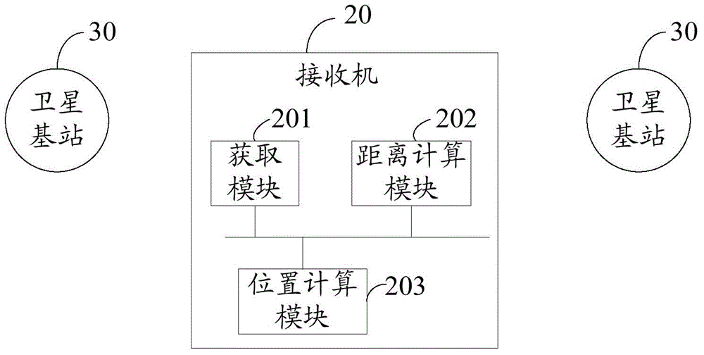
[0065] Please refer to figure 2 , an embodiment of the present invention provides a positioning system based on a satellite base station, including: a receiver 20 and a plurality of satellite base stations 30 covering a target area;
[0066] The satellite base station 30 is used to send positioning signals;
[0067] The receiver 20 includes:
[0068] An acquisition module 201, configured to acquire a positioning signal sent by a satellite base station, where the positioning signal carries position information of the satellite base station;
[0069] A distance calculation module 202, configured to calculate the distance between the receiver and the satellite base station according to the positioning signal;
[0070] The position calculation module 203 is configured to calculate the position of the receiver according to the position information of at least two base stations and the distances from the at least two satellite base stations.
[0071] In some embodiments of the p...
PUM
 Abstract
Description
Claims
Application Information