Unmanned aerial vehicle autonomous landing guidance system based on solar-blind region ultraviolet imaging

A technology for ultraviolet imaging, autonomous landing

Active Publication Date: 2016-04-13
ZHEJIANG UNIV
View PDF6 Cites 16 Cited by
  • Summary
  • Abstract
  • Description
  • Claims
  • Application Information

AI Technical Summary

Problems solved by technology

However, each method has certain limitations. The most common satellite navigation technology is the global positioning system, but within the last few kilometers of the autonomous landing guidance of the UAV, the positioning accuracy of the global positioning system cannot meet the requirements; the inertial navigation system As the system works over time, the positioning error will accumulate more and more; navigation systems based on computer vision are currently developing rapidly, but most of them work in the visible light or infrared bands, which are greatly affected by climate conditions, such as foggy days, etc.

Method used


Image

  • Unmanned aerial vehicle autonomous landing guidance system based on solar-blind region ultraviolet imaging
  • Unmanned aerial vehicle autonomous landing guidance system based on solar-blind region ultraviolet imaging
  • Unmanned aerial vehicle autonomous landing guidance system based on solar-blind region ultraviolet imaging

Examples


Embodiment Construction

[0054] The following will clearly and completely describe the technical solutions in the embodiments of the present invention with reference to the accompanying drawings in the embodiments of the present invention. Obviously, the described embodiments are only some of the embodiments of the present invention, not all of them. Based on the embodiments of the present invention, all other embodiments obtained by persons of ordinary skill in the art without creative efforts fall within the protection scope of the present invention.

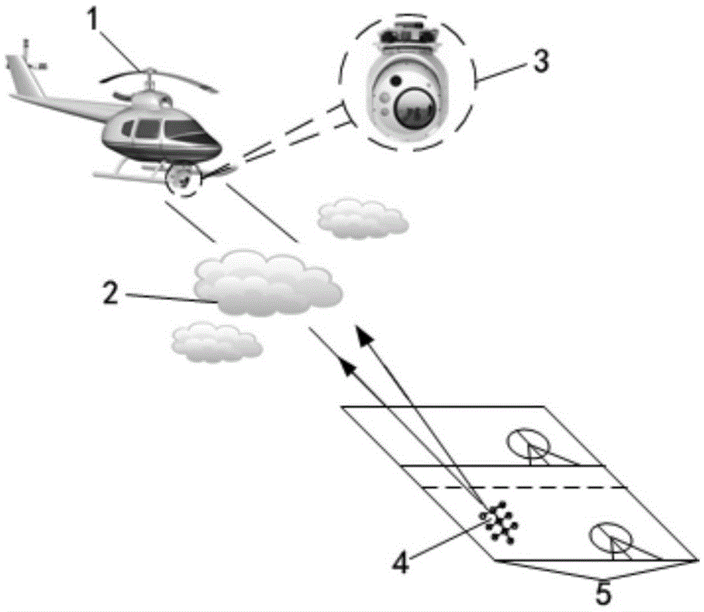
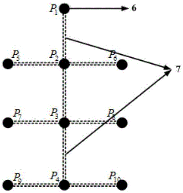
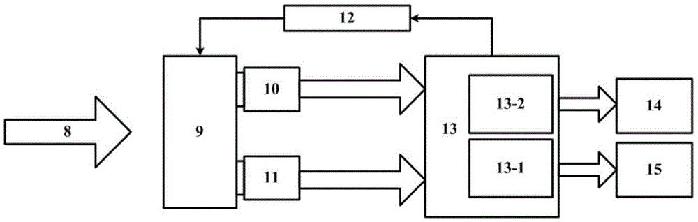
[0055] The invention is a method and system for autonomous landing guidance of UAVs based on ultraviolet imaging in solar blind areas. In order to make the object, technical solution and advantages of the present invention clearer, the present invention will be further described in detail below in combination with examples and accompanying drawings. It should be understood that the specific embodiments described herein are only used to illustrate the ...


PUM


Abstract

The invention discloses an unmanned aerial vehicle autonomous landing guidance system based on solar-blind region ultraviolet imaging. The system comprises an ultraviolet source beacon module, a two-channel imaging module, a data processing module, a data sending module and a data storage module. The ultraviolet source beacon module is arranged on a landing platform; the two-channel imaging module, the data processing module, the data sending module and the data storage module are arranged on an unmanned aerial vehicle; the unmanned aerial vehicle carries out imaging on the ultraviolet source beacon module through the two-channel imaging module; then, the data processing module carries out processing on imaging data; and the data sending module sends a part of processing results of the data processing module to an unmanned aerial vehicle flight control system, and sends the rest processing results to the data storage module for storing. The solar-blind region ultraviolet imaging technology is, for the first time, applied to unmanned aerial vehicle autonomous landing guidance, and unmanned aerial vehicle autonomous landing guidance based on the solar-blind region ultraviolet imaging is realized.

Description

technical field [0001] The invention relates to the technical field of autonomous landing guidance of unmanned aerial vehicles based on computer vision, in particular to an autonomous landing guidance system for unmanned aerial vehicles based on ultraviolet imaging in solar blind areas. Background technique [0002] Ultraviolet radiation in the solar spectrum is located in the wavelength range of 10-400nm in the electromagnetic radiation spectrum. UV rays have a variety of different properties and effects depending on the wavelength. Generally, ultraviolet radiation is divided into UV-A (near ultraviolet): 320-400nm; UV-B (mid-ultraviolet): 280-320nm; UV-C (far ultraviolet): 200-280nm; The atmosphere strongly absorbs, so it only exists in research and application under vacuum conditions, so it is called vacuum ultraviolet. [0003] Because the ozone layer in the atmospheric stratosphere has a strong absorption effect on ultraviolet rays near the wavelength of 250nm, the UV...

Claims


Application Information

Patent Timeline
Patent Type & Authority Applications(China)
IPC IPC(8): G05D1/12
CPCG05D1/12
Inventor 杨甬英刘东张磊张铁林江佳斌
Owner ZHEJIANG UNIV
Why Eureka
Try Eureka