

Method for forecasting urban heat island effect
An urban heat island effect and prediction method technology, applied in climate change adaptation, special data processing applications, instruments, etc., can solve problems such as difficulty in true and effective expansion, flat layout of urban heat islands, and difficulties in internal structure, etc. The effect of practical significance and high prediction accuracy
- Summary
- Abstract
- Description
- Claims
- Application Information
AI Technical Summary
Problems solved by technology
Method used
Image

Examples
specific Embodiment
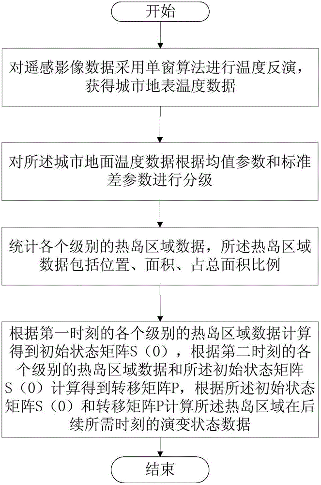
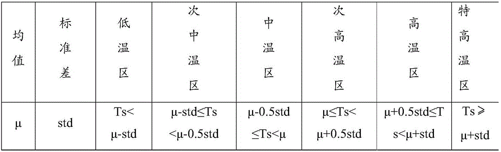
[0088] Obtain the historical remote sensing data of city A, use the single-window algorithm to perform temperature inversion, obtain the urban surface temperature data, and classify the urban surface temperature data according to the mean parameter and standard deviation parameter, which are divided into low temperature zone, sub-medium temperature zone, medium temperature zone, Sub-high temperature zone, high temperature zone, and ultra-high temperature zone; statistics of various levels of heat island area data, heat island area data including location, area, and proportion of total area. The initial state matrix S(0) is calculated according to the heat island area data of each level in October 2009, and the current matrix S(K) is calculated according to the heat island area data of each level in October 2014. According to the relationship between S(0) and S(K) S(K)=S(0)P K , Get the transition matrix P. According to S(2K)=S(0)P 2K The relationship is calculated to get the da...
PUM
 Abstract
Description
Claims
Application Information