Urban three-dimensional model data preprocessing method suitable for high-efficiency rendering
A technology of data preprocessing and 3D model, applied in the field of geographic spatial information system, can solve the problems of high hardware requirements and poor rendering effect, and achieve the effect of reducing the number and improving the efficiency
- Summary
- Abstract
- Description
- Claims
- Application Information
AI Technical Summary
Problems solved by technology
Method used
Image
Examples
Embodiment Construction
[0019] The present invention will be further described in detail below in conjunction with the accompanying drawings and embodiments.
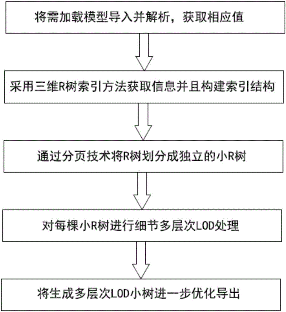
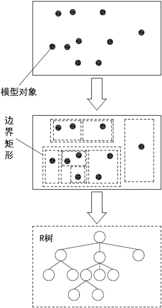
[0020] Such as Figure 1 to Figure 3 As shown, (1) import and analyze the model objects to be loaded in batches through the IO read-write plug-in, and obtain the center position, maximum value and minimum value of the model object as the AABB bounding box;
[0021] (2) Use the spatial R tree index method to build a tree index structure for the 3D model that has obtained the bounding box, center position, maximum value, and minimum value, and construct an R tree according to the tree index structure, in which each node contains the corresponding space The smallest cuboid of the object;
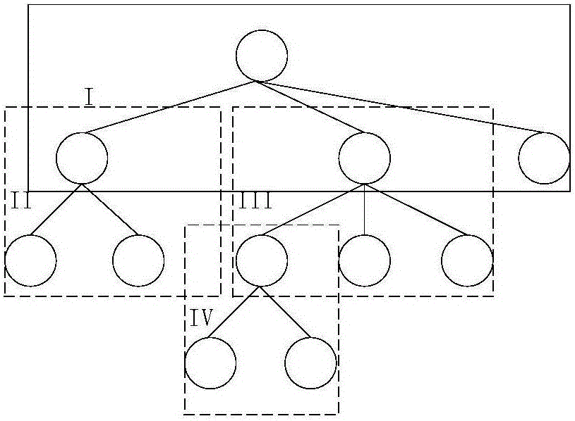
[0022] (3) Divide the built R tree into space pages from the leaf nodes upwards through the paging technology, and use each divided space page as an independent small R tree, and record the current level of information and information during the process of div...
PUM
 Abstract
Description
Claims
Application Information
 - R&D
- Intellectual Property
- Life Sciences
- Materials
- Tech Scout
- Unparalleled Data Quality
- Higher Quality Content
- 60% Fewer Hallucinations
Browse by: Latest US Patents, China's latest patents, Technical Efficacy Thesaurus, Application Domain, Technology Topic, Popular Technical Reports.
© 2025 PatSnap. All rights reserved.Legal|Privacy policy|Modern Slavery Act Transparency Statement|Sitemap|About US| Contact US: help@patsnap.com


