

Vehicle data processing method and vehicle terminal
A vehicle data and vehicle technology, applied in the vehicle field, can solve the problem that the driving vehicle cannot obtain the road conditions ahead in time
- Summary
- Abstract
- Description
- Claims
- Application Information
AI Technical Summary
Problems solved by technology
Method used
Image

Examples
Embodiment 1
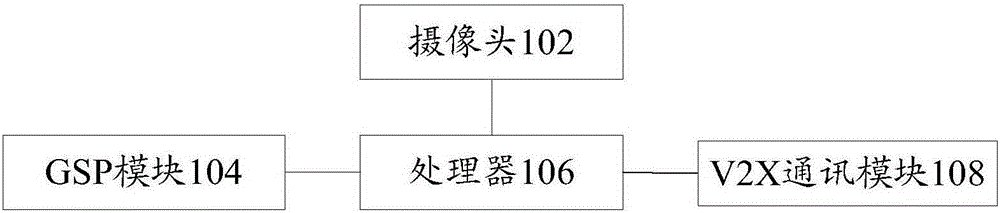
[0017] refer to figure 1 , shows a structural block diagram of a structural block diagram of a vehicle terminal according to an embodiment of the present invention, and may specifically include the following modules:
[0018] A camera 102 , a GPS (Global Position System, Global Positioning System) module 104 and a V2X communication module 108 respectively connected to the processor 106 .
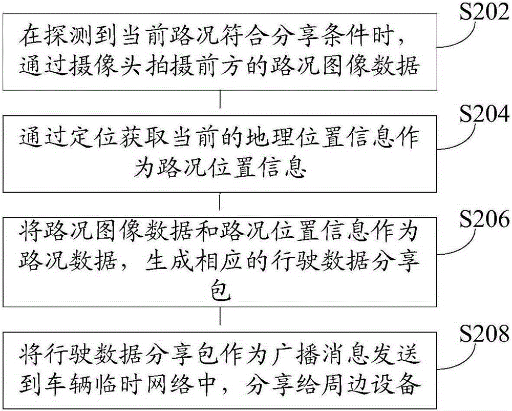
[0019] Camera 102 is used to capture the road condition image data ahead by camera when detecting that the current road conditions meet the sharing conditions; GPS module 104 is used to obtain current geographic location information as road condition position information through positioning; processor 106 is used to The road condition image data and the road condition location information are used as road condition data to generate a corresponding driving data sharing package; the V2X communication module 108 is used to send the driving data sharing package as a broadcast message to the vehi...
Embodiment 2
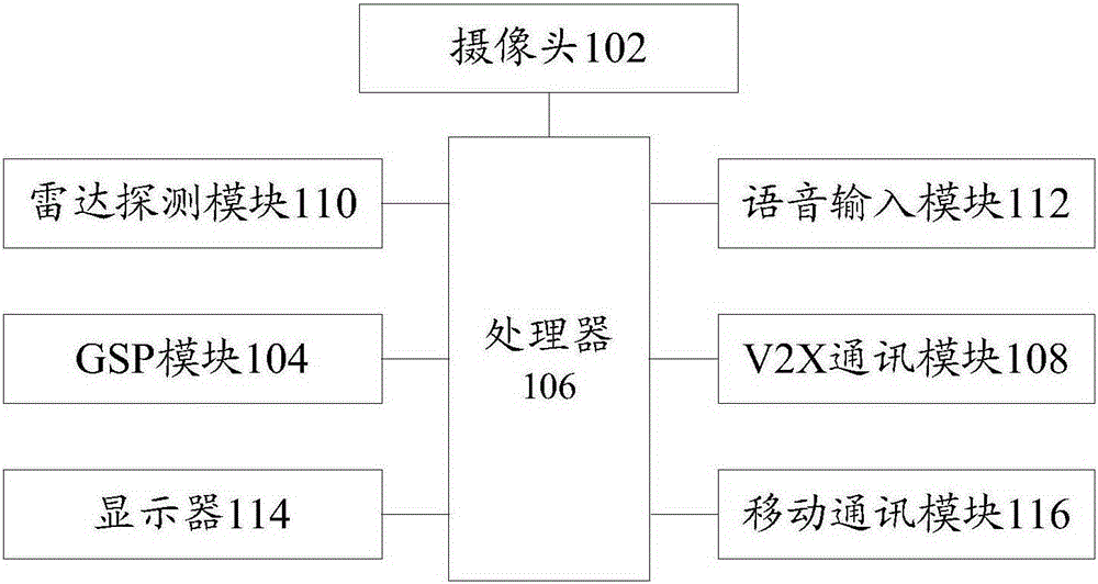
[0038] refer to image 3 , which shows a structural block diagram of a vehicle terminal according to another embodiment of the present invention, which may specifically include the following modules:
[0039] The radar detection module 110 , the camera 102 , the V2X communication module 108 , the GPS module 104 , the voice input module 112 , the display 114 , and the mobile communication module 116 are respectively connected to the processor 106 .
[0040] Specifically, the radar detection module 110 is configured to use radar to monitor the road conditions ahead, and determine whether the current road conditions meet the sharing conditions; the camera 102 is used to capture image data of the road conditions ahead through the camera when detecting that the current road conditions meet the sharing conditions, and The picture is sent to the processor 106; the GPS module 104 is used to search the road condition position information in the map, and marks the road condition positio...
PUM
 Abstract
Description
Claims
Application Information