
An Automatic Recognition Method of Floodplain and Main Channel of Compound Section Channel

An automatic identification and floodplain technology, applied in instrumentation, design optimization/simulation, calculation, etc., can solve the problems of flow model identification, beach trough reduction, complex flow velocity, and many parameters, and achieve clear physical concepts, strong operability, and calculation simple effect

Active Publication Date: 2019-08-06
HOHAI UNIV
View PDF4 Cites 0 Cited by
  • Summary
  • Abstract
  • Description
  • Claims
  • Application Information

AI Technical Summary

Problems solved by technology

Some scholars quantitatively judge the position of the main channel and floodplain according to the change characteristics of the average flow velocity of the channel section with the water depth, and apply it to the quasi-two-dimensional mathematical model, but the calculation of the flow velocity is too complicated, and there are many parameters that need to be calibrated, so it is not easy to apply into a quasi-two-dimensional mathematical model
In addition, some scholars have passed the flow modulus K (K=AR 2 / 3 ) to quantitatively divide the main side channel. Since the flow modulus is the combination of the cross-sectional area A and the hydraulic radius R, the actual river cross-sectional area is much larger than the hydraulic radius. The product of the two mainly reflects the characteristics of the cross-sectional area A, which increases with the elevation. When the floodplain is wide, the ability of the flow model to identify the floodplain is greatly reduced, and it is even difficult to identify

Method used


Image

  • An Automatic Recognition Method of Floodplain and Main Channel of Compound Section Channel
  • An Automatic Recognition Method of Floodplain and Main Channel of Compound Section Channel
  • An Automatic Recognition Method of Floodplain and Main Channel of Compound Section Channel

Examples


Embodiment Construction

[0025] Embodiments of the invention are described in detail below, examples of which are illustrated in the accompanying drawings. The embodiments described below by referring to the figures are exemplary only for explaining the present invention and should not be construed as limiting the present invention.

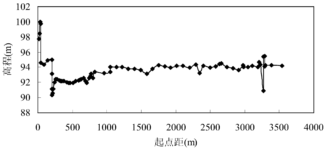
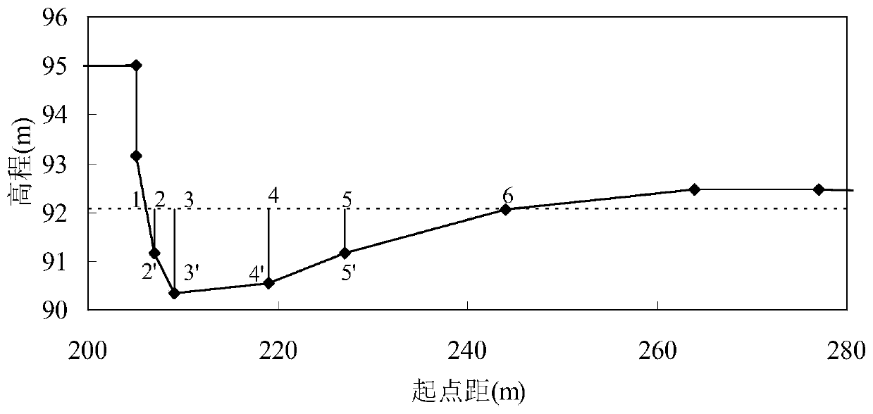
[0026] The hydraulic radius of a single channel section is continuous with the water level, but the hydraulic radius of a compound channel decreases rapidly at the moment of floodplain and then gradually increases with water depth. According to this change characteristic, the location and elevation of the floodplain can be determined. like figure 1 As shown, the flow process of the automatic identification method of the compound cross-section river floodplain and the main channel of the present invention is as follows:

[0027] (1) Obtain the topographic point data of the river section. The first point on the left side of the river section is the starting point, which i...


PUM


Abstract

The invention discloses an automatic identification method for a floodplain and a main channel in a compound-section channel. The method comprises the following steps of: selecting a lowest-point elevation and a highest-point elevation of a compound section; taking the lowest-point elevation and the highest-point elevation as the lowest water level and the highest water level of section overflowing; from the highest water level, uprising for 0.05m every time until reaching the highest water level; calculating a section overflowing area and a wetted perimeter corresponding to each water level, determining a corresponding hydraulic radius, and establishing relation curves of the water levels and the hydraulic radiuses; based on characteristics of the curves, calculating the difference value of the hydraulic radiuses corresponding to two adjacent water levels according to the water levels from low to high, setting the critical values of hydraulic radius amplitudes, capturing sudden changes in the relation curves of the water levels and the hydraulic radiuses, and taking the sudden changes as demarcation points of the plain and the channel, and the plain and the plain. The method can quantificationally and automatically identify the main channel and the floodplain in the compound section, is simple and feasible, can be applied to quasi-two-dimensional flow and sediment mathematical modeling, and further can be used for evolution analysis on identifying the plain and the channel in the compound-section channel.

Description

technical field [0001] The invention relates to an automatic identification method for floodplain and main channel in a quasi-two-dimensional mathematical model of a compound cross-section river, and belongs to the technical field of channel division in riverbed evolution analysis. Background technique [0002] The mathematical model of sediment is one of the important means to study the sediment problem. It has the advantages of less investment and short cycle. The mathematical model of sediment can be divided into one-dimensional mathematical model, two-dimensional mathematical model and three-dimensional mathematical model according to the number of dimensions. With the rapid development of computer technology, the calculation speed is getting faster and faster. These three mathematical models are used in practical engineering. Specifically, the one-dimensional mathematical model is mostly used for long-distance and long-term calculations; the two-dimensional mathematical ...

Claims


Application Information

Patent Timeline
Patent Type & Authority Patents(China)
IPC IPC(8): G06F17/50
CPCG06F30/20Y02A10/40
Inventor 吴腾吴玲莉秦杰朱瑞虎丁坚
Owner HOHAI UNIV
Learn More