
A drone autonomous flight system

A technology of unmanned aerial vehicles and subsystems, which is applied in the direction of finding the control of the target, can solve the problems of solution application, etc., and achieve the effect of strong scalability and good autonomous navigation effect

Active Publication Date: 2019-05-14
开平市飞滴无人机技术有限公司
View PDF5 Cites 0 Cited by
  • Summary
  • Abstract
  • Description
  • Claims
  • Application Information

AI Technical Summary

Problems solved by technology

[0002] At present, there are GPS navigation methods for unmanned aerial vehicle navigation, and methods for autonomous navigation include infrared scanning map drawing method and indoor visual system navigation method. Since these methods are still in laboratory research, there is no good solution for them. The current field of drones

Method used


Image

  • A drone autonomous flight system
  • A drone autonomous flight system
  • A drone autonomous flight system

Examples


Embodiment Construction

[0012] The present invention is further described in conjunction with the following examples.

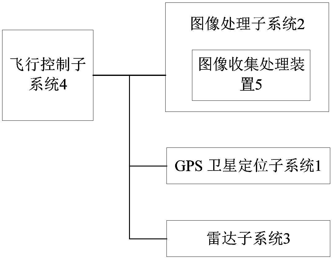
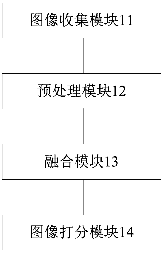
[0013] see figure 1 , figure 2 , a kind of unmanned aerial vehicle autonomous flight system of the present embodiment, comprises GPS satellite positioning subsystem 1, image processing subsystem 2, radar subsystem 3, flight control subsystem 4; Said GPS satellite positioning subsystem 1 is used to pass Receive satellite signals, determine the current longitude and latitude position of the UAV, and provide basic data for navigation; the image processing subsystem 2 is used to collect and process image information, match and track the target, and realize the tracking flight of the UAV; The radar subsystem 3 includes a microwave and millimeter wave radar module and a signal processing module, which are used to detect the surrounding terrain through the microwave and millimeter wave radar module, and input the detection signal into the signal processing module for target search; the f...


PUM


Abstract

The invention discloses an autonomous flight system of an unmanned aerial vehicle. The autonomous flight system comprises a GPS (global positioning system) satellite positioning subsystem, an image processing subsystem and a radar subsystem, wherein the GPS satellite positioning subsystem is used for receiving a satellite signal to determine the current longitude and latitude position of the unmanned aerial vehicle, so as to provide the basic data for navigation; the image processing subsystem is used for collecting and processing image information to match and track the target, so as to realize the tracking flight of the unmanned aerial vehicle; the radar subsystem comprises a microwave and millimeter wave radar unit and a signal processing unit, the surrounding terrain is detected by the microwave and millimeter wave radar unit, and a detection signal is inputted into the signal processing unit to search the target; the flight control subsystem is used for comprehensively processing and analyzing the information obtained by the GPS satellite positioning subsystem, the image processing subsystem and the radar subsystem, determining a flight plan, and executing different flight modes according to the flight plan. The autonomous flight system has the advantages that the route and flight path are judged according to self conditions, the autonomous navigation is realized, the extendibility is strong, and the autonomous navigation effect of the autonomous unmanned aerial vehicle is well realized.

Description

technical field [0001] The invention relates to the technical field of unmanned aerial vehicle control, in particular to an autonomous flight system of an unmanned aerial vehicle. Background technique [0002] At present, there are GPS navigation methods for unmanned aerial vehicle navigation, and methods for autonomous navigation include infrared scanning map drawing method and indoor visual system navigation method. Since these methods are still in laboratory research, there is no good solution for them. current field of drones. Contents of the invention [0003] In order to solve the above problems, the present invention aims to provide an autonomous flight system for unmanned aerial vehicles. [0004] The object of the present invention adopts following technical scheme to realize: [0005] A drone autonomous flight system, including a GPS satellite positioning subsystem, an image processing subsystem, a radar subsystem, and a flight control subsystem; the GPS satell...

Claims


Application Information

Patent Timeline
Patent Type & Authority Patents(China)
IPC IPC(8): G05D1/12
CPCG05D1/12
Inventor 邱炎新
Owner 开平市飞滴无人机技术有限公司
Learn More