

Satellite passive orbit measurement method and system
A passive, satellite technology, used in satellite radio beacon positioning systems, radio wave measurement systems, measurement devices, etc., to achieve the effect of less investment, simple equipment, and improved orbit measurement accuracy
- Summary
- Abstract
- Description
- Claims
- Application Information
AI Technical Summary
Problems solved by technology
Method used
Image

Examples
Embodiment Construction
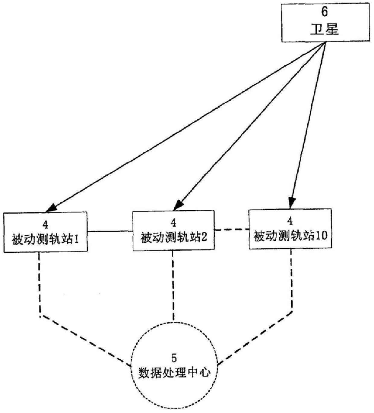
[0031] Refers to a measuring station that does not transmit radio signals but only receives satellite broadcast signals. can be composed of dihedral antenna groups
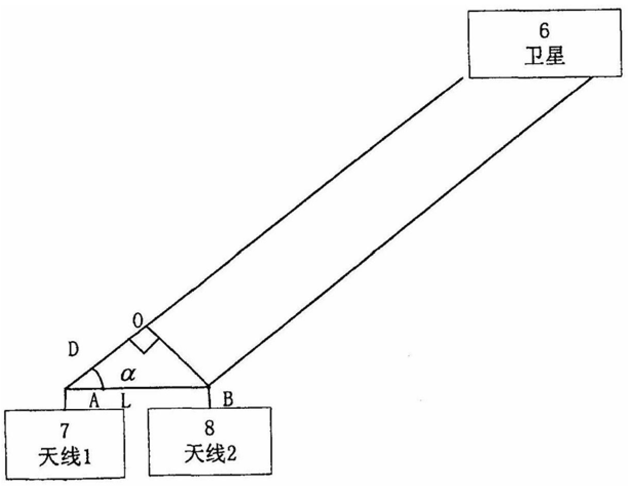
[0034] The binary interference array, as shown in Figure 1, has two antennas 7,8.
[0035] When satellite 6 transmission signal is received by antenna 7,8. The distance between antennas 7 and 8 (baseline L) can be accurately measured
[0036] Taking the time when the radiation source arrives at the antenna 8 as a reference, the relative time delay of arriving at the antenna 7 is Δt. Let the signal be
[0040]
[0042]
[0044]|R(τ)|≤|R(0)|(5)
[0047] Wherein, c is the speed of propagation of the signal.
[0049] cos α=D / L (7)
[0050] Here, the key is the measurement of the path difference D. We have invented a high-precision distance measurement method, directly receiving synchronous satellite
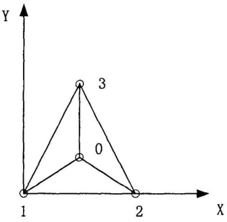
[0053] With antenna 0 as the center, the signals received by antennas 1, 2, and 3 should be transmitted to antenna 0. ...
PUM
 Abstract
Description
Claims
Application Information