Forestry big data construction method based on map
A big data and basic data technology, applied in the direction of electrical digital data processing, special data processing applications, instruments, etc., can solve the problem of low utilization rate, achieve the effect of solving isolated islands, improving reading speed and processing efficiency
- Summary
- Abstract
- Description
- Claims
- Application Information
AI Technical Summary
Problems solved by technology
Method used
Image
Examples
Embodiment Construction
[0050] In order to enable those skilled in the art to better understand the solution of the present invention, the present invention will be further described in detail below in conjunction with the accompanying drawings and specific embodiments.
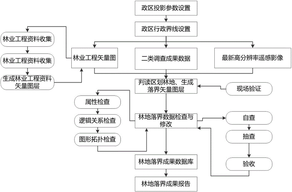
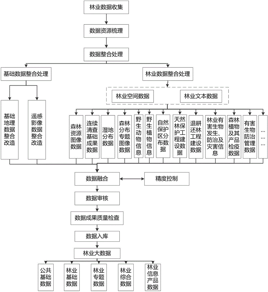
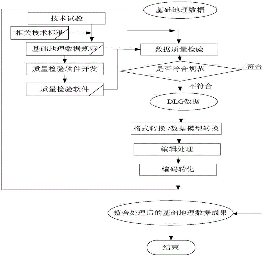
[0051] The forestry big data construction method provided by the embodiment of the present invention, based on a single map, carries out the integrated processing of public basic data, forestry basic data, forestry comprehensive data, forestry special data, and forestry information product data, and adopts a unified space-time framework, data assimilation, Spatialization of non-spatial data, etc., integrate, manage and analyze forestry big data in the form of maps, realize "a picture is worth a thousand words" data management and analysis, provide intuitive, spatiotemporal and quantitative information support for analysis and decision-making, and improve scientific decision-making.
[0052] The overall technical route is as figure...
PUM
 Abstract
Description
Claims
Application Information
 - R&D
- Intellectual Property
- Life Sciences
- Materials
- Tech Scout
- Unparalleled Data Quality
- Higher Quality Content
- 60% Fewer Hallucinations
Browse by: Latest US Patents, China's latest patents, Technical Efficacy Thesaurus, Application Domain, Technology Topic, Popular Technical Reports.
© 2025 PatSnap. All rights reserved.Legal|Privacy policy|Modern Slavery Act Transparency Statement|Sitemap|About US| Contact US: help@patsnap.com


