
Spatial-contiguity-considered vector space data coding method

A vector space and space proximity technology, which is applied in the field of vector space data encoding and can solve problems such as low spatial query performance.

Active Publication Date: 2017-05-10
武汉兆图科技有限公司
View PDF3 Cites 5 Cited by
  • Summary
  • Abstract
  • Description
  • Claims
  • Application Information

AI Technical Summary

Problems solved by technology

[0005] In order to solve the problem of low spatial query performance, the present invention provides a vector spatial data encoding method that takes spatial proximity into account, so as to adapt to the balanced storage of vector spatial data in column databases, optimize the storage of vector spatial data, and improve query performance

Method used

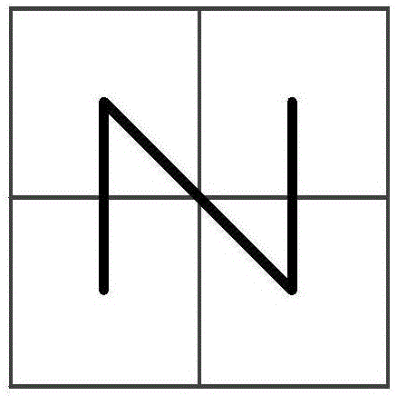
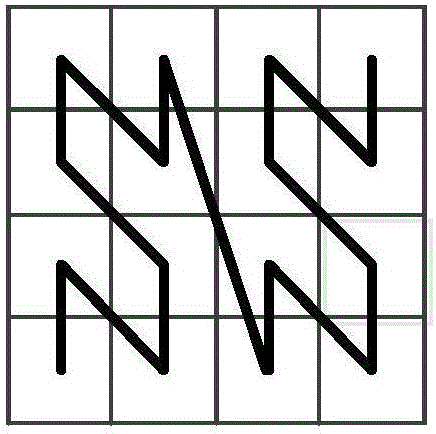
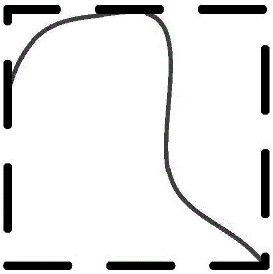

Image

  • Spatial-contiguity-considered vector space data coding method
  • Spatial-contiguity-considered vector space data coding method
  • Spatial-contiguity-considered vector space data coding method

Examples


Embodiment Construction

[0043] In order to enable those skilled in the technical field to which the application belongs to understand the application more clearly, the technical solutions of the application will be described in detail below through specific embodiments in conjunction with the accompanying drawings.

[0044] Rowkey is the unique identifier of the spatial object under the column database. In the column database, all data are organized and stored according to the Rowkey dictionary order. Columnar database query can only rely on Rowkey, the traditional Rowkey is only a unique ID sequence or timestamp, without any spatial information, does not have the ability of spatial indexing, and all spatial objects will be stored separately in multiple On the storage node, when processing large-scale data, it will reduce the performance of spatial query and increase the cost of database maintenance.

[0045] Therefore, the Rowkey coding design of the present invention will fully consider the follow...


PUM


Abstract

The invention discloses a spatial-contiguity-considered vector space data coding method. The spatial-contiguity-considered vector space data coding method includes the steps that whether a given object P is a point object or not is judged; if the space object P is a non-point object, the maximum order k where a grid capable of completely containing a minimum external-containing hyperrectangle is obtained through calculation, and then k+1 pieces of ZG(P)<j*> from the zero order to the k order are calculated, wherein ZG(P)<j*> represents the coded value of the space object P in the j* order; the k+1 pieces of ZG(P)<j*> are coded according to the coding rule of a space filling curve, and Geocode(f.geometry)* is obtained; then coding is carried out according to the formula that Rowkey(f)* is equal to the sum of Geocode(f.geometry)* and FID(f)*. Based on the layered coding of the space filling curve, in the same space division, different space objects have same prefix codes, then unique sequence ID values are added to serve as postfix codes, the space proximity of the vector space objects is considered, and Rowkey can also be prevented from being repeated. In this way, Rowkey has the features of a spatial index, and direct spatial querying in a database becomes possible.

Description

technical field [0001] This application relates to the field of geography, and in particular to a method for encoding vector space data that takes into account spatial proximity. Background technique [0002] With the advent of the era of big data, data not only has the characteristics of large data volume, high real-time requirements, and high value, but also has complex spatial location relationships. At the same time, the demand for services related to spatial location is increasing, such as LBS (based on Location-based services), GPS (Global Positioning System) navigation and other related services. In addition, due to the simple structure and easy organization of raster spatial data, the storage and management of raster spatial data in the cloud environment has achieved good results, while the vector spatial data itself has the characteristics of complex structure and complex relationships. The research on vector space big data is still relatively lacking, so how to st...

Claims


Application Information

Patent Timeline
IPC IPC(8): G06F17/30
CPCG06F16/2272
Inventor 郑坤方发林顾丹鹏张苗
Owner 武汉兆图科技有限公司
Learn More