
Rural landscape sensitiveness evaluation analysis method based on 3S (Remote sensing, Geography information systems and Global positioning systems) technology

A sensitivity and landscape technology, applied in the field of geographic information, can solve problems such as the lack of site analysis methods, and achieve accurate evaluation results

Inactive Publication Date: 2017-10-27
NANJING FORESTRY UNIV
View PDF3 Cites 10 Cited by
  • Summary
  • Abstract
  • Description
  • Claims
  • Application Information

AI Technical Summary

Problems solved by technology

In the practice of planning and design projects in urban and rural areas, there is a lack of a set of reasonable and standard site analysis methods to guide the later planning, design and management

Method used


Image

  • Rural landscape sensitiveness evaluation analysis method based on 3S (Remote sensing, Geography information systems and Global positioning systems) technology
  • Rural landscape sensitiveness evaluation analysis method based on 3S (Remote sensing, Geography information systems and Global positioning systems) technology
  • Rural landscape sensitiveness evaluation analysis method based on 3S (Remote sensing, Geography information systems and Global positioning systems) technology

Examples


Embodiment 1

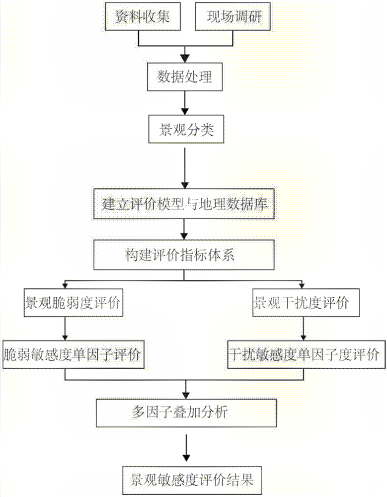
[0029] Such as figure 1 As shown, a kind of rural landscape sensitivity evaluation and analysis method based on 3S technology in this embodiment, the specific steps are as follows:

[0030] (1) Collect and organize data related to a certain town, and perform preprocessing

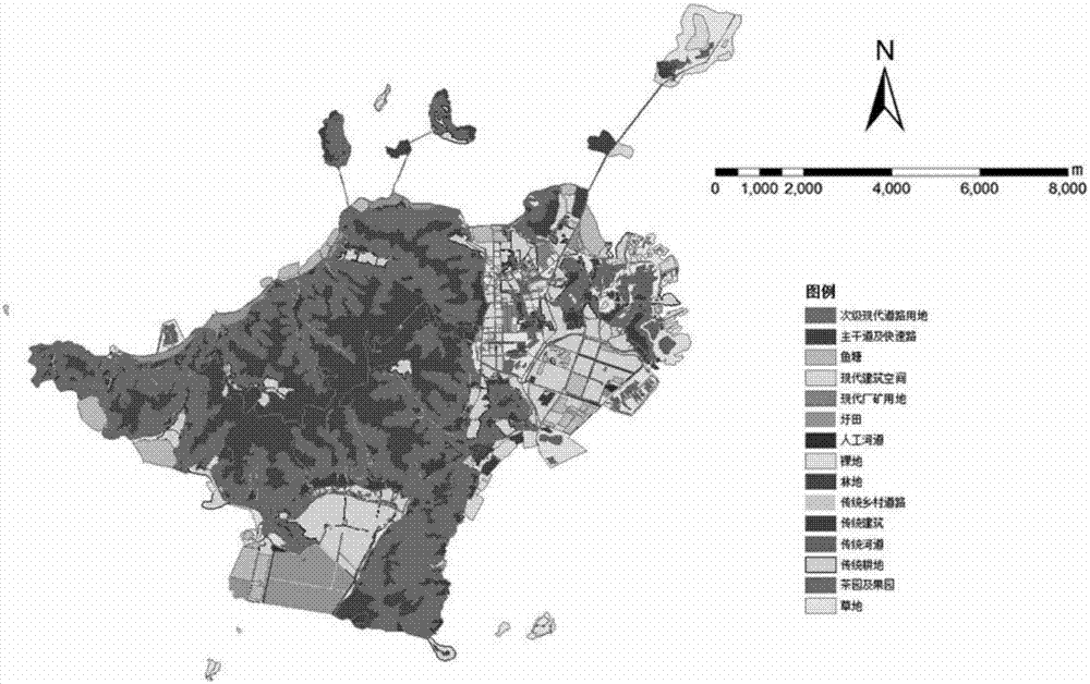
[0031] The image map of a town in 2016 obtained from Google Earth (Google Earth) geographic information application platform is used as the basic data, with a resolution of 10m. The image data receiving time is selected from May to October when the cloud cover is less than 10%, which can better reflect the growth of vegetation. Other auxiliary maps and written materials include the current land use map of a certain town at 1:50,000, the CAD topographic map of a certain town in 2007, the administrative division map of a certain town, etc. The acquired images were geometrically corrected in Autodesk CAD 2014 software. Different local landscape types have differences. Combined with the Google image features...


PUM


Abstract

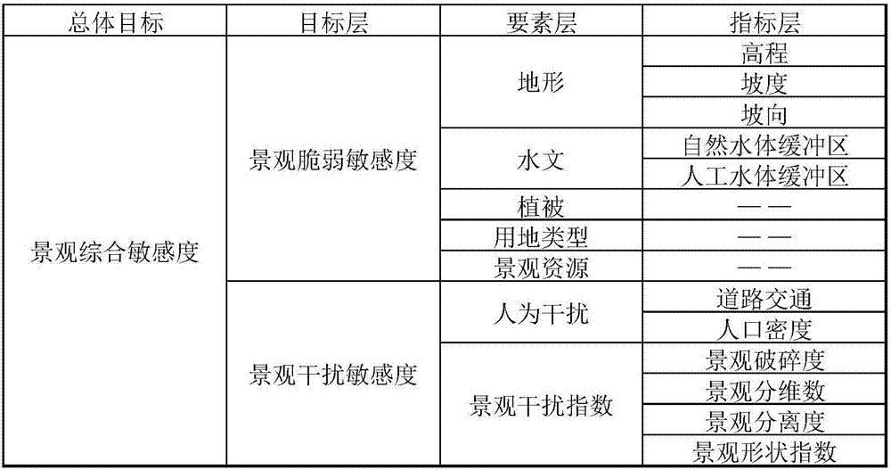
The invention discloses a rural landscape sensitiveness evaluation analysis method based on a 3S (Remote sensing, Geography information systems and Global positioning systems) technology. The method specifically comprises the following steps that: collecting and arranging basic data, establishing an index system, and carrying out single factor evaluation and comprehensive evaluation. A geographic information technology is applied, each index of landscape sensitiveness is analyzed, and an evaluation result is more accurate; a data analysis and rational technical analysis method is provided for the pre-phase analysis of rural planning and landscape design; an analysis result for the landscape sensitiveness can be taken as the effect data of an information management system, and a scientific basis and guidance is provided for management and construction departments.

Description

technical field [0001] The invention relates to a geographic information technology, in particular to a method for evaluating and analyzing rural landscape sensitivity based on 3S technology. Background technique [0002] In the project practice of planning and design in urban and rural areas, the traditional method is mostly based on the professional knowledge and experience of practitioners for preliminary analysis, and is dominated by qualitative and subjective evaluation methods. Planning and design are based on the perceptual understanding of the site by the designer. The pros and cons of the design results are limited to the personal level of the designer, and often the final planning and design scheme lacks rational technical data support, lacks scientificity and rationality. In the practice of planning and design projects in urban and rural areas, there is a lack of a set of reasonable and standard site analysis methods to guide the later planning, design and managem...

Claims


Application Information

Patent Timeline
IPC IPC(8): G06Q10/06G06Q50/26
CPCG06Q10/0639G06Q50/26
Inventor 唐晓岚任杨超任宇杰熊星王军围邓冕
Owner NANJING FORESTRY UNIV
Learn More