
Shopping mall visual rental management method and system based on building construction information model
A technology of building information model and management method, which is applied in the field of visual leasing management of shopping malls, can solve the problems of being unable to visually view the external environment and internal structure of the shop, and restrict the management and utilization efficiency of the shop, so as to achieve the effect of improving management and utilization efficiency
Active Publication Date: 2018-03-23
QINGDAO TECHNOLOGICAL UNIVERSITY
View PDF7 Cites 50 Cited by
- Summary
- Abstract
- Description
- Claims
- Application Information
AI Technical Summary
Problems solved by technology
[0003] At present, commercial leasing management mainly reflects the shop format and formalities of each floor in the project through the display of plane models. It is impossible to directly check the external environment and internal structure of the shop. Tenants have to go to the site to inspect the environment and business information. Retrieve a large amount of paper materials to confirm information such as pipelines and equipment maintenance, which restricts the management and utilization efficiency of berths
Method used
View moreImage
Smart ImageViewing Examples

Examples
Embodiment
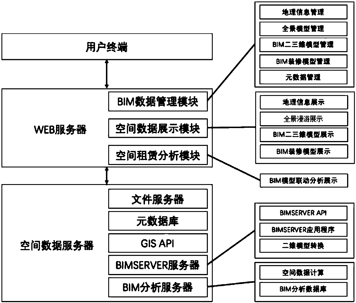
[0044] The specific process of realizing visual leasing management in this embodiment is as follows:
[0045] (1) Geographic information display:
[0046] (1) For different GIS application services, package the map services provided by each into a GIS API, and quote the Baidu map API file in the html file:
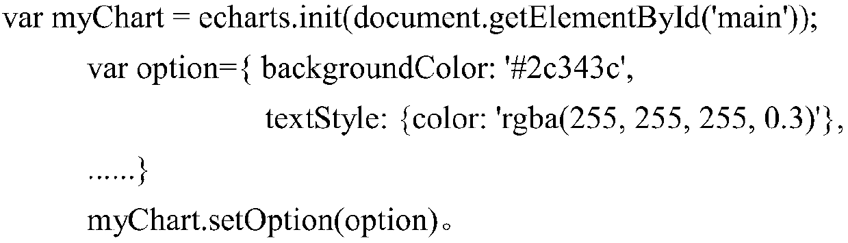
[0047]